Brunson in Hampton County, South Carolina — The American South (South Atlantic)
Prince Williams Baptist Church
Photographed by Mike Stroud, September 7, 2008
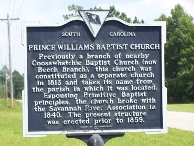
1. Prince Williams Baptist Church Marker
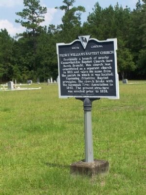
Previously a branch of nearby Coosawhatchie Baptist Church (now Beech Branch), this church was constituted as a separate church in 1813 and takes its name from the parish in which it was located. Espousing Primitive Baptist principals, the church broke with the Savannah River Association in 1840. The present structure was erected prior to 1859.
Erected 1979 by South Carolina Department of Archives and History; sponsored by the Congregation. (Marker Number 25-5.)
Topics. This historical marker is listed in this topic list: Religion & Religious Structures. A significant historical year for this entry is 1813.
Location. 32° 55.054′ N, 81° 7.97′ W. Marker is in Brunson, South Carolina, in Hampton County. It is on Prince Williams Road (State Highway 25-512) east of Pond Town Road (State Highway 25-315). Touch for map. Marker is in this post office area: Brunson SC 29911, United States of America. Touch for directions.

Regionally, this marker is in the Lowcountry, in the Ashepoo and Combahee and Edisto Basin. It is also in the American South, specifically in the Deep South, and on the Eastern Seaboard. Globally,
this page online
Other nearby markers. At least 8 other markers are within 4 miles of this marker, measured as the crow flies: Plywoods-Plastics Corporation / Westinghouse Micarta Division (approx. 3 miles away); Huspah Baptist Church and School (approx. 3.1 miles away); Whippy Swamp Muster Ground (approx. 3.2 miles away); American Legion Hut (approx. 3.3 miles away); World War II POW Camp (approx. 3.3 miles away); The Town of Brunson (approx. 3½ miles away); Hampton Colored School (approx. 3½ miles away); a different marker also named Hampton Colored School (approx. 3½ miles away).
Regarding Prince Williams Baptist Church. Constituted September 12, 1759 as Coosawhatchie Church. This church became in 1822 Beech Branch Baptist Church.
In that year of the founding of Coosawhatchie Church (1759), the Cherokees were on
Photographed by Mike Stroud, September 7, 2008
2. Prince Williams Baptist Church Marker
Photographed by Mike Stroud, 2008
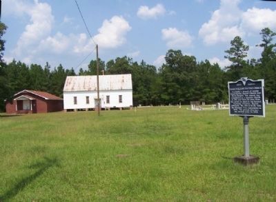
3. Prince Williams Baptist Church
Credits. This page was last revised on May 31, 2026. It was originally submitted on September 15, 2008, by Mike Stroud of Bluffton, South Carolina. This page has been viewed 1,854 times since then and 88 times this year. Photos: 1, 2, 3. submitted on September 15, 2008, by Mike Stroud of Bluffton, South Carolina. • Kevin W. was the editor who published this page.
