College Park in Prince George's County, Maryland — The American Northeast (Mid-Atlantic)
Harrison Store
Trolley Stop Sweet Shop
| — | City of College Park | — |

Photographed by Devry Becker Jones (CC0), March 16, 2018
1. Harrison Store/Trolley Stop Sweet Shop Marker
These two structures, built circa 1910 in the Colonial Revival style, represent the first commercial resources in the neighborhood. Both buildings were apartments with ground floor commercial space. The store drew its customers from riders of the trolley line that linked College Park and other nearby towns with downtown Washington. Today, the site retains neighborhood commercial zoning and continues to have a mix of uses.
[Sidebar:]
Commercial development is now concentrated along US Route 1 or Baltimore Avenue formerly known as the Washington-Baltimore Turnpike. White's Store, located at the intersection of College Avenue and Baltimore Avenue, was torn down around 1938 to make way for a new shopping center.
Erected by Anacostia Trails Heritage Area.
Topics. This historical marker is listed in these topic lists: Architecture • Industry & Commerce. A significant historical year for this entry is 1910.
Location. 38° 58.85′ N, 76° 55.914′ W. Marker is in College Park, Maryland, in Prince George's County. It is on College Avenue west of Dartmouth Avenue, on the right when traveling west. Touch for map. Marker
this page online

Regionally, this marker is in the Washington Metropolitan Area. It is also in the American South, specifically in the Upper South, in the Mid-Atlantic, and on the Eastern Seaboard. Globally, it is in the North Atlantic Region, North America, the Western Hemisphere, the Western World, and the Anglosphere. Historically, it finds itself in what was once one of the original Thirteen Colonies and also the Antebellum South.
Other nearby markers. At least 8 other markers are within walking distance of this marker: Holbrook House (within shouting distance of this marker); Cory House (about 400 feet away, measured in a direct line); McDonnell House (about 600 feet away); Old Parish House (about 600 feet away); Trolley Trail (about 600 feet away); Old Town (about 700 feet away); In Recognition of Rose Greene Colby (approx. 0.2 miles away); Taliaferro House (approx. 0.2 miles away). Touch for a list and map of all markers in College Park.
Additional commentary.
1. Harrison Store
“One of the first

Photographed by Devry Becker Jones (CC0), March 16, 2018
2. Harrison Store/Trolley Stop Sweet Shop Marker
— Submitted May 31, 2018, by Allen C. Browne of Silver Spring, Maryland.

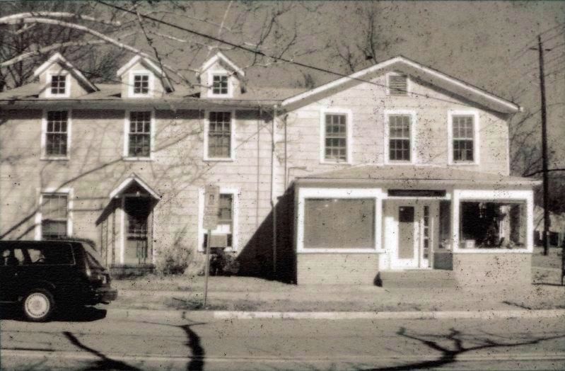
4. Harrison Store
Trolley Stop Sweet Shop
Trolley Stop Sweet Shop

Photographed by Allen C. Browne, May 28, 2018
5. White's Store

Photographed by Allen C. Browne, May 28, 2018
6. Harrison Store
Trolley Stop Sweet Shop
Trolley Stop Sweet Shop
Credits. This page was last revised on September 30, 2026. It was originally submitted on March 16, 2018, by Devry Becker Jones of Washington, District of Columbia. This page has been viewed 569 times since then and 93 times this year. Photos: 1, 2, 3. submitted on March 16, 2018, by Devry Becker Jones of Washington, District of Columbia. 4, 5, 6. submitted on May 31, 2018, by Allen C. Browne of Silver Spring, Maryland. • Bill Pfingsten was the editor who published this page.
