Newburyport in Essex County, Massachusetts — The American Northeast (New England)
The Bartlet Mall
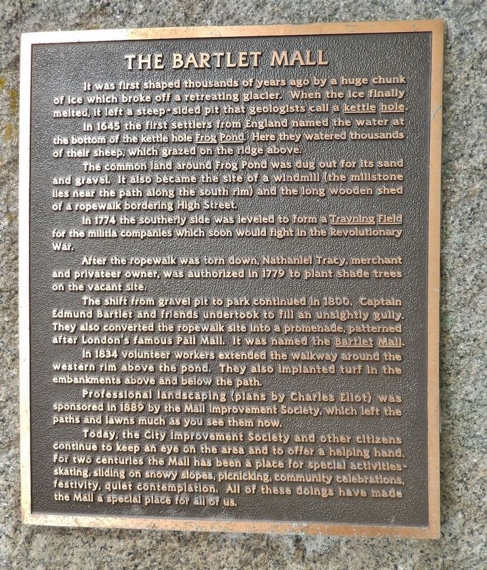
It was first shaped thousands of years ago by a huge chunk of ice which broke off a retreating glacier. When the ice finally melted, it left a steep-sided pit that geologists call a kettle hole.
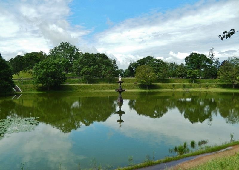
In 1645 the first settlers from England named the water at the bottom of the kettle hole Frog Pond. Here they watered thousands of their sheep, which grazed on the ridge above.
The common land around Frog Pond was dug out for its sand and gravel. It also became the site of a windmill (the millstone lies near the path along the south rim) and the long wooden shed of a ropewalk bordering High Street.
In 1774 the southerly side was leveled to form a Training Field for the militia companies which soon would fight in the Revolutionary War.
After the ropewalk was torn down, Nathaniel Tracy, merchant and privateer owner, was authorized in 1779 to plant shade trees on the vacant site.
The shift from gravel pit to park continued in 1800. Captain Edmund Bartlet and friends undertook to fill an unsightly gully. They also converted the ropewalk site into a promenade, patterned after London’s famous Pall Mall. It was named the Bartlet Mall.
In 1834 volunteer workers extended the walkway around the western rim above the pond. They also implanted turf in the embankments above and below the path.
Professional landscaping (plans by Charles Eliot) was sponsored in 1889 by the Mall Improvement Society, which left the paths and lawns much as you see them now.
Today, the City Improvement Society and other citizens continue to keep an eye on the area and to offer a helping hand. For two centuries the Mall has been a place for special activities – skating, sliding on snowy slopes, picnicking, community celebrations, festivity, quiet contemplation. All of these doings have made the Mall a special place for all of us.
Topics. This historical marker is listed in these topic lists: Parks & Recreational Areas • War, US Revolutionary.
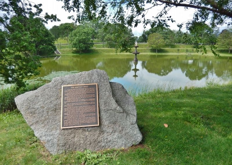
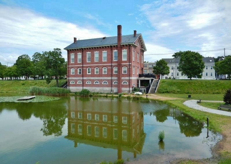
Location. 42° 48.498′ N, 70° 52.449′ W. Marker is in Newburyport, Massachusetts, in Essex County. Marker can be reached from the intersection of High Street (Massachusetts Route 1A) and Green Street, on the right when traveling south. Marker is located in the subject park, near the northwest corner of the Essex County Superior Court building, overlooking Frog Pond. Touch for map. Marker is at or near this postal address: 145 High Street, Newburyport MA 01950, United States of America. Touch for directions.
Other nearby markers. At least 8 other markers are within walking distance of this marker. Bombshell (within shouting distance of this marker); Within Lie Buried (about 500 feet away, measured in a direct line); Dalton House
(approx. 0.2 miles away); William Lloyd Garrison (approx. 0.2 miles away); The Memory of the Officers and Men (approx. ¼ mile away); Historic 1893 Newburyport Train Station (approx. ¼ mile away); Market Square Tea Burning (approx. 0.3 miles away); Watts' Cellar (approx. 0.3 miles away). Touch for a list and map of all markers in Newburyport.
More about this marker. Marker is a metal tablet mounted on a large, natural granite boulder.
Also see . . .
1. A Scenic Park Rich in History.
Bartlet Mall dates to the 1600s when the first English settlers used the area as a place to water and graze sheep. It was also a training area for militias that would go on to fight in the Revolutionary War. The Mall was professionally landscaped in the late 1880s using plans by landscape architect, Charles Eliot. This work resulted in the beautiful paths and grassy lawns enjoyed by visitors today. (Submitted on March 27, 2018, by Cosmos Mariner of Cape Canaveral, Florida.)
2. Bartlet Mall (Newburyport, Massachusetts).
The area around the Frog Pond has been used as a town common since the 1600’s. The promenade known as the Bartlet Mall was created in 1800 through the efforts of Captain Edmund Bartlet by filling in a ravine. In 1887, Charles Eliot developed a plan to improve the Common, and much of the park’s historical significance dates to this plan. The framework of the park and the essential elements designed by Eliot – the grading, stair locations and circulation routes – are enjoyed by the public to this day. Charles Eliot was an internationally famous, early seminal figure in the field of landscape architecture, and partnered with Frederick Law Olmsted before his untimely death in 1897. The National Register of Historic Places, which is the nation’s official listing of cultural resources most worthy of preservation, includes the Bartlet Mall and Superior Courthouse. (Submitted on March 27, 2018, by Cosmos Mariner of Cape Canaveral, Florida.)
Credits. This page was last revised on March 27, 2018. It was originally submitted on March 27, 2018, by Cosmos Mariner of Cape Canaveral, Florida. This page has been viewed 1,028 times since then and 114 times this year. Photos: 1, 2, 3, 4, 5, 6. submitted on March 27, 2018, by Cosmos Mariner of Cape Canaveral, Florida. • Andrew Ruppenstein was the editor who published this page.


