Near Menard in Menard County, Texas — The American South (West South Central)
Restoration and Reconstruction
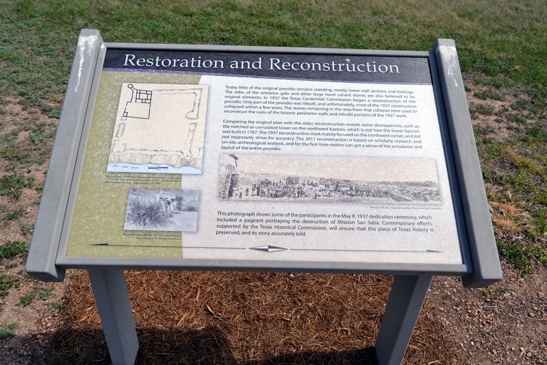
Comparing the original plan with the older reconstruction reveals some discrepancies, such as the notched or crenulated tower on the northwest bastion, which is not how the tower bastion was built in 1767. The 1937 reconstruction work mainly focused on the northwest corner, and did not necessarily strive for accuracy. The 2011 reconstruction is based on scholarly research and on-site archeological analysis, and for the first time visitors can get a sense of the actual size and layout of the entire presidio.
This photograph shows some of the participants in the May 8, 1937 dedication ceremony, which included a pageant portraying the destruction of Mission San Sabá. Contemporary efforts, supported by the Texas Historical Commission, will ensure that this piece of Texas history is preserved, and its story accurately told.
(Upper Left Graphic Caption)
Two comparative presidio plans illustrated the size and position of the original 1757 presidio with the reconstruction presidio of 1937. The reconstruction is shown in heavy black lines. Image courtesy of Ivey, 1981
(Lower Left Image Caption)
The presidio shown after the 1937 partial reconstruction. Image courtesy of the National Park Service
(Right Image Caption)
Photo by N.H. Rose. Image courtesy of the Presidio San Sabá Corporation
Topics. This historical marker is listed in this topic list: Forts and Castles. A significant historical year for this entry is 1937.
Location. 30° 55.345′ N, 99° 48.099′ W. Marker is near Menard, Texas, in Menard County. Marker can be reached from U.S. 190, 1.1 miles Frisco Avenue (U.S. 83). Marker is located at the Presidio de San Saba Historic Site within the presidio walls; the above directions are to the driveway entrance to the historic site. Touch for map. Marker is in this post office area: Menard TX 76859, United States of America. Touch for directions.
Other nearby markers. At least 8 other markers are within walking distance of this marker. Real Presidio de San Saba (here, next to this marker); VIP Quarters (within shouting distance of this marker); Plaza (within shouting distance of this marker); Livestock Corral
(within shouting distance of this marker); NW Bastion (within shouting distance of this marker); Presidio de San Sabá (within shouting distance of this marker); Bastions of Defense (within shouting distance of this marker); Welcome To Menard (about 400 feet away, measured in a direct line). Touch for a list and map of all markers in Menard.
Also see . . .
1. San Luis de Las Amarillas Presidio. From the Texas State Historical Association’s “Handbook of Texas Online”. (Submitted on April 4, 2018.)
2. Presidio de San Saba Historic Site. Official website. Includes before and after restoration videos. (Submitted on April 4, 2018.)
Credits. This page was last revised on April 4, 2018. It was originally submitted on April 4, 2018, by Duane Hall of Abilene, Texas. This page has been viewed 163 times since then and 10 times this year. Photos: 1. submitted on April 4, 2018. 2. submitted on April 2, 2018, by Duane Hall of Abilene, Texas. 3, 4. submitted on April 4, 2018, by Duane Hall of Abilene, Texas.


