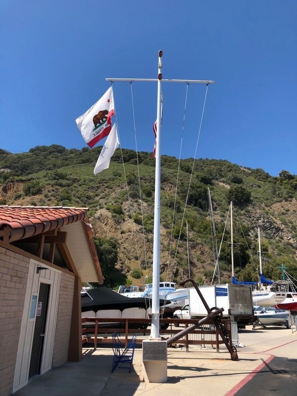
Avila Beach in San Luis Obispo County, California — The American West (Pacific Coastal)
Port Harford Wharf & Pacific Coast Railway
Commemoration July 19, 1986
Inscription.
Pacific Coast Steamship Company organized 1876
Pacific Coast Railway ( PCRR, SLO & SMVRR) 1882
Vision & enterprise of the narrow gauge railroad expanded trade & settlement on the California central coast between Avila, San Luis Obispo, Arroyo Grande, Nipomo, Santa Maria, Orcutt, Los Alamos & Los Olivos. Ah Louis, supervisor of his Chinese labor crew, built the roadbed and laid the rail.
Erected 1986 by Port San Luis Harbor District, Friends of the Pacific Coast Railway and South County Historical Society, Railway Centennial Committe.
Topics. This historical marker is listed in these topic lists: Asian Americans • Railroads & Streetcars • Waterways & Vessels. A significant historical year for this entry is 1873.
Location. 35° 10.288′ N, 120° 45.384′ W. Marker is in Avila Beach, California, in San Luis Obispo County. Marker is on Avila Beach Drive near Diablo Canyon Road, on the right when traveling north. The marker is located at the base of the flagpole next to the Port San Luis Harbormaster's Office. Touch for map. Marker is at or near this postal address: 3950 Avila Beach Drive, Avila Beach CA 93424, United States of America. Touch for directions.
Other nearby markers. At least 8 other markers are within 7 miles of this marker, measured as the crow flies. Sailing Ship Anchor (here, next to this marker); Port San Luis (within shouting distance of this marker); Port Harford Pier (approx. ¼ mile away); Point San Luis Light Station (approx. 0.8 miles away); Pier Into The Past (approx. one mile away); The History of Pismo Beach Wharf and Pier (approx. 6.7 miles away); History of Pismo Clams in California (approx. 6.8 miles away); Pismo Beach Pier Plaza (approx. 6.8 miles away). Touch for a list and map of all markers in Avila Beach.
Credits. This page was last revised on May 4, 2018. It was originally submitted on May 4, 2018, by Barry Swackhamer of Brentwood, California. This page has been viewed 295 times since then and 29 times this year. Photos: 1, 2. submitted on May 4, 2018, by Barry Swackhamer of Brentwood, California.

