City of London in Greater London, England, United Kingdom — Northwestern Europe (the British Isles)
Walbrook Wharf
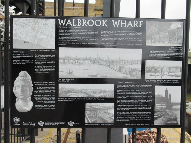
Walbrook Wharf is the point where the now buried Walbrook River fed into the River Thames.
The Walbrook is one of London’s ‘Lost Rivers’, a watercourse which has been lost to time and history.
The Walbrook was a feature of Roman London separating the two hills of Cornhill and Ludgate.
It was enclosed and surrounding land reclaimed and began silting up in the 2nd century.
A number of industries such as glass manufacturing, leatherworking and pottery production and were established around the Walbrook due to the available source of water.
The Riverside's historical evolution
The history of the City waterfront defines the evolution of the City as a trading, commercial and financial centre of national and international importance. Since Roman times the waterfront has been intensively used for the trading of goods from Britain and abroad.
The wharves and quays built on the river bank extended the working waterfront further into the river, separated by a series of lanes and alleys linking the river to the markets, for example at Cheapside.
Cousin Lane, known from 1280, on the east side of Walbrook Wharf is one of these historic streets.
During the 10th to the 15th century the waterfront was rapidly improved and extended with embankments, docks and quays. The earliest docks were at Queenhithe, Vintry and Dowgate. Dowgate was at the confluence of the Walbrook and the Thames.
From 1558 the administration of trade in the City was organised through 20 Legal Quays between London Bridge and the Tower of London, handling half of the nation's trade.
The late 18th century was a period which saw the volume of trade triple, to make London the world's busiest port.
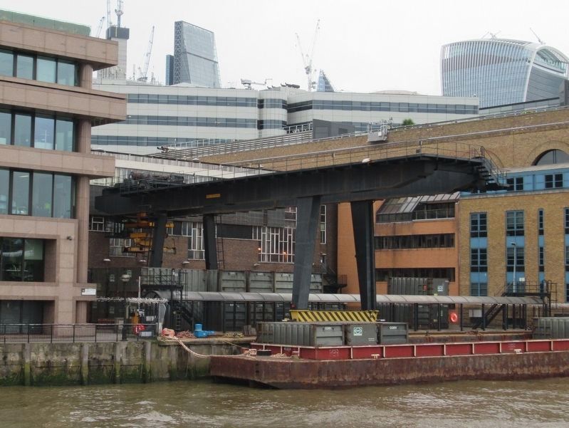
Walbrook Wharf was first opened in 1963 and underwent major redevelopment in 1995. It is used as a waste transfer station for refuse from central London.
It currently handles around 45,000 – 50,000 tonnes of waste per year: 5,000 tonnes of domestic/street cleansing waste (including 1500 tonnes of recycling) and around 40,000 tonnes of commercial waste.
Waste is loaded straight into shipping containers and each one can contain 12 tonnes.
Up to 12 containers are filled with waste Monday to Friday and about five on Saturday and Sunday. Each barge has 26 containers delivered to the Energy from Waste plant at Belvedere in Bexley.
The Riverside Resource Recovery Energy from Waste facility receives waste from 4 other London boroughs and will process enough non-recyclable residual waste each year to generate electricity to power around 100,000 homes.
All of the City of London's non-recyclable waste is processed through the facility
resulting in the City of London being one of the first Local Authorities in the country to achieve zero waste to landfill status.
The majority of waste is delivered by river to the Energy from Waste plant, removing more than 100,000 lorry movements from the capital's congested roads each year.
Three Cranes Wharf is situated east of Queenhithe and west of London Bridge. It is located in a section of the Riverside which was dedicated to storing wine that was imported from other countries, most notably, France. Three Cranes Wharf derives its name from the three large wooden cranes that lifted wine from ships.
Topics. This historical marker is listed in these topic lists: Industry & Commerce • Waterways & Vessels.
Location. 51° 30.578′ N, 0° 5.55′ W. Marker is in City of London, England, in Greater London. Marker can be reached from the intersection of Upper Thames Street and Bell Wharf Lane, on the right when traveling east. Located on the Riverside Walk (Thames Path). Touch for map. Marker is in this post office area: City of London, England EC4V 3BG, United Kingdom. Touch for directions.
Other nearby markers. At least 8 other markers are within walking distance of this marker. Foundation Stone (about 120 meters away, measured in a direct line); Sixty Years of Peace (about 120 meters away); Whittington Garden (about 120 meters away); Worshipful Company of Innholders (about 150 meters away); The Alfred Plaque (about 180 meters away); Queenhithe (about 210 meters away); Queenhithe Mosaic (about 210 meters away); Tallow Chandlers Hall (about 210 meters away). Touch for a list and map of all markers in City of London.
Also see . . . Walbrook Wharf on Wikipedia. (Submitted on May 28, 2018, by Michael Herrick of Southbury, Connecticut.)
Credits. This page was last revised on January 27, 2022. It was originally submitted on May 28, 2018, by Michael Herrick of Southbury, Connecticut. This page has been viewed 551 times since then and 129 times this year. Photos: 1, 2, 3. submitted on May 28, 2018, by Michael Herrick of Southbury, Connecticut.


