Georgetown in Northwest Washington in Washington, District of Columbia — The American Northeast (Mid-Atlantic)
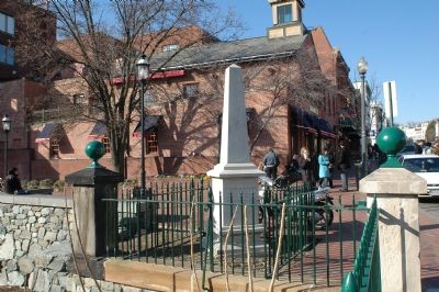
Chesapeake & Ohio Canal
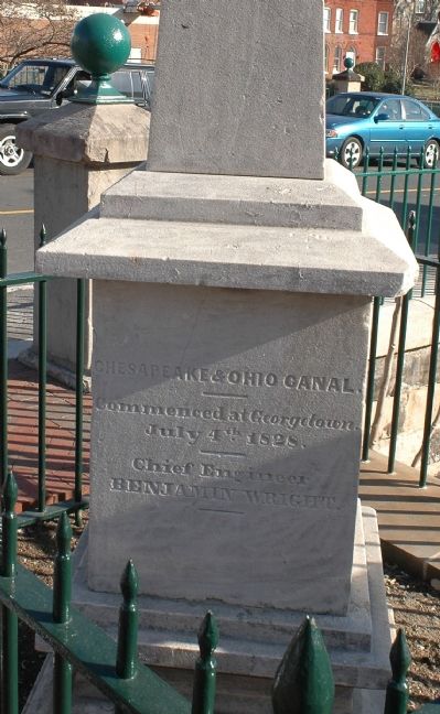
Chesapeake & Ohio Canal. Commenced at Georgetown. July 4th 1828. Chief Engineer Benjamin Wright.
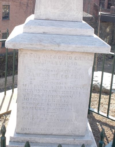
Chesapeake & Ohio Canal Company, 1850. President James M. Coale. Directors William A. Bradley, Henry Daingerfield, Wm. Cost Johnson, John Pickell, George Schley, Samuel P. Smith. Clerk Walter S. Bringgold. Treasurer Lawrence J. Brengle.
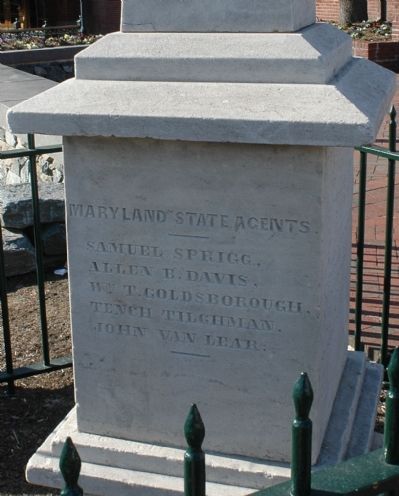
Maryland State Agents. Samuel Sprigg, Allen B. Davis, Wm. T. Goldsborough, Tench Tilghman, John Van Lear.
Erected 1850 by Chesapeake & Ohio Canal Company.
Topics and series. This historical marker is listed in this topic list: Waterways & Vessels. In addition, it is included in the Chesapeake and Ohio (C&O) Canal series list. A significant historical date for this entry is July 4, 1824.
Location. 38° 54.262′ N, 77° 3.776′ W. Marker is in Northwest Washington in Washington, District of Columbia. It is in Georgetown. Marker is at the intersection of Wisconsin Avenue Northwest and C&O Canal Towpath Northwest, on the right when traveling south on Wisconsin Avenue Northwest. Touch for map. Marker is at or near this postal address: 1062 Wisconsin Avenue Northwest, Washington DC 20007, United States of America. Touch for directions.
Other nearby markers. At least 5 other markers are within walking distance of this marker. Crossroads of Georgetown (within shouting distance of this marker); World War I Memorial (about 300 feet away, measured in a direct line); The City Tavern (about 300 feet away); Canal House (about 400 feet away); Potomac No. 5 (about 400 feet away). Touch for a list and map of all markers in Northwest Washington.
Also see . . . Chesapeake & Ohio Canal National Historical Park. (Submitted on February 22, 2006.)
Additional keywords. C&O Canal, C & O Canal, C and O Canal
Photographed By Tom Fuchs, February 20, 2006
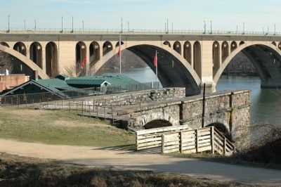
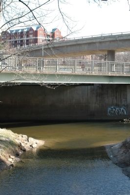
5. The Eastern Terminus of the C&O Canal
The Canal empties into Rock Creek. Lower bridge carries the Rock Creek and Potomac Parkway over Rock Creek. Upper bridge is the Potomac River Freeway northbound, curving around to terminate at westbound K Street, N.W.
Postcard by the Washington News Company, circa 1910
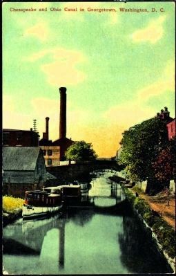
11. The Chesapeake and Ohio Canal in Georgetown, Washington, D.C.
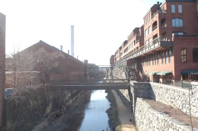
The back of the postcard reads, "This canal runs from Washington to Columbia, Md., and is used to transport coal and other products, and also shows the canal passing through historic Georgetown." Although difficult to confirm, this would seem to be the same perspective as Photo 6 on this page, looking west from the bridge on Wisconsin Avenue.
Credits. This page was last revised on January 30, 2023. It was originally submitted on February 22, 2006, by Tom Fuchs of Greenbelt, Maryland. This page has been viewed 4,711 times since then and 38 times this year. Photos: 1, 2, 3, 4. submitted on February 22, 2006, by Tom Fuchs of Greenbelt, Maryland. 5. submitted on February 24, 2006, by Tom Fuchs of Greenbelt, Maryland. 6, 7. submitted on February 22, 2006, by Tom Fuchs of Greenbelt, Maryland. 8. submitted on February 24, 2006, by J. J. Prats of Powell, Ohio. 9. submitted on February 24, 2006, by Tom Fuchs of Greenbelt, Maryland. 10. submitted on February 22, 2006, by Tom Fuchs of Greenbelt, Maryland. 11. submitted on January 7, 2015. • J. J. Prats was the editor who published this page.
