Near Rice in Prince Edward County, Virginia — The American South (Mid-Atlantic)
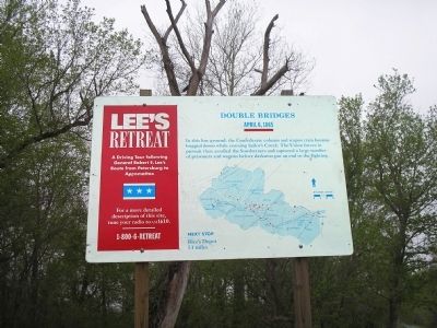
Double Bridges
Lee’s Retreat
— April 6, 1865 —
Next Stop
Rice’s Depot
5.1 miles
Erected by Virginia Civil War Trails.
Topics. This historical marker is listed in this topic list: War, US Civil.
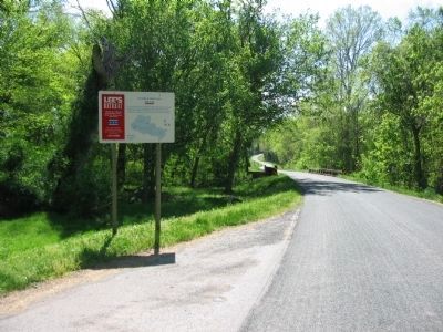
Location. 37° 19.572′ N, 78° 15.317′ W. Marker is near Rice, Virginia, in Prince Edward County. Marker is on Virginia Route 619, on the right when traveling south. Touch for map. Marker is in this post office area: Rice VA 23966, United States of America. Touch for directions.
Other nearby markers. At least 8 other markers are within 3 miles of this marker, measured as the crow flies. A different marker also named Double Bridges (approx. 0.2 miles away); Lockett House (approx. half a mile away); Sailor’s Creek (approx. half a mile away); a different marker also named Lockett House (approx. half a mile away); Crossing Little Sailor's Creek (approx. 2.1 miles away); Assaulting the Confederate Battle Line (approx. 2.1 miles away); Battle of Sailor's (Sayler's) Creek (approx. 2.1 miles away); Hillsman House (approx. 2.2 miles away). Touch for a list and map of all markers in Rice.
Click on the ad for more information.
Please report objectionable advertising to the Editor.
sectionhead>More about this marker. Below the main text of the marker is a map of the retreat showing important stops along the route.Please report objectionable advertising to the Editor.
Regarding Double Bridges. Part of a driving tour following General Robert E. Lee's route from Petersburg to Appomattox. While visiting the site a more detailed description is played on short range radio on AM1610. Or call 1-800-6-retreat.
Also see . . .
1. Lee's Retreat to Appomattox. Virginia Civil War Trails. (Submitted on September 27, 2008, by Bill Coughlin of Woodland Park, New Jersey.)
2. Sailor’s Creek. CWSAC Battle Summaries. (Submitted on September 27, 2008, by Bill Coughlin of Woodland Park, New Jersey.)
3. Sailor's Creek State Park. Virginia State Parks website. (Submitted on September 27, 2008, by Bill Coughlin of Woodland Park, New Jersey.)
Credits. This page was last revised on June 16, 2016. It was originally submitted on September 27, 2008, by Bill Coughlin of Woodland Park, New Jersey. This page has been viewed 1,806 times since then and 53 times this year. Photos: 1, 2. submitted on September 27, 2008, by Bill Coughlin of Woodland Park, New Jersey. 3. submitted on June 12, 2010, by Craig Swain of Leesburg, Virginia.


