City of London in Greater London, England, United Kingdom — Northwestern Europe (the British Isles)
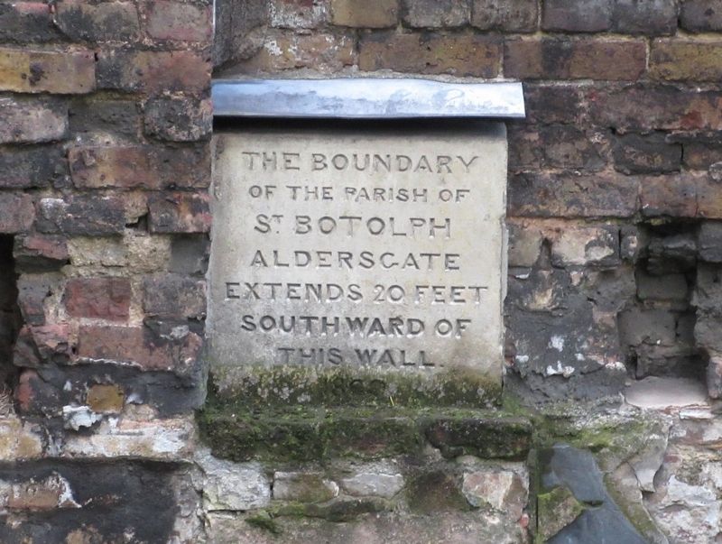
The boundary of St Botolph
Photographed by Michael Herrick, May 2, 2018
1. The boundary of St Botolph Marker
Of the Parish of
St Botolph
Aldersgate
Extends 20 feet
Southward of
This Wall
1800
Erected 1800.
Topics. This historical marker is listed in these topic lists: Forts and Castles • Religion & Religious Structures.
Location. 51° 31.007′ N, 0° 5.754′ W. Marker is in City of London, England, in Greater London. It is at the intersection of Noble Street and London Wall, on the left when traveling north on Noble Street. Touch for map. Marker is in this post office area: City of London, England EC2V 7EE, United Kingdom. Touch for directions.

Regionally, this marker is in London and in the Greater South East. Globally, it is on the Atlantic Ocean, in the North Atlantic Region, in Europe, in Atlantic Europe, on one of the British Isles, in the Western World, and in the Anglosphere. Historically, it finds itself in what was once the Roman Empire.
Other nearby markers. At least 8 other markers are within walking distance of this marker: Fire prevention (a few steps from this marker); Set in stone (a few steps from this marker); Noble Street Garden
this page online
Also see . . .
1. St Botolph Aldgate. London Lives 1690 to 1800 website entry (Submitted on September 9, 2024, by Larry Gertner of New York, New York.)
2. London’s Roman City Wall. Historic UK Guide website entry (Submitted on June 3, 2018, by Michael Herrick of Southbury, Connecticut.)
3. London Wall. Wikipedia website entry (Submitted on June 3, 2018, by Michael Herrick of Southbury, Connecticut.)
Photographed by Michael Herrick, May 2, 2018
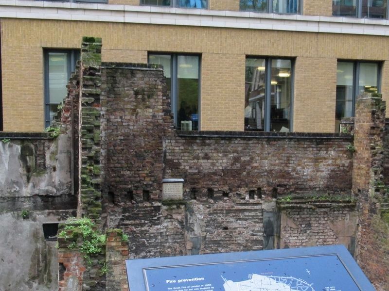
2. The boundary of St Botolph Marker
The marker, set in the Roman City Wall.
Credits. This page was last revised on September 9, 2024. It was originally submitted on June 3, 2018, by Michael Herrick of Southbury, Connecticut. This page has been viewed 358 times since then and 17 times this year. Photos: 1, 2. submitted on June 3, 2018, by Michael Herrick of Southbury, Connecticut.
