
Laurel in Sarasota County, Florida — The American South (South Atlantic)
Laurel Turpentine and Lumber Industry
Photographed by Julie Szabo, January 20, 2008
1. Laurel Turpentine and Lumber Industry Marker
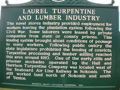
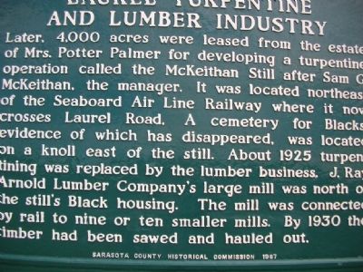
Later, 4,000 acres were leased from the estate of Mrs. Potter Palmer for developing a turpentine operation called the McKeithan Still after Sam G. McKeithan, the manager. It was located northeast of the Seaboard Air Line Railway where it now crosses Laurel Road. A cemetery for Blacks, evidence of which has disappeared, was located on a knoll east of the still. About 1925 turpentining was replaced by the lumber business. J. Ray Arnold Lumber Company's large mill was north of the still's Black
this page online
Erected 1987 by Sarasota County Historical Commission.
Topics. This historical marker is listed in these topic lists: African Americans • Cemeteries & Burial Sites • Horticulture & Forestry • Industry & Commerce • Natural Resources • Railroads & Streetcars • Settlements & Settlers. A significant historical year for this entry is 1910.
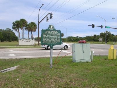
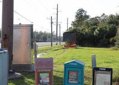
Location. Marker is missing. It was located near 27° 8.318′ N, 82° 26.743′ W. Marker was in Laurel, Florida, in Sarasota County. It was at the intersection of Laurel Road East and Mission Valley Blvd., on the right when traveling west on Laurel Road East. Touch for map. Marker was in this post office area: Nokomis FL 34275, United States of America. Touch for directions.

Regionally, this marker was on Florida’s Gulf Coast. It was also in the American South and on the Gulf Coast. Globally, it was in the North Atlantic Region, North America, a Gulf of Mexico state, the Western Hemisphere, the Western World, and the Anglosphere. Historically,
Photographed by Julie Szabo, January 20, 2008
2. Laurel Turpentine and Lumber Industry Marker Reverse
Other nearby markers. At least 8 other markers are within 2 miles of this location, measured as the crow flies: Laurel Turpentine Company / Blackburn Sawmill Quarters (approx. ¼ mile away); Johnson Chapel / Albee Quarters (approx. half a mile away); Shakett Creek / Estuary "the cradle of the ocean" (approx. ¾ mile away); Venice Post Office (approx. 0.9 miles away); Turpentine / Venice Ice House (approx. 1.2 miles away); Knight Memorial/Area First Cemetery (approx. 1.3 miles away); History of Nokomis / Fred Albee (approx. 1.4 miles away); Nokomis School (approx. 1½ miles away).
Photographed by Julie Szabo, January 20, 2008
3. Laurel Turpentine and Lumber Industry Marker
Photographed by Dave W, December 3, 2022
4. Laurel Turpentine and Lumber Industry Marker
Concrete pole with marker missing.
Credits. This page was last revised on December 5, 2022. It was originally submitted on January 21, 2008, by Julie Szabo of Oldsmar, Florida. This page has been viewed 3,094 times since then and 57 times this year. Last updated on September 27, 2008, by Philip Lohrenz of Staten Island, New York. Photos: 1, 2, 3. submitted on January 21, 2008, by Julie Szabo of Oldsmar, Florida. 4. submitted on December 5, 2022, by Dave W of Co, Colorado. • Kevin W. was the editor who published this page.
