Elk Grove in Sacramento County, California — The American West (Pacific Coastal)
Murphy’s Corral
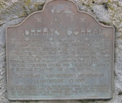
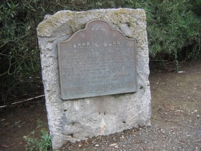
This is the site of the beginning of the conquest of California by the United States on June 10, 1846. American settlers led by Ezekial Merritt overpowered soldiers under Lt. Francisco Arce and took their Mexican Army horses from the corral of the Murphy Ranch on the north bank of the Cosumnes River. The “Bear Flag” action in Sonoma followed on June 14, 1846.
Erected 1959. (Marker Number 680.)
Topics and series. This historical marker is listed in this topic list: War, Mexican-American. In addition, it is included in the California Historical Landmarks series list. A significant historical month for this entry is June 1908.
Location. 38° 22.366′ N, 121° 21.54′ W. Marker is in Elk Grove, California, in Sacramento County. Marker is on West Stockton Boulevard east of Promenade Parkway, on the left when traveling east. Touch for map. Marker is in this post office area: Elk Grove CA 95624, United States of America. Touch for directions.
Other nearby markers. At least 8 other markers are within 3 miles of this marker, measured as the crow flies. Rhoads School (approx. 1.8 miles away); Old Elk Grove (approx. 2 miles away); The Lincoln Highway (approx. 2 miles away); James Hall (approx. 2 miles away); Elk Grove History (approx. 2.4 miles away); a different marker also named Elk Grove History (approx. 2˝ miles away); Site of the First County Free Library Branch in California (approx. 2˝ miles away); Hasman Building/General Store (approx. 2˝ miles away). Touch for a list and map of all markers in Elk Grove.
Additional commentary.
1. 1844 - Mrs. Murphy’s kindergarten
Mrs. Murphy’s school was somewhat of a home school. It was open for neighboring children as well as the Murphy children. Although it was not a formal school and it was not a public school, it was Elk Grove’s first place of education. The Murphys lived north of the Cosumnes River and west of what is now Highway 99. At the time that road was known as the Monterey Trail, and it led from New Helvetia (Sutter’s Fort) to the Mexican capital of Monterey. The Murphy Ranch played a prominent role in the history of the early days of California. The Incident at Murphy’s Corral was a defining moment in California history and one of the first steps in California breaking away from Mexico and becoming a state.
Source: ELK GROVE CITIZEN HISTORY HAPPENED HERE-The History of Our Schools
EGUSD – ABOUT TO CELEBRATE ITS 50TH
March 21, 2008, By Elizabeth Pinkerton
— Submitted September 28, 2008, by Syd Whittle of Mesa, Arizona.
Credits. This page was last revised on August 5, 2019. It was originally submitted on September 28, 2008, by Syd Whittle of Mesa, Arizona. This page has been viewed 2,882 times since then and 18 times this year. Photos: 1, 2. submitted on September 28, 2008, by Syd Whittle of Mesa, Arizona.

