Sabine Pass in Jefferson County, Texas — The American South (West South Central)
Dick Dowling
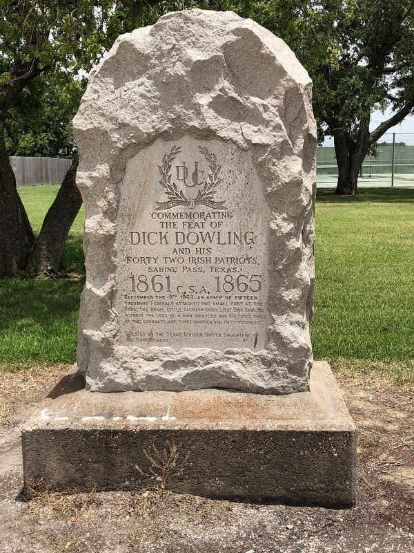
Photographed by Brian Anderson, June 10, 2018
1. Dick Dowling Marker
the feat of
Dick Dowling
and his forty two Irish patriots
Sabine Pass, Texas.
1861 C.S.A. 1865
Erected 1937 by Texas Division United Daughters of the Confederacy.
Topics and series. This memorial is listed in this topic list: War, US Civil. In addition, it is included in the United Daughters of the Confederacy series list. A significant historical date for this entry is September 8, 1863.
Location. 29° 43.958′ N, 93° 53.689′ W. Memorial is in Sabine Pass, Texas, in Jefferson County. It is on South Gulfway Drive (State Highway 87), on the right when traveling north. Touch for map. Memorial is at or near this postal address: 5310 South Gulfway Drive, Sabine Pass TX 77655, United States of America. Touch for directions.

Regionally, this memorial is in Texas’ Golden Triangle. It is also in the American South, on the Gulf Coast, and in the Piney Woods.
this page online
Other nearby markers. At least 8 other markers are within walking distance of this marker: Beach Road (here, next to this marker); Sabine Pass World War II Memorial (about 700 feet away, measured in a direct line); Sabine Pass Veterans Memorial (about 700 feet away); Fort Sabine (about 800 feet away); City of Sabine and Sabine Pass (approx. 0.2 miles away); 1886 Hurricane at Sabine Pass (approx. 0.2 miles away); Sabine Bank Lighthouse (approx. 0.2 miles away); Melvin Gillette (approx. 0.2 miles away). Touch for a list and map of all markers in Sabine Pass.
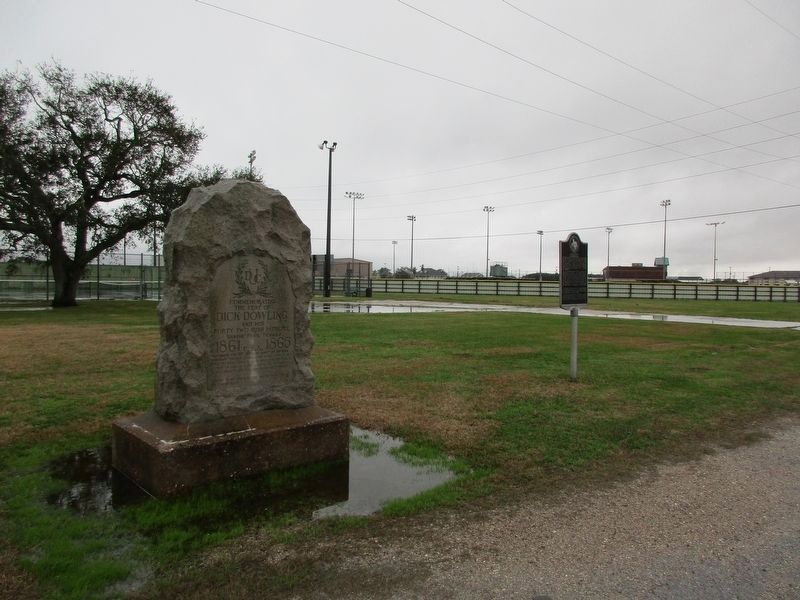
Photographed by Jeff Leichsenring, January 21, 2023
2. Dick Dowling Marker
The marker is next to the Beach Road Marker.
Credits. This page was last revised on January 30, 2023. It was originally submitted on June 14, 2018, by Brian Anderson of New Albany, Ohio. This page has been viewed 467 times since then and 23 times this year. Photos: 1. submitted on June 14, 2018, by Brian Anderson of New Albany, Ohio. 2. submitted on January 28, 2023, by Jeff Leichsenring of Garland, Texas. • Andrew Ruppenstein was the editor who published this page.
