
Midtown in Sacramento in Sacramento County, California — The American West (Pacific Coastal)
Sutter's Fort
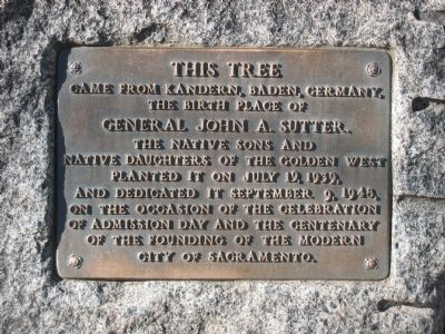
This Tree Came From Kandern, Baden, Germany
| — | The Birthplace of General John A. Sutter | — |
Photographed by Syd Whittle, January 15, 2006
1. Sutter's Fort Marker
The Native Sons and Native Daughters of the Golden West planted it on July 19, 1939, and dedicated it September 9, 1948, on the occasion of the celebration of Admission Day and the Centenary of the founding of the modern City of Sacramento.
Erected 1948 by The Native Sons and Native Daughters of the Golden West. (Marker Number 525.)
Topics and series. This historical marker is listed in these topic lists: Forts and Castles • Industry & Commerce • Settlements & Settlers. In addition, it is included in the California Historical Landmarks, the Historic Trees, the National Historic Landmarks, and the Native Sons/Daughters of the Golden West series lists. A significant historical month for this entry is July 1918.
Location. 38° 34.341′ N, 121° 28.25′ W. Marker is in Sacramento, California, in Sacramento County. It is in Midtown. It can be reached from L Street. Marker is located at the base of the European Oak Tree within the walls of The Sutter's Fort State Historic Park. Touch for map. Marker is at or near this postal address: 2701 L Street, Sacramento CA 95816, United States of America. Touch for directions.

Regionally,
this page online
Other nearby markers. At least 8 other markers are within walking distance of this marker: The Coloma Road (within shouting distance of this marker); California State Indian Museum (about 300 feet away); New Helvetia Cemetery (approx. 0.3 miles away); General Albert M. Winn (approx. 0.4 miles away); The Dunn Mansion (approx. 0.4 miles away); William McKinley Park (approx. half a mile away); The First Hundred Years are the Hardest (approx. half a mile away); First United Methodist Church (approx. half a mile away). Touch for a list and map of all markers in Sacramento.
Another marker is no longer nearby. General John A. Sutter (was about 300 feet away, measured in a direct line but has been permanently removed).
Regarding Sutter's Fort. This site is California
Photographed by Syd Whittle, January 15, 2006
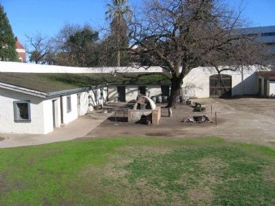
2. Inside the Walls - The European Oak
The marker is to the right of the Tree.
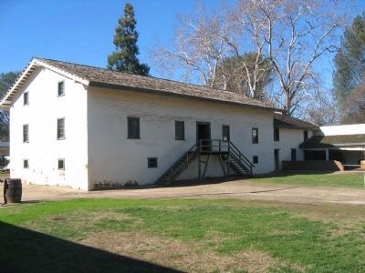
John Augustus Sutter, born of Swiss parents in Germany, arrived in New York in July 1834 and in California in July 1839. He founded the fort in 1839 to protect 'New Helvetia,' his 76-square-mile Mexican land grant. Of the original fort, the two-story central building, made of adobe and oak, remains, the fort's outer walls and rooms, which had disappeared by the 1860s, were reconstructed after the State acquired the property in 1890.
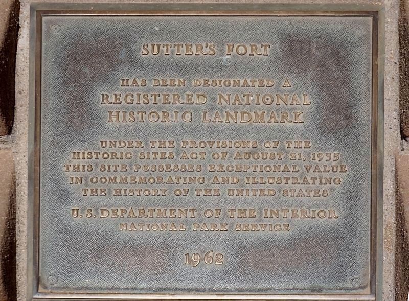
This site is a National Historic Landmark:
Statement of Significance (as of designation - January 20, 1961):
During the 1840s, Sutter's Fort, situated at the convergence of overland immigrant trails, was the most strategically located site in Northern California. The fort was the focal point of the various agricultural enterprises controlled by its builder, John Agustus Sutter. Discovery of gold in the Sierra foothills, ironically at a saw mill constructed for Sutter, led to the collapse of Sutter's growing empire.
Related markers. Click here for a list of markers that are related to this marker. - The route from Sutter’s Fort to Sutter’s Mill.
Also see . . .
1. California State Parks: The History of Sutter’s Fort.
Photographed by Craig Baker
3. National Historic Landmark
2. The California State Military Museum: Sutter’s Fort, Fort New Helvatia, Fort Sacramento. (Submitted on September 28, 2008, by Syd Whittle of Mesa, Arizona.)
3. Hidden Treasures of Sutter’s Fort - with Huell Howser. Half-hour video produced for PBS in 2017 includes a tour the fort and its archives. (Submitted on May 16, 2024.)
Additional keywords. California Historical Landmark
Photographed by Syd Whittle, January 15, 2006
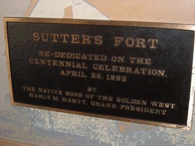
4. Marker inside the museum
Sutter’s Fort - Re-dedicated on the Centennial Celebration April 23, 1993 by The Native Sons of the Golden West - Harly M. Harty, Grand President
Photographed by Syd Whittle, January 15, 2006
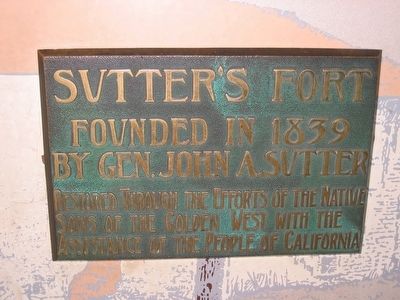
5. Marker inside museum, dedicated in 1905
Sutter’s Fort - Founded in 1839 by Gen. John A. Sutter. Restored through the efforts of the Native Sons of the Golden West with the assistance of the people of California.
Photographed by Syd Whittle, January 15, 2006
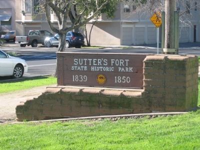
6. Sutter's Fort State Historic Park
Photographed by Syd Whittle, January 15, 2006
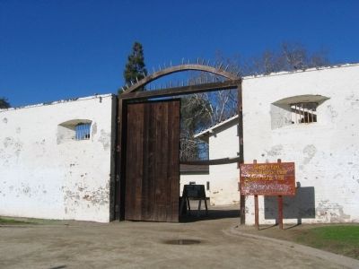
7. Entrance to Sutter's Fort
Photographed by Mike Stroud, May 1978
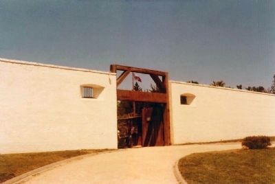
8. Sutter's Fort Entrance
Notice the slight change in appearance in the Fort's Entrance in the almost 30 years between these two photographs.
Photographed by Syd Whittle, January 15, 2006
9. Sutter's Fort
Photographed by Syd Whittle, January 15, 2006
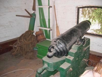
10. Cannon
Sutter had the cannon in the Southeast bastion of the original fort until 1846, when the guns were removed and it was used for storage.
Then the bastion was used as a hospital for Cholera and other patients in 1849-50, with a Dr. Deal in charge.
Photographed by Mike Stroud, May 1978
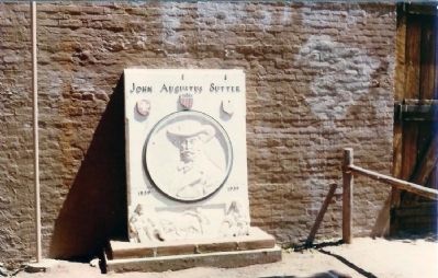
11. John Augustus Sutter 1839-1939
by E.P. Charlton & Co, Sacramento
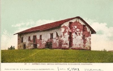
12. Vintage Postcard - circa 1907
from Sutter's Fort SHP
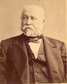
13. John A. Sutter - 1878
from Sutters Fort SHP Brochure
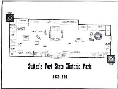
14. Sutter's Fort Site Map
California State Library - Archives
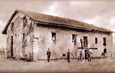
15. Sutter's Fort
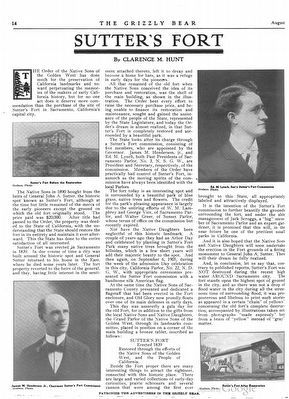
16. Sutter's Fort by Clarence M. Hunt
An article from the August 1907 edition of the Grizzly Bear magazine, the official organ of the Native Sons and the Native Daughters of the Golden West, about the preservation of Sutter's Fort.
Credits. This page was last revised on May 17, 2024. It was originally submitted on September 28, 2008, by Syd Whittle of Mesa, Arizona. This page has been viewed 7,328 times since then and 222 times this year. Photos: 1, 2. submitted on September 28, 2008, by Syd Whittle of Mesa, Arizona. 3. submitted on November 14, 2023, by Craig Baker of Sylmar, California. 4, 5, 6, 7. submitted on September 28, 2008, by Syd Whittle of Mesa, Arizona. 8. submitted on October 11, 2008, by Mike Stroud of Bluffton, South Carolina. 9, 10. submitted on September 28, 2008, by Syd Whittle of Mesa, Arizona. 11. submitted on October 11, 2008, by Mike Stroud of Bluffton, South Carolina. 12. submitted on September 28, 2008, by Syd Whittle of Mesa, Arizona. 13. submitted on October 11, 2008, by Syd Whittle of Mesa, Arizona. 14. submitted on January 31, 2009, by Syd Whittle of Mesa, Arizona. 15. submitted on February 5, 2009, by Syd Whittle of Mesa, Arizona. 16. submitted on June 16, 2016, by James King of San Miguel, California.
