Near Boise in Ada County, Idaho — The American West (Mountains)
Kelton Road
The Oregon Trail

Photographed By Barry Swackhamer, May 3, 2018
1. Kelton Road Marker
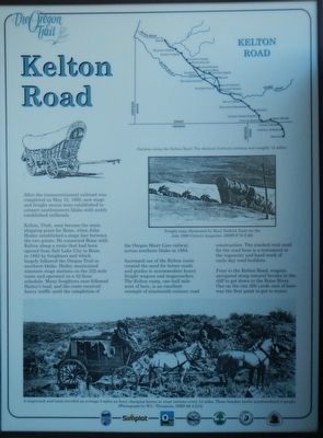
Captions: (top right) Map of the Kelton Road; (middle right) Freight train illustrated by Mary Hallock Foote for the July 1889 Century magazine.; (bottom) A stagecoach and team traveled an average of 5 miles and hour, changing horses at stage stations every 12 miles. Three benches inside accommodated 9 people.
Kelton, Utah, soon became the main shipping point for Boise, when John Hailey established a stage line between the two points. He connected Boise with Kelton along a route that had been opened from Salt Lake City to Boise in 1836 by freighters and which largely followed the Oregon Trail in southern Idaho. Hailey maintained nineteen stage stations on the 232-mile route and operated on a 42-hour schedule. Many freighters soon followed Hailey's lead, and the route received heavy traffic until the completion of the Oregon Short Line railway across southern Idaho in 1884.
Increased use of the Kelton route created the need for better roads and grades to accommodate heavy freight wagons and stagecoaches. The Kelton ramp, one-half mile west of here, is an excellent example of nineteenth-century road construction. The stacked rock used for the road base is a testament to the ingenuity and hard work of early-day road builders.
Prior to the Kelton Road, wagons navigated steep natural breaks in the cliff to get down to the Boise River. One on the rim 300 yards east of here was the first point to get water.
Erected by Ada County Parks and Recreation, Idaho Department of Transportation, Simplot.
Topics and series. This historical marker is listed in this topic list: Roads & Vehicles. In addition, it is included in the Oregon Trail series list.
Location. 43° 32.538′ N, 116° 6.582′ W. Marker is near Boise, Idaho, in Ada County. Marker is at the intersection of U.S. 21 and East Lake Forest Drive, on the right when traveling north on U.S. 21. Touch for map. Marker is in this post office area: Boise ID 83716, United States of America. Touch for directions.
Other nearby markers. At least 8 other markers are within walking distance of this marker. Idaho's Emigrant Trails (a few steps from this marker); Bonneville Point (a few steps from this marker); Fort Boise (a few steps from this marker); Ezra Meeker (a few steps from this marker); "Our Road Was Very Steep…" (approx. 0.4 miles away); The Oregon Trail (approx. 0.8 miles away); Beaver Dick's Ferry (approx. 0.8 miles away); Whitman Overlook (approx. 0.9 miles away). Touch for a list and map of all markers in Boise.
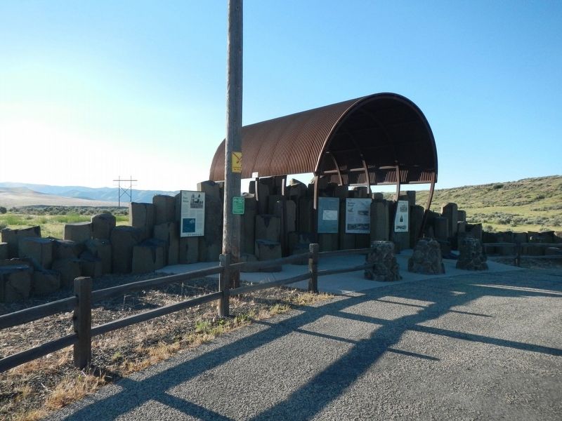
More about this marker. This marker is located at Oregon Trail display just off the highway.
Credits. This page was last revised on June 19, 2018. It was originally submitted on June 19, 2018, by Barry Swackhamer of Brentwood, California. This page has been viewed 949 times since then and 94 times this year. Photos: 1, 2. submitted on June 19, 2018, by Barry Swackhamer of Brentwood, California.
