Penn Township near Duncannon in Perry County, Pennsylvania — The American Northeast (Mid-Atlantic)
Duncannon
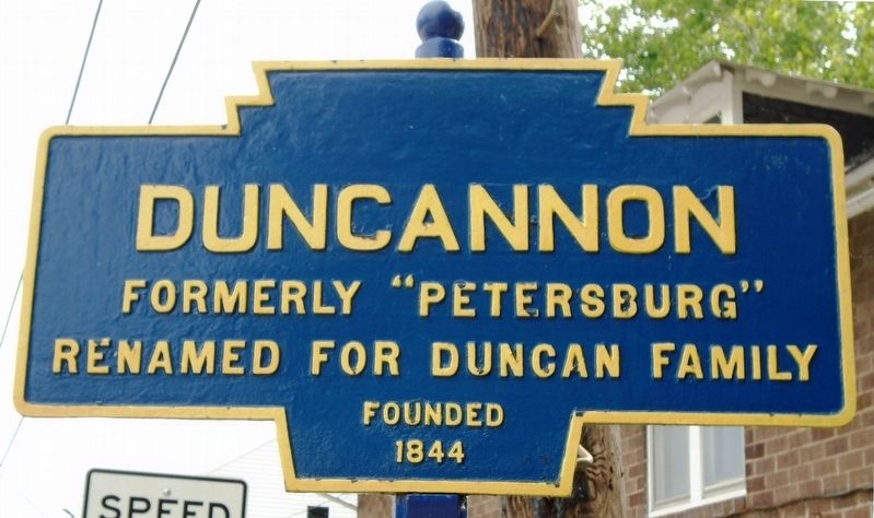
Photographed by William Fischer, Jr., July 4, 2018
1. Duncannon Marker
Renamed for Duncan Family
Founded 1844
Topics and series. This historical marker is listed in this topic list: Settlements & Settlers. In addition, it is included in the Pennsylvania Keystone Markers series list. A significant historical year for this entry is 1844.
Location. 40° 23.311′ N, 77° 1.863′ W. Marker is near Duncannon, Pennsylvania, in Perry County. It is in Penn Township. It is on South Market Street north of U.S. 11/15, on the right when traveling north. Marker is near the Market Street bridge's NE abutment. Touch for map. Marker is at or near this postal address: 38 S Market St, Duncannon PA 17020, United States of America. Touch for directions.

Regionally, this marker is in South-Central Pennsylvania, in the Susquehanna Valley, and in Greater Harrisburg. It is also in the American Northeast, in the Mid-Atlantic, in Appalachia, and specifically in Northern Appalachia. Globally, it is in North America, the Western Hemisphere, the Western World, and the Anglosphere. Historically, it finds itself in what was once the Haudenosaunee (Iroquois) Confederacy and also one of the
this page online
Other nearby markers. At least 8 other markers are within walking distance of this marker: Entering Duncannon (within shouting distance of this marker); a different marker also named Entering Duncannon (within shouting distance of this marker); Veterans Memorial (about 400 feet away, measured in a direct line); Duncannon Square (about 400 feet away); Clark's Ferry Bridge (about 600 feet away); The Railroad in Duncannon (about 600 feet away); Duncannon Presbyterian Church Annex (about 700 feet away); Duncannon National Bank (about 700 feet away). Touch for a list and map of all markers in Duncannon.
Also see . . .
1. Duncannon Borough PA. Website homepage (Submitted on July 8, 2018, by William Fischer, Jr. of Reynoldsburg, Ohio.)
2. Duncannon PA. Appalachian Trail Conservancy (Submitted on July 8, 2018, by William Fischer, Jr. of Reynoldsburg, Ohio.)
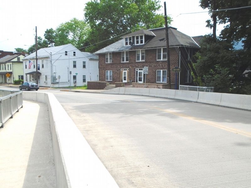
Photographed by William Fischer, Jr., July 4, 2018
2. Duncannon Marker
Credits. This page was last revised on February 20, 2023. It was originally submitted on July 8, 2018, by William Fischer, Jr. of Reynoldsburg, Ohio. This page has been viewed 533 times since then and 56 times this year. Photos: 1, 2. submitted on July 8, 2018, by William Fischer, Jr. of Reynoldsburg, Ohio.
