Williamsburg in Whitley County, Kentucky — The American South (East South Central)
Mahan Hall
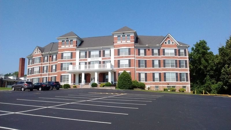
Photographed by Tom Bosse, July 4, 2018
1. Mahan Hall Marker
Erected by Kentucky Historical Society & Kentucky Department of Highways. (Marker Number 2084.)
Topics. This historical marker is listed in this topic list: Education. A significant historical month for this entry is May 1954.
Location. Marker has been reported missing. It was located near 36° 44.359′ N, 84° 9.876′ W. Marker was in Williamsburg, Kentucky, in Whitley County. It was on West Sycamore Street, on the left when traveling north. Touch for map. Marker was in this post office area: Williamsburg KY 40769, United States of America. Touch for directions.

Regionally, this marker was in Eastern Kentucky and in the Cumberland Plateau. It was also in the American South, specifically in the Upper South, in Appalachia, and specifically in Southern
this page online
Other nearby markers. At least 8 other markers are within walking distance of this location: Roburn Hall (about 600 feet away); Clyde V. and Patricia Bennett Building (approx. 0.2 miles away); Cumberland College (approx. 0.2 miles away); "Aunt Julia" Marcum (approx. 0.4 miles away); Scott's Raid (approx. 0.4 miles away); County Named, 1818 (approx. 0.4 miles away); Samuel Cox, 1756-1832 (approx. half a mile away); Roy Martis Chappell (approx. 0.6 miles away). Touch for a list and map of all markers in Williamsburg.
Another marker is no longer nearby. Gillespie Hall (was about 600 feet away, measured in a direct line but has been confirmed missing).
More about this marker. Marker is still visible on Google Street View.
Credits. This page was last revised on July 16, 2018. It was originally submitted on July 12, 2018, by Tom Bosse of Jefferson City, Tennessee. This page has been viewed 368 times since then and 24 times this year. Photo 1. submitted on July 12, 2018, by Tom Bosse of Jefferson City, Tennessee. • Bill Pfingsten was the editor who published this page.
