Murphy in Cherokee County, North Carolina — The American South (South Atlantic)
Trail of Tears
Fort Butler and the Cherokee Removal of 1838
Photographed by Tom Bosse, April 5, 2018
1. Trail of Tears Marker
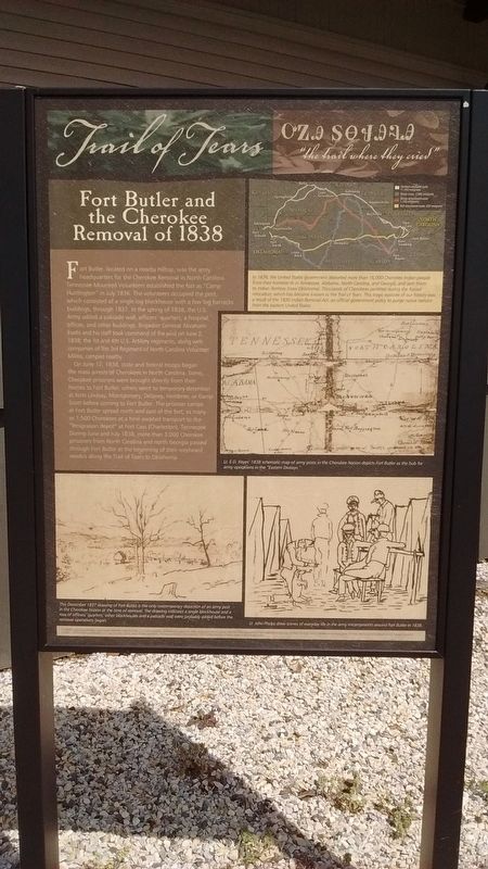
In 1838, the United States government deported more than 16,000 Cherokee Indian people from their homeland in Tennessee, Alabama, North Carolina, and Georgia, and sent them to Indian Territory (now Oklahoma). Thousands of Cherokee perished during the forced relocation, which has become known as the Trail of Tears. This tragic episode of our history was a result of the 1832 Indian Removal Act, an official government policy to purge native nations from the eastern United States.
Fort Butler, located on a nearby hilltop, was the army headquarters for the Cherokee Removal in North Carolina. Tennessee Mounted Volunteers established the fort as “Camp Huntington” in July 1836. The volunteers occupied the post, which consisted of a single log blockhouse with a few log barracks buildings, through 1837. In the spring of 1838, the U.S. Army added a palisade wall, officers’ quarters, a hospital, offices, and other buildings. Brigadier General Abraham Eustis and his staff took command of the post on June 2, 1838; the 1st and 4th U.S. Artillery regiments, along with companies of the 3rd Regiment of North Carolina Volunteer Militia, camped nearby.
On June 12, 1838, state and federal troops began the mass arrests of Cherokees in North Carolina. Some Cherokee prisoners were brought directly from their homes to Fort Butler, others went to temporary detention at forts Lindsay, Montgomery, Delaney, Hembree, or Camp Scott become to Fort Butler. The prisoner camps at Fort Butler spread north and east of the fort; as many as 1,500 Cherokees at a time awaited transport to the “emigration depot” at Fort Cass (Charleston), Tennessee. During June and July 1838, more than 3,000 Cherokee prisoners from North Carolina and north Georgia passed through Fort Butler at the beginning of their westward exodus along the Trail of Tears to
this page online
(captions)
Lt. E.D. Keyes’ 1838 schematic map of army posts in the Cherokee Nation depicts Fort Butler as the hub for army operations in the “Eastern Division”.
This December 1837 drawing of Fort Butler is the only contemporary depiction of an army post in the Cherokee Nation at the time of removal. The drawing indicates a single blockhouse and a row of officers’ quarters; other blockhouses and a palisade wall were probably added before the removal operations began.
Lt. John Phelps drew scenes of everyday life in the army encampments around Fort Butler in 1838.
Erected by North Carolina Chapter of the Trail of Tears Association.
Topics and series. This historical marker is listed in these topic lists: Forts and Castles • Indigenous Peoples and Communities. In addition, it is included in the Trail of Tears series list. A significant historical date for this entry is June 2, 1838.
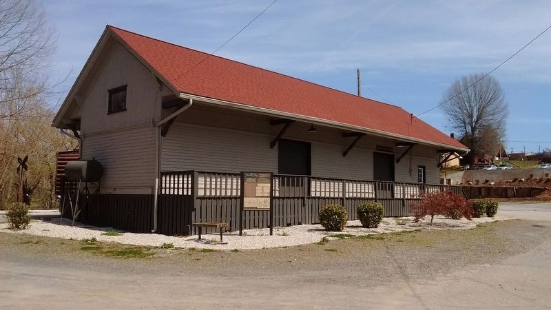
Location. 35° 5.162′ N, 84° 2.213′ W. Marker is in Murphy, North Carolina, in Cherokee County. It is on Railroad Street west of Valley River Avenue (Business U.S. 19), on the left when traveling north. Marker is located in front of the old
Photographed by Tom Bosse, April 5, 2018
2. Trail of Tears Marker

Regionally, this marker is in North Carolina’s Mountains. It is also in the American South, specifically in the Upper South, in Appalachia, and specifically in Southern Appalachia. Globally, it is in North America, the Western Hemisphere, the Western World, and the Anglosphere. Historically, it finds itself in what was once the original Cherokee Nation, the territory of the Mississippian Culture, one of the original Thirteen Colonies, one of the Confederate States of America, and the Antebellum South.
Other nearby markers. At least 8 other markers are within walking distance of this marker: Murphy North Carolina Rail (within shouting distance of this marker); Fort Butler (about 800 feet away, measured in a direct line); Cherokee County Veterans Memorial (approx. 0.2 miles away); 60 Sons of North Carolina (approx. 0.2 miles away); Harshaw Chapel and Cemetery (approx. 0.2 miles away); In Memory of the Servicemen of Cherokee County (approx. 0.2 miles away); Millstone from Thomas C. Thatham Mill (approx. 0.2 miles away); Water Powered 500 Pound Hammer (approx. 0.2 miles away). Touch for a list and map of all markers in Murphy.
Another marker is no longer nearby. Cherokee War (was approx. 0.2 miles away but has been confirmed missing).
Also see . . . North Carolina Trail of Tears Association. Association website homepage (Submitted on February 11, 2022, by Larry Gertner of New York, New York.)
Credits. This page was last revised on February 11, 2022. It was originally submitted on July 18, 2018, by Tom Bosse of Jefferson City, Tennessee. This page has been viewed 1,297 times since then and 85 times this year. Photos: 1, 2. submitted on July 18, 2018, by Tom Bosse of Jefferson City, Tennessee. • Bernard Fisher was the editor who published this page.
