Fort Monroe in Hampton, Virginia — The American South (Mid-Atlantic)
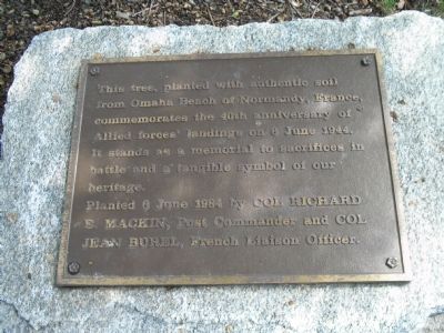
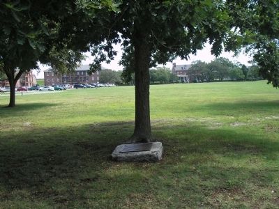
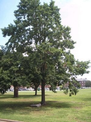
Omaha Beach Memorial Tree
Planted 6 June 1984 by Col Richard E. Mackin, Post Commander and Col Jean Burel, French Liaison Officer.
Erected 1984.
Topics. This historical marker is listed in this topic list: Notable Events. A significant historical date for this entry is June 6, 1944.
Location. 37° 0.216′ N, 76° 18.489′ W. Marker is in Hampton, Virginia. It is in Fort Monroe. Marker is on Ruckman Road, on the right when traveling north. Marker is on the grounds of Fort Monroe, on the parade field. Touch for map. Marker is in this post office area: Fort Monroe VA 23651, United States of America. Touch for directions.
Other nearby markers. At least 8 other markers are within walking distance of this marker. The Lincoln Gun (a few steps from this marker); An Enduring Legacy? (about 500 feet away, measured in a direct line); Lee's Quarters (about 500 feet away); "Ruth Window" (about 500 feet away); Fort Monroe (about 600 feet away); 12-Pounder Gun-Howitzer (about 600 feet away); 14 – Pounder James Rifle (about 600 feet away); 3 – Inch Ordnance Rifle (about 600 feet away). Touch for a list and map of all markers in Hampton.
Also see . . .
1. Ohama Beach. (Submitted on October 3, 2008, by Bill Coughlin of Woodland Park, New Jersey.)
2. Unofficial Fort Monroe website. (Submitted on October 3, 2008, by Bill Coughlin of Woodland Park, New Jersey.)
3. Fort Monroe National Monument, National Park Service. (Submitted on August 19, 2019.)
4. Fort Monroe (Stone Fort) National Register of Historic Places Registration Form (pdf file). (Submitted on August 19, 2019.)
Credits. This page was last revised on February 1, 2023. It was originally submitted on October 3, 2008, by Bill Coughlin of Woodland Park, New Jersey. This page has been viewed 1,281 times since then and 24 times this year. Photos: 1, 2, 3. submitted on October 3, 2008, by Bill Coughlin of Woodland Park, New Jersey.


