
Near Westbrook in Mitchell County, Texas — The American South (West South Central)
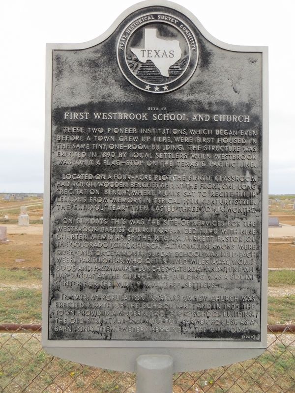
Site of First Westbrook School and Church
Photographed by Bill Kirchner, November 12, 2017
1. Site of First Westbrook School and Church Marker
Located on a four-acre plot, the single classroom had rough, wooden benches and, at the front, one long "recitation bench", where pupils sat to recite their lessons from memory in typical 19th Century style. The school "year" then lasted three to six months.
On Sundays this was the site of services for the Westbrook Baptist Church, organized 1890 with nine charter members, by the Rev. J.C. Burkett, Pastor of the Colorado (City) Church. Although sermons were given only once a month, Sunday school was held each week. Parishioners, who often lived miles away, would cook and pack basket lunches Saturday and spend all day Sunday at the church. The building was a social center for the widely scattered settlers.
In 1902, as population increased, a new church was erected north of the school yard; and in 1905 the town provided a modern, two-story school building. The old structure
this page online
Erected 1969 by State Historical Survey Committee. (Marker Number 4912.)
Topics. This historical marker is listed in these topic lists: Education • Religion & Religious Structures. A significant historical year for this entry is 1890.
Location. 32° 20.695′ N, 101° 1.235′ W. Marker is near Westbrook, Texas, in Mitchell County. It is on Farm to Market Road 670 0.4 miles south of Interstate 20, on the right when traveling south. Touch for map. Marker is in this post office area: Westbrook TX 79565, United States of America. Touch for directions.

Regionally, this marker is in Big Country. Globally, it is in North America, a Gulf of Mexico state, the Western Hemisphere, the Western World, and the Anglosphere. Historically, it finds itself in what was once New Spain, the Comanchería, the Republic of Texas, and one of the Confederate States of America.
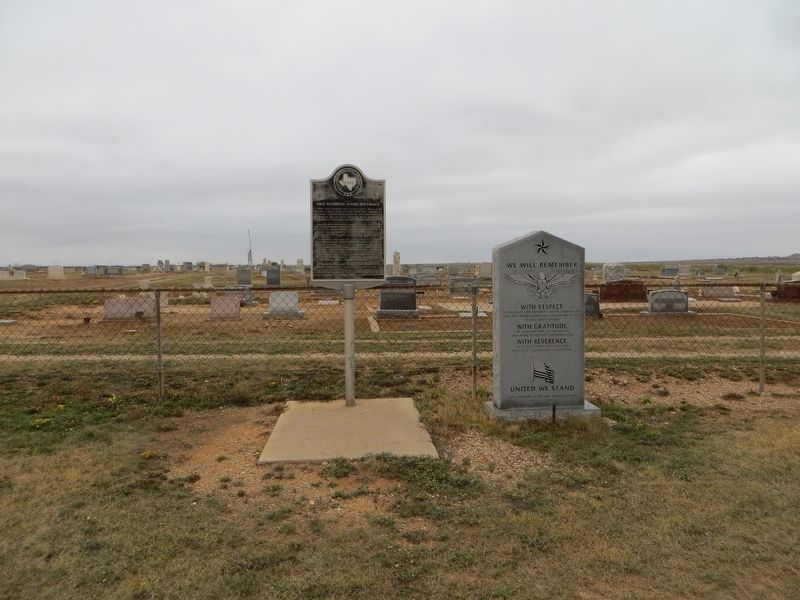
Other nearby markers. At least 8 other markers are within 10 miles of this marker, measured as the crow flies: We Will Remember (here, next to this marker); Discovery Well of the Permian Basin
Photographed by Bill Kirchner, November 12, 2017
2. Site of First Westbrook School and Church Marker
Photographed by Bill Kirchner, November 12, 2017
3. Site of First Westbrook School and Church Marker
Credits. This page was last revised on July 19, 2018. It was originally submitted on July 19, 2018, by Bill Kirchner of Tucson, Arizona. This page has been viewed 559 times since then and 43 times this year. Photos: 1, 2, 3. submitted on July 19, 2018, by Bill Kirchner of Tucson, Arizona.
