Cumberland Township near Gettysburg in Adams County, Pennsylvania — The American Northeast (Mid-Atlantic)
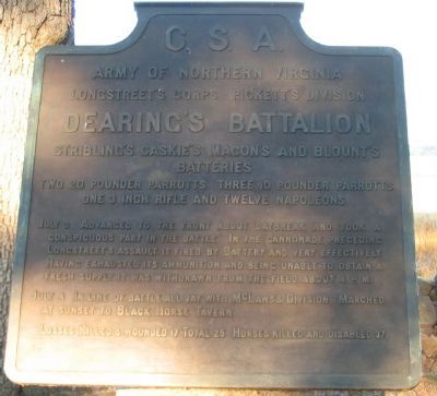
Dearing's Battalion
Pickett's Division - Longstreet's Corps
— Army of Northern Virginia —
Army of Northern Virginia
Longstreet's Corps Pickett's Division
Dearing's Battalion
Stribling's, Caskie's, Macon's, and Blount's
Batteries
Two 20 pounder Parrotts, Three 10 pounder Parrotts
One 3 inch Rifle and Twelve Napoleons
July 3 Advanced to the front about daybreak and took a conspicuous part in the battle. In the cannonade preceding Longstreet's assault it fired by Battery and very effectively. Having exhausted its ammunition and being unable to obtain a fresh supply it was withdrawn from the field about 4 p.m.
July 4 In line of battle all day with McLaws's Division. Marched at sunset to Black Horse Tavern.
Losses. Killed 8, wounded 17. Total 25. Horses killed and disabled 37.
Erected 1910 by Gettysburg National Military Park Commission.
Topics. This historical marker is listed in this topic list: War, US Civil. A significant day of the year for for this entry is July 3.
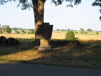
Location. 39° 48.305′ N, 77° 15.366′ W. Marker is near Gettysburg, Pennsylvania, in Adams County. It is in Cumberland Township. Marker is at the intersection of West Confederate Avenue and Amphitheater Road, on the left when traveling south on West Confederate Avenue. Located on Seminary Ridge, in front of the Pitzer's Woods section, in Gettysburg National Military Park. Touch for map. Marker is in this post office area: Gettysburg PA 17325, United States of America. Touch for directions.
Other nearby markers. At least 8 other markers are within walking distance of this marker. Macon's Battery - Dearing's Battalion (a few steps from this marker); Caskie's Battery - Dearing's Battalion - (within shouting distance of this marker); Lieutenant General James Longstreet (within shouting distance of this marker); Stribling's Battery - Dearing's Battalion (about 300 feet away, measured in a direct line); Norcom's Battery - Eshleman's Battalion (about 500 feet away); Richardson's Battery - Eshleman's Battalion (about 600 feet away); Patterson's Battery - Lane's Battalion (about 700 feet away); Eshleman's Battalion (about 700 feet away). Touch for a list and map of all markers in Gettysburg.
Also see . . . Report of Maj. James Dearing. Of the great cannonade, Dearing wrote:
When the signal guns were fired, I at once brought my battalion in battery to the front, and commenced firing slowly and deliberately. To insure more accuracy and to guard against the waste of ammunition, I fired by battery. The firing on the part of my battalion was very good, and most of the shell and shrapnel burst well. My fire was directed at the batteries immediately in my front, and which occupied the heights charged by Pickett's division.
Three caissons were seen by myself to blow up, and I saw several batteries of the enemy leave the field. At one time, just before General Pickett's division advanced, the batteries of the enemy in our front had nearly all ceased firing; only a few scattering batteries here and there could be seen to fire. (Submitted on October 4, 2008, by Craig Swain of Leesburg, Virginia.)

Photographed By Craig Swain, August 17, 2008
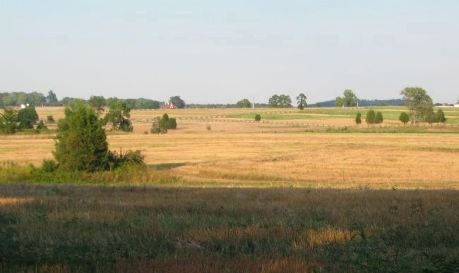
3. Dearing's Battalion Deployed Forward
Early on July 3, Dearing's Battalion deployed forward of Seminary Ridge, dressed on line with the Confederate artillery positioned around the Peach Orchard. The undulating ground between Seminary and Cemetery Ridge is evident in this view. In the distant center is the spire of the U.S. Regulars Monument. Scanning to the right is the top of the Vermont Monument. On the left are some of the buildings around the Spangler Farm. To the right are those of the Sherfy Farm. Dearing's Battalion deployed on a rise of ground, which appears in this line of site in front of the U.S. Regulars Monument. The Emmitsburg Road is blocked from the line of site by this rise of ground. Thus the cannonade and following infantry battle on July 3 was largely concealed from view by those on Seminary Ridge due to the terrain. An issue further exacerbated by the smoke of battle.
Credits. This page was last revised on February 7, 2023. It was originally submitted on October 4, 2008, by Craig Swain of Leesburg, Virginia. This page has been viewed 864 times since then and 17 times this year. Photos: 1, 2, 3. submitted on October 4, 2008, by Craig Swain of Leesburg, Virginia.

