Saint John, New Brunswick — The Atlantic Provinces (North America)
Carleton Martello Tower
⎯⎯⎯
Tour Martello Carleton
Photographed by J. J. Prats, October 7, 2004
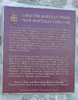
1. Carleton Martello Tower Marker

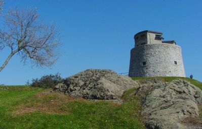
Construction of this tower was begun by the British Army during the War of 1812 as one of the projected series of fortifications intended to block the western land approach to Saint John. Subsequent to its completion in 1815 the tower was largely neglected, seeing only occasional use in times of emergency, including service as a fire control headquarters in the second world war. The original structure typifies the English martello tower design, a popular form of coastal defence in the British Isles during the Napoleonic period.
L’armée britannique entreprit l’érection de cette tour pendant la guerre de 1812 en vue de protéger l’entrée de Saint-Jean d’une attaque qui viendrait de l’ouest. Une fois achevée en 1815, la tour fut en grande partie laissée à elleméme, ne servant plus qu’en temps de crise. Elle tint lieu de base de directions de tir au cours de la Seconde Guerre Mondiale. L’ouvrage intial est typique de tours martello angalises, fortifications côtières répandues dans les iles britanniques à l’époque napoléonienne.
Erected by Historic Sites and Monuments Board of
this page online
Topics and series. This historical marker is listed in these topic lists: Landmarks • War of 1812. In addition, it is included in the Canada, Historic Sites and Monuments Board series list. A significant historical year for this entry is 1812.
Location. 45° 15.122′ N, 66° 4.58′ W. Marker is in Saint John, New Brunswick. It can be reached from Whipple Street near Lancaster Street. Directions: From Highway 1 take the Digby Ferry (Exit 120) and follow the Parks Canada Beaver signs and Digby Ferry signs to Market Place. At the end of Market Place, turn right at St. John/Dufferin streets to Whipple. Touch for map. Marker is at or near this postal address: 454 Whipple St, Saint John NB E2M 2R4, Canada. Touch for directions.

Regionally, this marker is in the Saint John and the Fundy Shore. It is also in the Maritimes and in Atlantic Canada. Globally, it is in the North Atlantic Region, North America, the Western Hemisphere, the Western World, and the Anglosphere. Historically, it finds itself in what was once a British colony, the Viceroyalty of New France, and Acadia.
Other nearby markers. At least 8 other markers
Photographed by J. J. Prats, October 7, 2004
2. The Carleton Martello Tower
Photographed by J. J. Prats, October 7, 2004
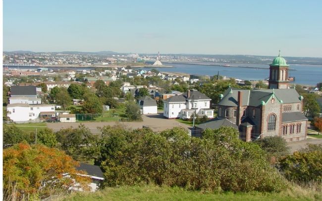
3. View of Saint John From the Tower
Credits. This page was last revised on March 14, 2026. It was originally submitted on September 19, 2006, by J. J. Prats of Powell, Ohio. This page has been viewed 10,452 times since then and 25 times this year. Last updated on July 22, 2018, by Jim Watters of Saint John, New Brunswick. Photos: 1, 2, 3. submitted on September 19, 2006, by J. J. Prats of Powell, Ohio. • Syd Whittle was the editor who published this page.
