Myrtle Beach in Horry County, South Carolina — The American South (South Atlantic)
Mayors of Surfside Beach
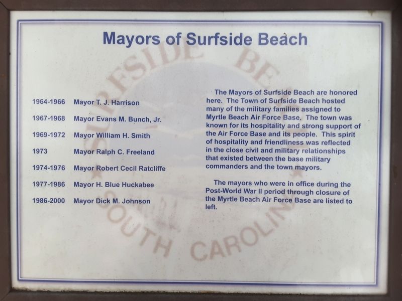
Photographed by Charles Keller, July 7, 2017
1. Mayors of Surfside Beach Marker
The mayors who were in office during the Post-World War II period through closure of the Myrtle Beach Air Force Base are listed to left.
1964-1966 Mayor T. J. Harrison
1967-1968 Mayor Evans M. Bunch, Jr.
1969-1972 Mayor William H. Smith
1973 Mayor Ralph C. Freeland
1974-1976 Mayor Robert Cecil Ratcliffe
1977-1986 Mayor H. Blue Huckabee
1986-2000 Mayor Dick M. Johnson
Topics. This historical marker is listed in this topic list: Government & Politics.
Location. 33° 39.595′ N, 78° 55.652′ W. Marker is in Myrtle Beach, South Carolina, in Horry County. It is at the intersection of Farrow Parkway and South Kings Highway (Business U.S. 17),
this page online

Regionally, this marker is on the Grand Strand and in the Pee Dee. It is also in the American South, specifically in the Deep South, and on the Eastern Seaboard. Globally, it is in the North Atlantic Region, North America, the Western Hemisphere, the Western World, and the Anglosphere. Historically, it finds itself in what was once the territory of the Mississippian Culture, one of the original Thirteen Colonies, one of the Confederate States of America, and the Antebellum South.
Other nearby markers. At least 8 other markers are within walking distance of this marker: Mayors of Myrtle Beach (a few steps from this marker); Replacement Training Unit (RTU) 1968-1969 (a few steps from this marker); Splinter City (within shouting distance of this marker); Reactivation of 354th Fighter Day Wing (within shouting distance of this marker); Myrtle Beach Army Air Field / Myrtle Beach Air Force Base (about 300 feet away, measured in a direct line); Myrtle Beach Air Force Base 1980 - 1990 (about 300 feet away); Myrtle Beach World War II Memorial (about 300 feet away); 354th Tactical Fighter Wing A-7D (about 300 feet away). Touch for a list and map of all markers in Myrtle Beach.
Credits. This page was last revised on August 1, 2018. It was originally submitted on July 27, 2018, by Charles Keller of Myrtle Beach, South Carolina. This page has been viewed 1,038 times since then and 66 times this year. Photo 1. submitted on July 27, 2018, by Charles Keller of Myrtle Beach, South Carolina. • Andrew Ruppenstein was the editor who published this page.
Editor’s want-list for this marker. Wide shot of marker and its surroundings. • Can you help?
