Deadwood in Lawrence County, South Dakota — The American Midwest (Upper Plains)
McGovern Hill
— A Trail to Deadwood's Past —
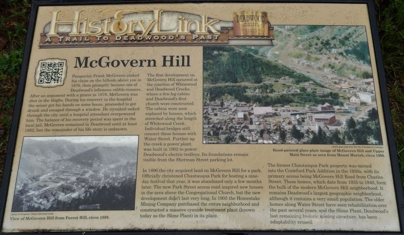
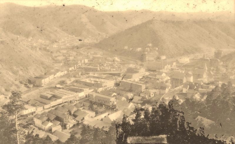
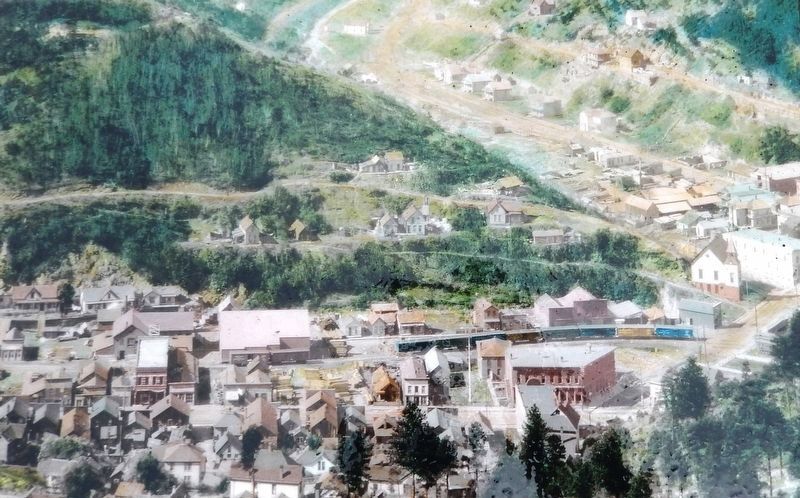
The first development on McGovern Hill occurred at the junction of Whitewood and Deadwood Creeks, where a few log cabins and Deadwood's first church were constructed. The cabins were soon replaced by houses, which stretched along the length of Whitewood Creek. Individual bridges still connect these houses with Water Street. Further up the creek a power plant was built in 1902 to power Deadwood's electric trolleys. Its foundations visible from the Sherman Street parking lot.
In 1896 the city acquired land on McGovern Hill for a park. Officially christened Chautauqua Park for hosting a nine-day festival that year, it was abandoned only a few months later. The new Park Street access road inspired new houses in the area above the Congregational Church, but the new development didn't last very long. In 1905 the Homestake Mining Company purchased the entire neighborhood and constructed a massive cyanide treatment plant (known today as the Slime Plant) in its place.
The former Chautauqua Park property was turned into the Crawford Park Addition in the 1930s, with its primary access being McGovern Hill Road from Charles Street. These homes, which date from 1935 to 1940, form the bulk of the modern McGovern Hill neighborhood. It remains Deadwood's largest geographic neighborhood, although it contains a very small population. The older homes along Water Street have seen rehabilitation over the past several years, and the Slime Plant, Deadwood's last remaining historic mining structure, has been adaptability reused.
Erected by The Deadwood Historic Preservation Commission.
Topics. This historical marker is listed in these topic lists: Industry & Commerce • Settlements & Settlers.
Location. 44° 22.222′ N, 103° 43.754′ W. Marker is in Deadwood, South Dakota, in Lawrence County. Marker can be reached from the intersection of Charles Street (CanAm Highway) (U.S. 85) and Cedar Lane, on the right when traveling south. Marker is located a few yards from the George S. Mickelson Rail
Trail, just south of the trailhead and parking lot, on the north/west side of the trail. Touch for map. Marker is at or near this postal address: 32 Charles Street, Deadwood SD 57732, United States of America. Touch for directions.
Other nearby markers. At least 8 other markers are within walking distance of this marker. Chicago Burlington & Quincy Railroad Yard (within shouting distance of this marker); George S. Mickelson Trail (within shouting distance of this marker); The Resilient Whitewood Creek (within shouting distance of this marker); Burlington Interurban Power Plant (about 300 feet away, measured in a direct line); Radial Brick Smokestack (about 400 feet away); Interurban Trolley (about 400 feet away); Cleveland (about 500 feet away); Rev. L.R.S. Ferguson Ski & Sled Area (about 500 feet away). Touch for a list and map of all markers in Deadwood.
Related markers. Click here for a list of markers that are related to this marker.
Also see . . . Deadwood History: McGovern Hill. This link presents a variety of historic photos and associated commentary related to Deadwood's McGovern Hill. (Submitted on August 4, 2018, by Cosmos Mariner of Cape Canaveral, Florida.)
Credits. This page was last revised on October 20, 2023. It was originally submitted on August 3, 2018, by Cosmos Mariner of Cape Canaveral, Florida. This page has been viewed 314 times since then and 26 times this year. Photos: 1. submitted on August 3, 2018, by Cosmos Mariner of Cape Canaveral, Florida. 2, 3, 4. submitted on August 4, 2018, by Cosmos Mariner of Cape Canaveral, Florida. • Bill Pfingsten was the editor who published this page.


