Ottoman Siege of 1529
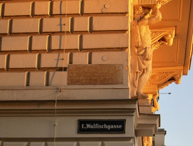
Donnerstag, den 14. Oktober 1529
wiesen an dieser Stelle Salm und Reischach
auch den letzten und heftigsten Angriff
Suleimanns zurück.
Here stood the "Carinthian" tower. On Thursday, October 14, 1529 from this location, Salm and Reischach repelled Suleiman's (the Ottoman commander) last and most forceful attack.
Topics. This historical marker is listed in this topic list: Wars, Non-US. A significant historical date for this entry is October 14, 1529.
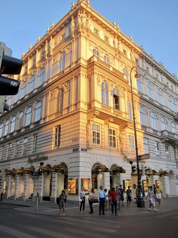
Location. 48° 12.211′ N, 16° 22.23′ E. Marker is in Wien. It is in Innere Stadt. Marker is at the intersection of Walfischgasse and Kärntner Straße, on the right when traveling east on Walfischgasse. Touch for map. Marker is at or near this postal address: Walfischgasse 2, Wien 1010, Austria. Touch for directions.
Other nearby markers. At least 8 other markers are within walking distance of this marker. Ludwig Hevesi (about 90 meters away, measured in a direct line); Matthias Sindelar (about 120 meters away); Wiener Aero-Club (about 120 meters away); Staatsoper (about 150 meters away); Mahnmal Gegen Krieg und Faschismus / Monument against War and Fascism
More about this marker. The marker is at the southeast corner of the intersection, about 5 meters up, and is both easy to miss and difficult to read.
Also see . . . Siege of Vienna (Wikipedia). "The Siege of Vienna in 1529 was the first attempt by the Ottoman Empire, led by Suleiman the Magnificent, to capture the city of Vienna, Austria. The siege signalled the pinnacle of the Ottoman Empire's power and the maximum extent of Ottoman expansion in central Europe. Thereafter, 150 years of bitter military tension and reciprocal attacks ensued, culminating in the Battle of Vienna of 1683, which marked the start of the 15-year-long Great Turkish War....The inability of the Ottomans to capture Vienna in 1529 turned the tide against almost a century of conquest throughout eastern and central Europe. The Ottoman Empire had previously annexed Central Hungary and established a vassal state in Transylvania in the wake of the Battle
Credits. This page was last revised on February 1, 2022. It was originally submitted on August 4, 2018, by Andrew Ruppenstein of Lamorinda, California. This page has been viewed 195 times since then and 28 times this year. Photos: 1, 2. submitted on August 4, 2018, by Andrew Ruppenstein of Lamorinda, California.
Editor’s want-list for this marker. Better photo of the marker • Can you help?

