Thurmont in Frederick County, Maryland — The American Northeast (Mid-Atlantic)
Making Charcoal
Catoctin Mountain Park
| — | National Park Service, U.S. Department of the Interior | — |
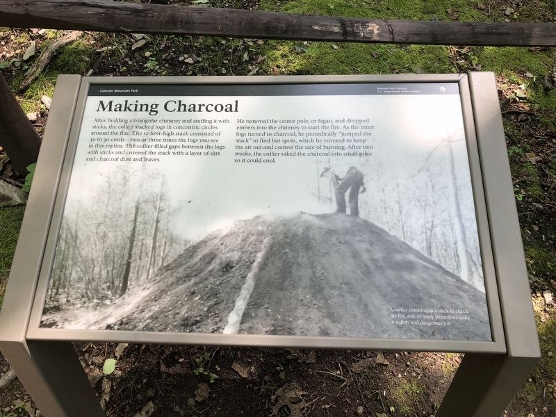
He removed the center pole, or fagan, and dropped embers into the chimney to start the fire. As the inner logs turned to charcoal, he periodically "jumped the stack" to find hot spots, which he covered to keep the air out and control the rate of burning. After two weeks, the collier raked the charcoal into small piles so it could cool.
[Caption:]
A collier climbs atop a stack to check the fire, one of many hazardous tasks in a dirty and dangerous job.
Erected by National Park Service, U.S. Department of the Interior.
Topics. This historical marker is listed in this topic list: Industry & Commerce. A significant historical year for this entry is 1873.
Location. 39° 38.692′ N, 77° 26.633′ W. Marker is in Thurmont, Maryland, in Frederick County. It can be reached
this page online

Regionally, this marker is in the Washington Metropolitan Area and in Central Maryland. It is also in the American Mid-Atlantic. Globally, it is in North America, the Western Hemisphere, the Western World, and the Anglosphere. Historically, it finds itself in what was once one of the original Thirteen Colonies and also the Antebellum South.
Other nearby markers. At least 8 other markers are within walking distance of this marker: Collier's Hut (within shouting distance of this marker); Wood Hauler's Sled (about 300 feet away, measured in a direct line); Preparing the Hearth (about 400 feet away); Wood—the Essential Ingredient (about 500 feet away); Signs of the Past (about 600 feet away); Fueling the Furnace (about 700 feet away); Making Whiskey (approx. half a mile away); Blue Blazes Still (approx. 0.6 miles away). Touch for a list and map
Credits. This page was last revised on January 12, 2026. It was originally submitted on August 5, 2018, by Devry Becker Jones of Washington, District of Columbia. This page has been viewed 297 times since then and 14 times this year. Photos: 1, 2. submitted on August 5, 2018, by Devry Becker Jones of Washington, District of Columbia. • Andrew Ruppenstein was the editor who published this page.
