
Jonesborough in Washington County, Tennessee — The American South (East South Central)
Jacob Brown
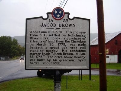
Photographed by Stanley and Terrie Howard, September 26, 2009
1. Jacob Brown Marker
Erected by Tennessee Historical Commission. (Marker Number 1A 25.)
Topics and series. This historical marker is listed in this topic list: Settlements & Settlers. In addition, it is included in the Tennessee Historical Commission series list. A significant historical month for this entry is March 1777.
Location. 36° 12.518′ N, 82° 28.456′ W. Marker is in Jonesborough, Tennessee, in Washington County. It is at the intersection of Tennessee Route 81 S and Taylor Bridge Road ( Route 81) on Tennessee Route 81 S. Touch for map. Marker is in this post office area: Jonesborough TN 37659, United States of America. Touch for directions.

Regionally, this marker is in East Tennessee and in the Tri-Cities Area. It is also in the American South, specifically in the Upper South, in Appalachia,
this page online
Other nearby markers. At least 8 other markers are within 6 miles of this marker, measured as the crow flies: Keystone Pottery (approx. one mile away); Cherokee Church (approx. 2 miles away); Old Dutch Meeting House (approx. 2 miles away); The Tester Brothers (approx. 2.8 miles away); Plum Grove (approx. 3.9 miles away); a different marker also named Plum Grove (approx. 4.3 miles away); a different marker also named Plum Grove (approx. 4.3 miles away); Thomas Embree (approx. 5.2 miles away). Touch for a list and map of all markers in Jonesborough.
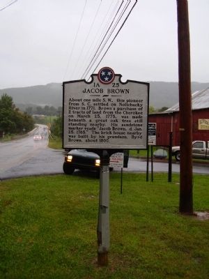
Photographed by Stanley and Terrie Howard, September 26, 2009
2. Jacob Brown Marker
Credits. This page was last revised on August 14, 2018. It was originally submitted on September 28, 2009, by Stanley and Terrie Howard of Greer, South Carolina. This page has been viewed 2,563 times since then and 74 times this year. Last updated on August 10, 2018, by Byron Hooks of Sandy Springs, Georgia. Photos: 1, 2. submitted on September 28, 2009, by Stanley and Terrie Howard of Greer, South Carolina. • Andrew Ruppenstein was the editor who published this page.
