St. Simons Island in Glynn County, Georgia — The American South (South Atlantic)
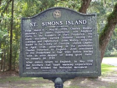
St. Simons Island
From March 9 - May 12, 1738, Charles Wesley, secretary to James Oglethorpe, was Anglican cleric to the founders of Fort Frederica. His stern discipline earned disfavor among the colonists and Oglethorpe. John Wesley, religious leaders of the colony of Georgia, visited Charles in April 1736, preaching in the storehouse. Charles returned to England. John ministered to the Fredericans in four trips before leaving "with utter despair of doing good there" on January 26, 1737.
After John's return to England, in May 1738 the brothers had "heart warming experiences" and later founded the Methodist movement.
Erected 1993 by General Conference, The Methodist Church 1960.
Topics. This historical marker is listed in these topic lists: Churches & Religion • Colonial Era • Forts and Castles • Settlements & Settlers. A significant historical date for this entry is January 26, 1737.
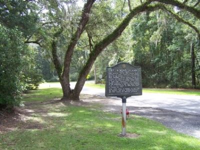
Location. 31° 13.338′ N, 81° 23.202′ W. Marker is on St. Simons Island, Georgia, in Glynn County. Opposite Fort Frederica entrance. Touch for map. Marker is at or near this postal address: 200 Block Mimosa Dr, Saint Simons Island GA 31522, United States of America. Touch for directions.
Other nearby markers. At least 8 other markers are within walking distance of this marker. The Georgia Navy (a few steps from this marker); William Bartram Trail (a few steps from this marker); Reverends John & Charles Wesley / Wesley Memorial Garden (within shouting distance of this marker); Frederica - Military Road (about 700 feet away, measured in a direct line); Frederica - Old Burial Ground (about 800 feet away); Christ Episcopal Church (approx. 0.2 miles away); Strong Walls From Refuse (approx. 0.2 miles away); The Wesley Oak (approx. 0.2 miles away). Touch for a list and map of all markers in St. Simons Island.
Also see . . .
1. St. Simons Island, Wikipedia entry. St. Simons Island is one of Georgia's renowned Golden Isles Saint Simons' next military contribution was due to the Naval Act of 1794, when timber harvested from two thousand Southern live oak trees from Gascoigne Bluff was used to build the USS Constitution and five other frigates (see Six original United States frigates). The USS Constitution is known as "Old Ironsides" for the way the cannonballs bounced off the hard live oak planking. (Submitted on October 6, 2008, by Mike Stroud of Bluffton, South Carolina.)
2. St. Simons Island, Georgia - Historic Sites and Landmarks. History and Stunning Scenery (Submitted on May 9, 2011, by Mike Stroud of Bluffton, South Carolina.)
Credits. This page was last revised on November 25, 2020. It was originally submitted on October 6, 2008, by Mike Stroud of Bluffton, South Carolina. This page has been viewed 1,264 times since then and 33 times this year. Photos: 1, 2. submitted on October 6, 2008, by Mike Stroud of Bluffton, South Carolina. • Bill Pfingsten was the editor who published this page.

