Fredericktown in Washington County, Kentucky — The American South (East South Central)
Washington County
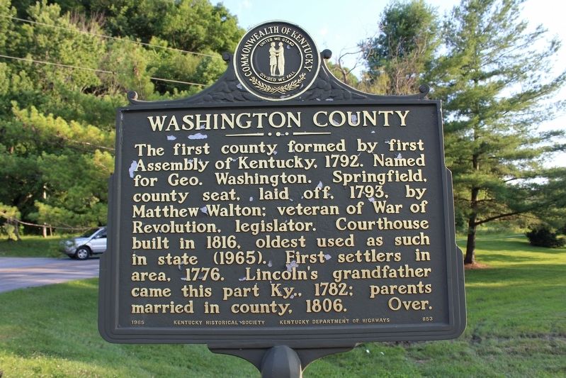
The first county formed by first Assembly of Kentucky, 1792. Named for Geo. Washington. Springfield, county seat, laid off, 1793, by Matthew Walton; veteran of War of Revolution, legislator. Courthouse built in 1816, oldest used as such in state (1965). First settlers in area, 1776. Pres. Lincoln's grandfather came this part Ky., 1782; parents married in county, 1806.
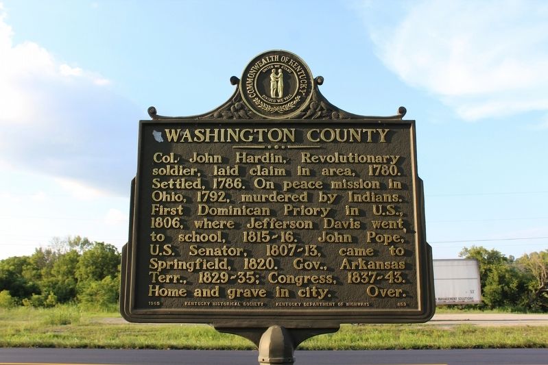
Col. John Hardin, Revolutionary soldier, laid claim in area, 1780. Settled, 1786. On peace mission in Ohio, 1792, murdered by Indians. First Dominican Priory in U.S., 1806, where Jefferson Davis went to school, 1815-16. John Pope, U.S. Senator, 1807-13, came to Springfield, 1820. Governor, Arkansas Terr., 1829-35; Congress, 1837-43. Home and grave in city. Over.
Erected 1965 by Kentucky Historical Society & Kentucky Department of Highways. (Marker Number 853.)
Topics and series. This historical marker is listed in these topic lists: Notable Places • Political Subdivisions. In addition, it is included in the Kentucky Historical Society series list. A significant historical year for this entry is 1792.
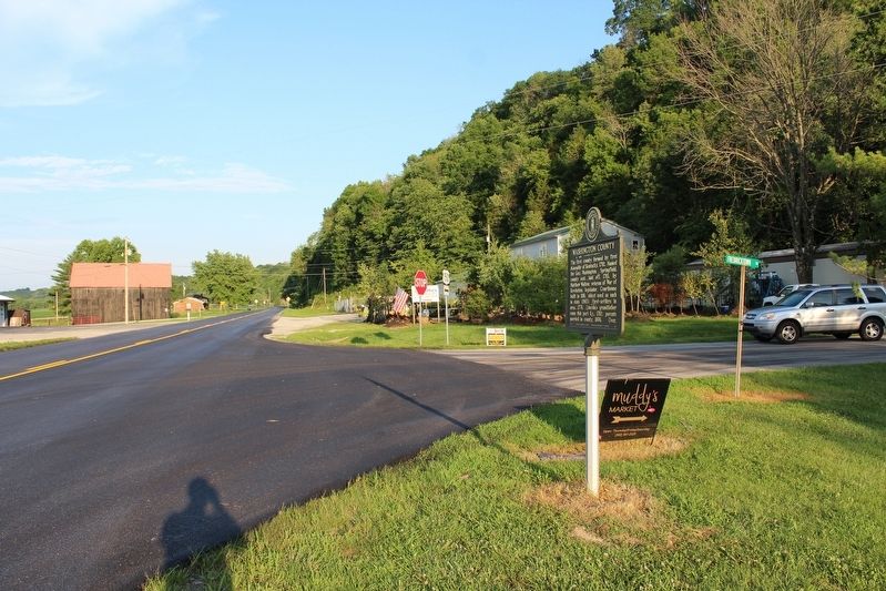
Location. 37° 45.706′ N, 85° 20.184′ W. Marker is in Fredericktown, Kentucky, in Washington County. Marker is at the intersection of Bardstown Road (U.S. 150 ) and Old Frederickstown / Bardstown Road (County Route 1872), on the left when traveling west on Bardstown Road. Touch for map. Marker is in this post office area: Springfield KY 40069, United States of America. Touch for directions.
Other nearby markers. At least 8 other markers are within 7 miles of this marker, measured as the crow flies. Grundy Plantation / Felix Grundy (approx. 3.8 miles away); Ferguson Chapel Site (approx. 3.9 miles away); Matthew Walton (approx. 5.4 miles away); Saint Catharine (approx. 5.6 miles away); Camp Charity (approx. 6.1 miles away); Saint Rose Priory (approx. 6.2 miles away); Kincheloe's Station (approx. 6.6 miles away); Lincoln Cabin (approx. 6.6 miles away).
Credits. This page was last revised on April 7, 2022. It was originally submitted on August 12, 2018, by Tom Bosse of Jefferson City, Tennessee. This page has been viewed 304 times since then and 35 times this year. Photos: 1, 2, 3. submitted on August 12, 2018, by Tom Bosse of Jefferson City, Tennessee. • Andrew Ruppenstein was the editor who published this page.


