Norman in Cleveland County, Oklahoma — The American South (West South Central)
The Beginning of Cleveland County
Photographed by Brian Anderson, August 11, 2018
1. The Beginning of Cleveland County Marker
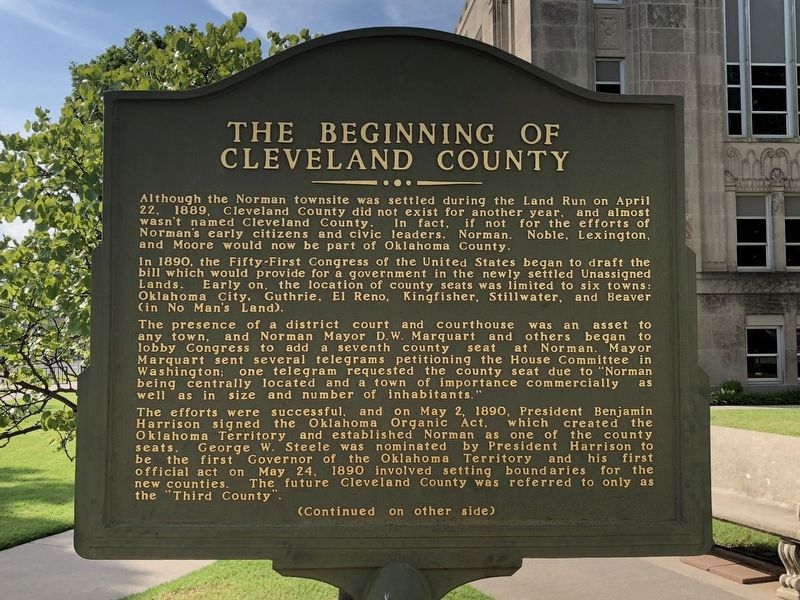
Although the Norman townsite was settled during the Land Run on April 22, 1889, Cleveland County did not exist for another year, and almost wasn't named Cleveland County. In fact, if not for the efforts of Norman's early citizens and civic leaders, Norman, Noble, Lexington, and Moore would now be part of Oklahoma County.
In 1890, the Fifty-First Congress of the United States began to draft the bill which would provide for a government in the newly settled Unassigned Lands. Early on, the location of county seats was limited to six towns: Oklahoma City, Guthrie, El Reno, Kingfisher, Stillwater, and Beaver (in No Man's Land).
The presence of a district court and courthouse was an asset to any town, and Norman Mayor D.W. Marquart and others began to lobby Congress to add a seventh county seat at Norman. Mayor Marquart sent several telegrams petitioning the House Committee in Washington; one telegram requested the county seat due to "Norman being centrally located and a town of importance commercially as well as in size and number of inhabitants."
The efforts were successful, and on May 2, 1890, President Benjamin
this page online
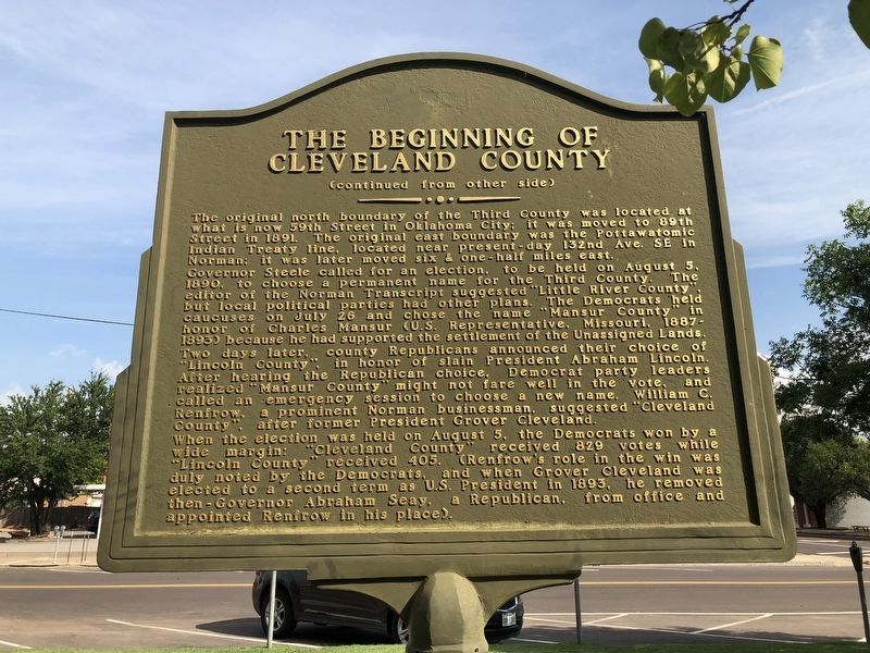
The original north boundary of the Third County was located at what is now 59th Street in Oklahoma City; it was moved to 89th Street in 1891. The original east boundary was the Pottawatomic Indian Treaty line, located near present day 132nd Ave. SE in Norman; it was later moved six & one-half miles east.
Governor Steele called for an election, to be held on August 5, 1890 to choose a permanent name for the Third County. The editor of the Norman Transcript suggested "Little River County", but local political parties had other plans. The Democrats held caucuses on July 26 and chose the name "Mansur County" in honor of Charles Mansur (U.S. Representative, Missouri, 1887-1893) because he had supported the settlement of the Unassigned Lands.
Photographed by Brian Anderson, August 11, 2018
2. The Beginning of Cleveland County Marker reverse
When the election was held on August 5, the Democrats won by a wide margin: "Cleveland County” received 829 votes while "Lincoln County" received 405. (Renfrow's role in the win was duly noted by the Democrats, and when Grover Cleveland was elected to a second term as U.S. President in 1893, he removed then-Governor Abraham Seay, a Republican, from office and appointed Renfrow in his place).
Erected by Norman Historic District Commission.
Topics and series. This historical marker is listed in this topic list: Political Subdivisions. In addition, it is included in the Former U.S. Presidents: #22 and #24 Grover Cleveland, and the Former U.S. Presidents: #23 Benjamin Harrison series lists. A significant historical date for this entry is May 2, 1890.
Location. 35° 13.218′ N,
Photographed by Brian Anderson, August 11, 2018
3. The Beginning of Cleveland County Marker

Regionally, this marker is in Central Oklahoma—Frontier Country and in Greater Oklahoma City. It is also in the American South, specifically on the prairies, and on the Southern Plains. Globally, it is in North America, the Western Hemisphere, the Western World, and the Anglosphere. Historically, it finds itself in what was once the territory of the Mississippian Culture and also the Louisiana Purchase.
Other nearby markers. At least 8 other markers are within walking distance of this marker: Cleveland County Courthouse (within shouting distance of this marker); 100 Block – North (about 400 feet away, measured in a direct line); Santa Fe Depot (about 400 feet away); 200 Block North (about 500 feet away); 100 Block – South (about 500 feet away); 200 Block – South (about 500 feet away); The Inception of Oklahoma Football (about 500 feet away); U.S. Naval Air Station (about 600 feet away). Touch for a list and map of all markers in Norman.
Also see . . . Cleveland County - The Encyclopedia of Oklahoma History and Culture. Oklahoma Historical Society (Submitted on August 13, 2018, by Brian Anderson of New Albany, Ohio.)
Credits. This page was last revised on October 22, 2025. It was originally submitted on August 13, 2018, by Brian Anderson of New Albany, Ohio. This page has been viewed 706 times since then and 34 times this year. Photos: 1, 2, 3. submitted on August 14, 2018, by Brian Anderson of New Albany, Ohio. • Andrew Ruppenstein was the editor who published this page.
