
Near Hahira in Lowndes County, Georgia — The American South (South Atlantic)
Site: Franklinville
Photographed by David Seibert, January 10, 2005
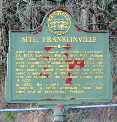
1. Site: Franklinville Marker
In 1833, the County Seat was moved to Troupville, a small settlement about four miles west of present-day Valdosta.
Erected 1961 by Georgia Historical Commission. (Marker Number 092-3.)
Topics and series. This historical marker is listed in this topic list: Settlements & Settlers. In addition, it is included in the Georgia Historical Society series list. A significant historical date for this entry is December 23, 1852.
Location. 30° 58.975′ N, 83° 16.649′ W. Marker is near Hahira, Georgia, in Lowndes County. It is on Franklinville Road 0.2 miles east of Skipper Bridge Road, on the left when traveling east. Touch for map. Marker is in this post office area: Hahira GA 31632, United States of America. Touch for directions.

Regionally, this marker is in Georgia’s Coastal Plain.
this page online
Other nearby markers. At least 8 other markers are within 10 miles of this marker, measured as the crow flies: Hahira High School (approx. 5.4 miles away); Hahira Veterans Memorial (approx. 5.8 miles away); Mary Turner and the Lynching Rampage of 1918 (approx. 6.1 miles away); Old Coffee Road (approx. 8.3 miles away); Valdosta Street Railroad Company Waiting Station, 1917 (approx. 9.3 miles away); Drexel Park (approx. 9½ miles away); Site of Troupville (approx. 9.8 miles away); Troupville (approx. 9.9 miles away). Touch for a list and map of all markers in Hahira.
Photographed by David Seibert, January 10, 2005
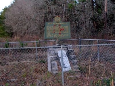
2. Site: Franklinville Marker
Credits. This page was last revised on January 31, 2020. It was originally submitted on October 6, 2008, by David Seibert of Sandy Springs, Georgia. This page has been viewed 2,117 times since then and 23 times this year. Photos: 1, 2. submitted on October 6, 2008, by David Seibert of Sandy Springs, Georgia. • Bill Pfingsten was the editor who published this page.
