Apalachicola in Franklin County, Florida — The American South (South Atlantic)
Historic Franklin Square
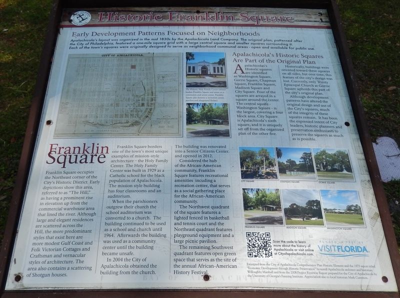
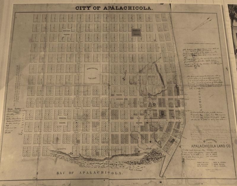
Early Development Patterns Focused on Neighborhoods
Franklin Square
Franklin Square occupies the Northeast corner of the City's Historic District. Early depictions show this area, referred to as "The Hill," as having a prominent rise in elevation up from the commercial warehouse area that lined the river. Although large and elegant residences are scattered across the Hill, the more predominant styles that exist here are more modest Gulf Coast and Folk Victorian Cottages and Craftsman and vernacular styles of architecture. The area also contains a scattering of Shotgun houses.
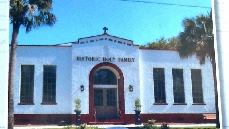
Franklin Square borders one of the town's most unique examples of mission-style architecture — the Holy Family Center. The Holy Family Center was built in 1929 as a Catholic school for the black population of Apalachicola. The mission style building has four classrooms and an auditorium.
When the parishioners outgrew their church the school auditorium was converted to a church. The building continued to be used as a school and church until 1964. Afterwards the building was used as a community center until the building became unsafe.
In 2004 the City of Apalachicola obtained the building from the church. The building was renovated into a Senior Citizens Center, and opened in 2012.
Considered the hub of the African-American community, Franklin Square features recreational amenities including a recreation center, that serves as a social gathering place for the African-American community.
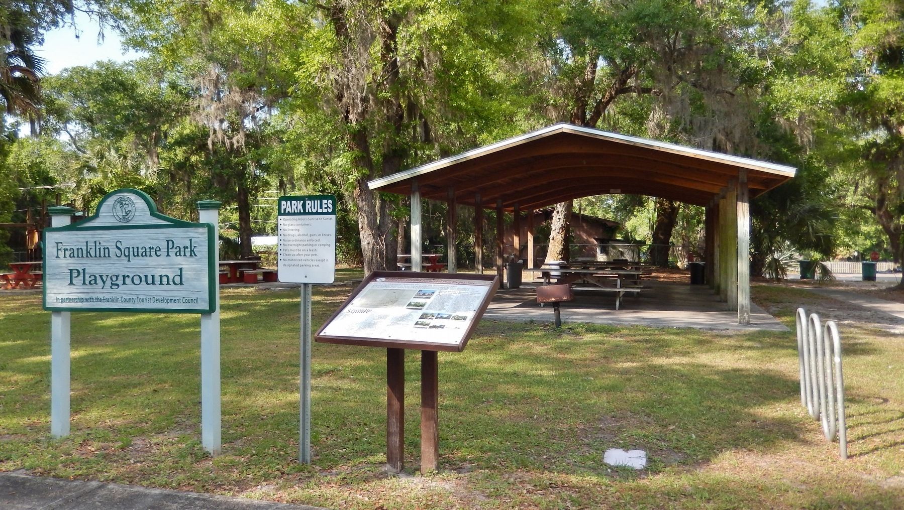
The Northwest quadrant of the square features a lighted fenced in basketball and tennis court and the Northeast quadrant features playground equipment and a large picnic pavilion.
The remaining Southwest quadrant features open green space that serves as the site of the annual African-American History Festival.
Apalachicola's Historic Squares Are Part of the Original Plan
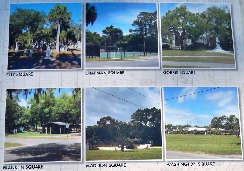
Apalachicolas' historic squares are identified as Washington Square, Gorrie Square, Chapman Square, Franklin Square, Madison Square and City Square. Four of the squares are arrayed in a square around the center. The central square - Washington Square - is the largest, covering a four block area. City Square is Apalachicola's sixth square, and it is uniquely set off from the organized plan of the other five.
Historically, buildings were oriented toward these squares on all sides, but over time, this feature of the city's design was lost. Currently, only Trinity Episcopal Church at Gorrie Square upholds this part of the city's original plan.
Although development patterns have altered the original design and use of the City's squares, much of the integrity of these squares remain. It has been the expressed intent of City leaders, historic planners and preservation enthusiasts to preserve the squares as much as is possible.
Excerpted from the City of Apalachicola Comprehensive Plan Historic Element and the 1975 report titled "Economic Development through Historic Preservation" by noted Apalachicola architect and historian Willoughby Marshall and from the 2008 Project Riverway Report prepared for the City of Apalachicola by the University of Georgia's Fanning Institute. Appreciation also to local historian Mark Curenton.
Topics. This historical marker is listed in these topic lists: African Americans • Architecture • Parks & Recreational Areas.
Location. 29° 43.855′ N, 84° 59.594′ W. Marker is in Apalachicola, Florida, in Franklin County. Marker is at the intersection of 6th Street and Avenue L, on the right when traveling west on 6th Street. Located in the Franklin Square Park Playground. Touch for map. Marker is in this post office area: Apalachicola FL 32320, United States of America. Touch for directions.
Other nearby markers. At least 8 other markers are within walking distance of this marker. The Hanserd-Fry House (approx. half a mile away); The Raney House (approx. half a mile away); The Dr. Alvan W. Chapman House (approx. half a mile away); Chestnut Street Cemetery of Early Apalachicola (approx. half a mile away); a different marker also named The Dr. Alvan W. Chapman House (approx. half a mile away); Methodist Episcopal Church South (approx. half a mile away); Trinity Episcopal Church (approx. 0.6 miles away); Fort Coombs - Franklin Guards (approx. 0.6 miles away). Touch for a list and map of all markers in Apalachicola.
Also see . . . Apalachicola's Historic Squares. All six of Apalachicola’s historic squares (City, Chapman, Gorrie, Franklin, Madison and Washington) fall within the Apalachicola Historic District which contains a remarkable number of structures built during the town’s most prosperous times in the nineteenth and early twentieth century. The major portion of the Historic District is residential with single-family dwellings predominating. Generally, the residential area is oriented north-south along Fifth and Sixth Streets and has the highest concentration of pre-1860 buildings. The area west of Sixth Street along Bay Avenue and Avenues B, C, D and E, developed around
the turn of the century. Several churches and public and parochial school buildings can be found here. (Submitted on August 22, 2018, by Cosmos Mariner of Cape Canaveral, Florida.)
Credits. This page was last revised on August 23, 2018. It was originally submitted on August 18, 2018, by Cosmos Mariner of Cape Canaveral, Florida. This page has been viewed 462 times since then and 70 times this year. Photos: 1, 2, 3, 4, 5. submitted on August 22, 2018, by Cosmos Mariner of Cape Canaveral, Florida. • Bernard Fisher was the editor who published this page.
