San Patricio in San Patricio County, Texas — The American South (West South Central)
Battle of San Patricio
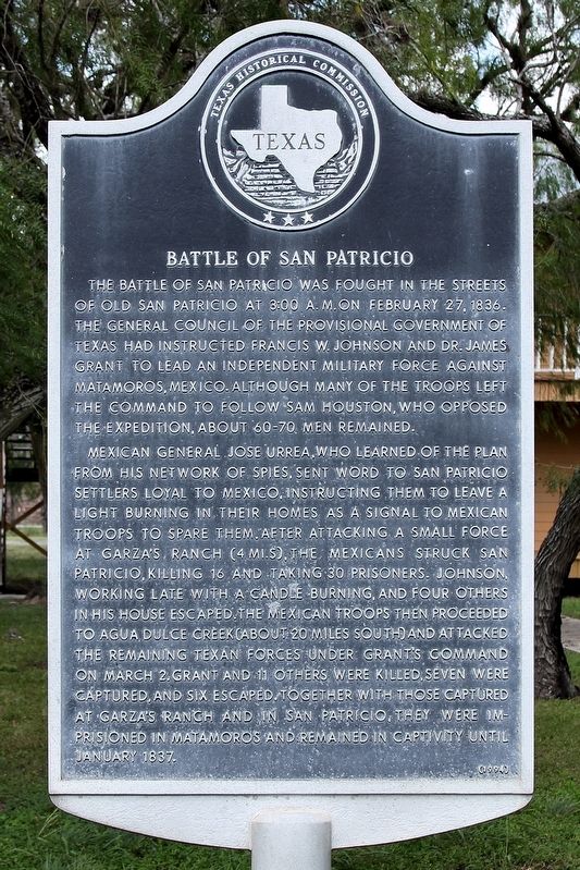
Photographed by Larry D. Moore, August 11, 2018
1. Battle of San Patricio Marker
Mexican general Jose Urrea, who learned of the plan from his network of spies, sent word to San Patricio settlers loyal to Mexico, instructing them to leave a light burning in their homes as a signal to Mexican troops to spare them. After attacking a small force at Garza's Ranch (4 mi. S), the Mexicans struck San Patricio, killing 16 and taking 30 prisoners. Johnson, working late with a candle burning, and four others in his house escaped. The Mexican troops then proceeded to Agua Dulce Creek (about 20 miles south) and attacked the remaining Texan forces under Grant's command on March 2. Grant and 11 others were killed, seven were captured, and six escaped. Together with those captured at Garza's Ranch and in San Patricio, they were imprisoned in Matamoros and remained in captivity until January 1837.
Erected 1994 by Texas Historical Commission. (Marker Number 330.)
Topics. This historical marker is listed in this topic list: War, Texas Independence. A significant historical date for this entry is February 27, 1836.
Location. 27° 57.115′ N, 97° 46.375′ W. Marker is in San Patricio, Texas, in San Patricio County. It is on Main Street (Farm to Market Road 666) north of McGloin Street, on the right when traveling south. Touch for map. Marker is at or near this postal address: 4615 Main St, Mathis TX 78368, United States of America. Touch for directions.

Regionally, this marker is in the American South and on the
this page online
Other nearby markers. At least 8 other markers are within walking distance of this marker: Old Cemetery on the Hill (here, next to this marker); Josepha Rodriguez (here, next to this marker); Courthouses of San Patricio County (a few steps from this marker); San Patricio de Hibernia (a few steps from this marker); San Patricio County (a few steps from this marker); Saint Patrick's Catholic Church (approx. 0.2 miles away); Education in San Patricio (approx. ¼ mile away); Old Dougherty House (approx. ¼ mile away). Touch for a list and map of all markers in San Patricio.
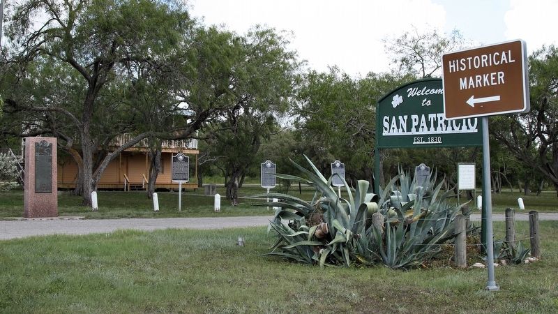
Photographed by Larry D. Moore, August 11, 2018
2. Battle of San Patricio Marker Area

Photographed by Jeff Leichsenring, April 12, 2026
3. Battle of San Patricio Marker
Marker is second from right; markers, from right to left: Old Cemetery on the Hill (3703), Courthouses of San Patricio County (1094), Josepha Rodriguez (14201), San Patricio de Hibernia (4550) and San Patricio County (4549)
Credits. This page was last revised on April 13, 2026. It was originally submitted on August 18, 2018, by Larry D. Moore of Del Valle, Texas. This page has been viewed 1,740 times since then and 180 times this year. Photos: 1, 2. submitted on August 18, 2018, by Larry D. Moore of Del Valle, Texas. 3. submitted on April 13, 2026, by Jeff Leichsenring of Garland, Texas. • Bernard Fisher was the editor who published this page.
