Mid City in Los Angeles in Los Angeles County, California — The American West (Pacific Coastal)
Rocha Adobe
Photographed by Craig Baker, August 4, 2018
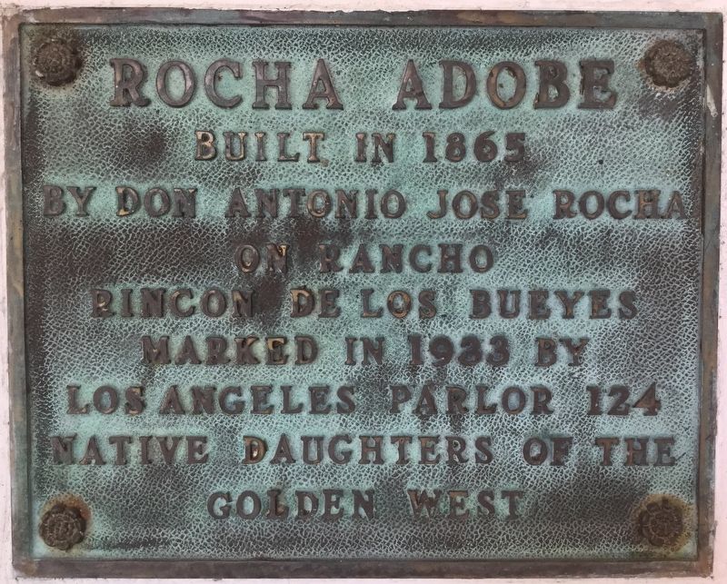
1. Rocha Adobe Marker
Built in 1865 by Don Antonio Jose Rocha on Rancho Rincon de los Bueyes.
Marked in 1933 by Los Angeles Parlor 124 Native Daughters of the Golden West.
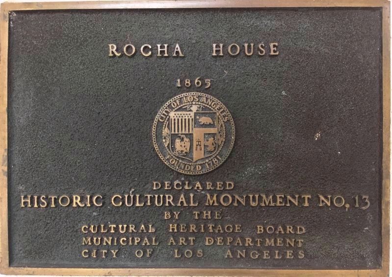
Rocha House, 1865.
Declared Historic Cultural Monument No. 13 by the Cultural Heritage Board, Municipal Art Department, City of Los Angeles.
Erected 1933 by Native Daughters of the Golden West. (Marker Number 13.)
Topics and series. This historical marker is listed in this topic list: Settlements & Settlers. In addition, it is included in the Los Angeles Historic-Cultural Monument, and the Native Sons/Daughters of the Golden West series lists. A significant historical year for this entry is 1865.
Location. 34° 2.371′ N, 118° 23.051′ W. Marker is in Los Angeles, California, in Los Angeles County. It is in Mid City. It can be reached from South Shenandoah Street south of Cadillac Avenue, on the left when traveling south. Touch for map. Marker is at or near this postal address: 2400 S Shenandoah St, Los Angeles CA 90034, United States of America. Touch for directions.

Regionally, this marker is in the Transverse Ranges. It is also on the American Pacific
this page online
Other nearby markers. At least 8 other markers are within 2 miles of this marker, measured as the crow flies: The Helms Building (approx. 0.7 miles away); Los Angeles Center for Advanced Studies (approx. 0.8 miles away); Ivy Substation (approx. one mile away); Studio Pass (approx. 1.2 miles away); The Citizen Publishing Building (approx. 1.2 miles away); The Culver Studios (approx. 1.2 miles away); Main Street (approx. 1.2 miles away); The Culver Hotel (approx. 1.2 miles away). Touch for a list and map of all markers in Los Angeles.
More about this marker. Rocha and Dominguez were the original owners of nearby Rancho La Brea.
Rincon de los Bueyes means Corner with the Steers, translated from Spanish.
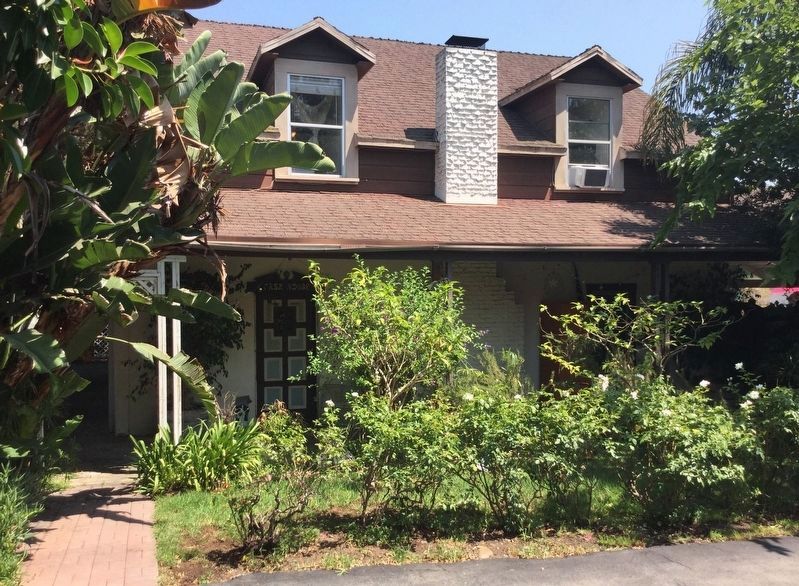
The adobe is located at the end of a narrow driveway, secluded between houses and apartments.
This is a private residence, not open to the public.
Photographed by Craig Baker, August 4, 2018
2. L.A. City Historic Monument No. 13
Photographed by Craig Baker, August 4, 2018
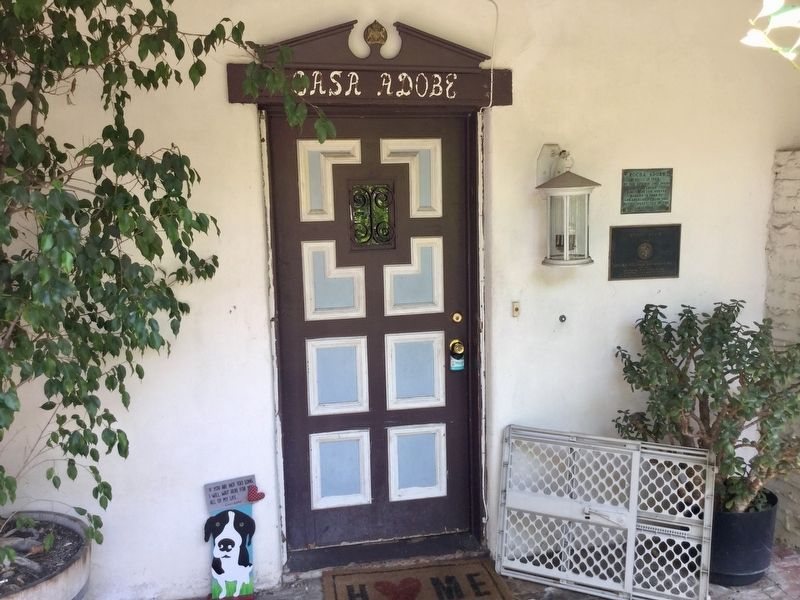
3. Rocha Adobe Marker
Photographed by Craig Baker, August 4, 2018
4. Rocha Adobe - West Side
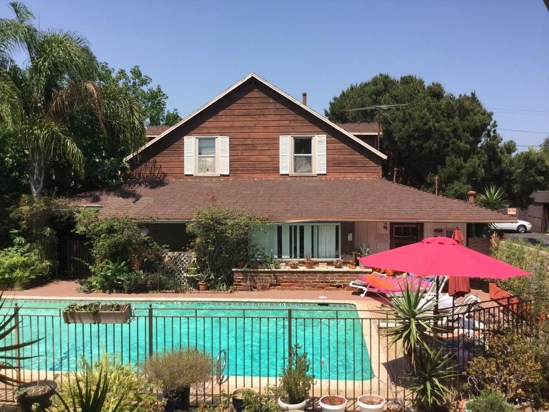
Photographed by Craig Baker, August 4, 2018
5. Rocha Adobe - South Side
Pool is part of the apartment complex next door.
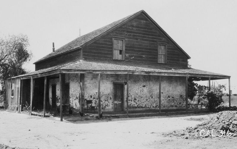
courtesy USC Library, circa 1921
6. Antonio Jose Rocha's Adobe, North Side
Credits. This page was last revised on September 1, 2025. It was originally submitted on August 22, 2018, by Craig Baker of Sylmar, California. This page has been viewed 2,010 times since then and 117 times this year. Last updated on August 23, 2018, by Craig Baker of Sylmar, California. Photos: 1, 2, 3, 4, 5, 6. submitted on August 22, 2018, by Craig Baker of Sylmar, California. • Andrew Ruppenstein was the editor who published this page.
