Missoula in Missoula County, Montana — The American West (Mountains)
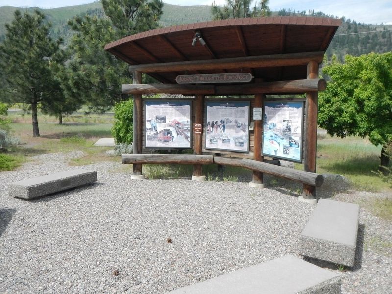
Journey Through the Blackfoot
Blackfoot River Corridor
Photographed By Barry Swackhamer, May 9, 2018
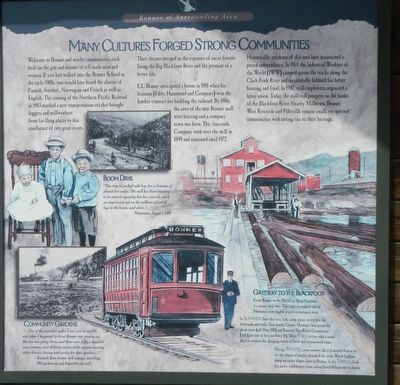
1. Many Cultures Forge Strong Communities panel
Captions: (upper center left) Boom Days "The river is packed with logs for a distance of almost two miles. The mill has been running to its utmost capacity; but has scarcely made an impression yet on the millions of feet of logs to the booms and above." - Missoulian, August 1, 1881; (bottom left) Community Gardens "...One of the grandest sights I ever saw in my life was when I happened to be at Bonner one evening as the sun was going down, and there were fully a hundred men, women, and children, many of the women wearing white dresses, hoeing and caring for their gardens..." - Kenneth Ross, former mill manager, describing 1918 gardens on land donated by the mill; Gateway to the Blackfoot From Bonner to the Blackfoot River Corridor in a stone's skip away. Take time to explore one of Montana's most highly prized recreational area. In Summer, float the river, fish, camp, picnic or explore the backroads and trails. Visit nearby Garnet, Montana's best preserved ghost town (off Hwy 200) and Bonner's Two Rivers Community Park (just east of here on Hwy 10). When Fall arrives take a scenic drive to witness the changing colors of larch and cottonwood trees. During Winter, cross-country ski at Lubrecht Forest or try the slopes of nearby, downhill ski area. Watch bighorn sheep on rocky slopes close to Bonner. In the Spring look for native widowers from arrow-leaved balsamroot to lupine.
Welcome to Bonner and nearby communities, each built on the grit and dreams of self-made men and women. It you had walked into the Bonner School in the early 1900s, you would have heard the chatter of Finnish, Swedish, Norwegian and French as well as English. The coming of the Northern Pacific Railroad in 1883 marked a new transportation era that brought loggers and millworkers from far-flung places to this confluence of two great rivers. Their dreams merged in the expanses of uncut forests lining the Big Blackfoot River and the promise of a better life.
E.L. Bonner anticipated a boom in 1881 when his business (Eddy, Hammond and Company) won the lumber contract for building the railroad. By 1886, the saws of the new Bonner mill were buzzing and a company town was born. The Anaconda Company took over the mill in 1898 and remained until 1972.
Historically, residents of this area have maintained a proud independence. In 1914, the Industrial Works of the World (IWW) camped across the tracks along the Clark Fork River and successfully lobbied for better housing and food. In 1942, mill employees organized a labor union. Today, the mill still prospers on the banks of the Blackfoot River. Nearby Milltown, Bonner, West Riverside and Piltzville remain small, yet spirited communities with strong ties to their heritage.
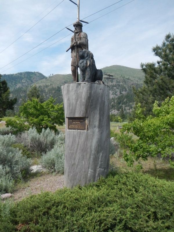
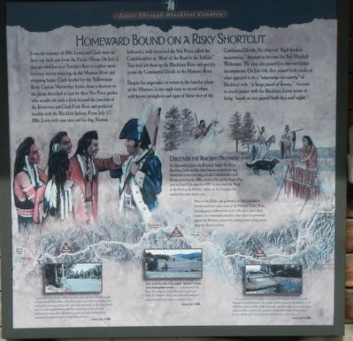
It was the summer of 1806, Lewis and Clark were on their way back east from the Pacific Ocean. On July 3, they divided forces at Traveler's Rest to explore more territory before reuniting on the Missouri River and returning home. Clark headed for the Yellowstone River. Captain Meriwether Lewis chose a shortcut to the plains described to him by their Nez Perce guides, who would ride only a little beyond the junction of the Bitterroot and Clark Fork River and predicted trouble with the Blackfeet Indians. From July 3-7, 1806, Lewis with nine men and his dog Seaman, followed a well-worn trail the Nez Perce called the Cokahlarishkit or "River of the Road to the Buffalo." This trail led them up the Blackfoot River and quickly across the Continental Divide to the Missouri River.
Despite his impatience to return to the familiar plains of the Missouri, Lewis took time to record swans, wild horses, pronghorn and signs of bison west of the Continental Divide. He observed "high broken mountains," destined to become the Bob Marshall Wilderness. The men also passed five deserted Indian encampments. On July 6th, they joined fresh tracks of what appeared to be a "returning
Photographed By Barry Swackhamer, May 9, 2018
2. Homeward Bound on a Risky Shortcut pane;
Captions: (center) Discover the Ancient Pathway For thousands of years, the Kootenai, Nez Perce, Blackfeet, Crow and Shoshone Indians traveled with dog travois that etched ruts deep into the Cokahlarishkit trail. Horses arrived in the 1700s, a train in 1913 and the Rogers Pass road to Great Falls opened in 1939. As you travel the "River of the Road to the Buffalo," reflect on the footsteps that marked this route before you. Most of the Salish tribe gathered each May and June to harvest nutritious camas roots in the Potomac Valley Basin. Bison hunting parties followed the trail to the plains about three times a year, sometimes joined by other allies for protection against the Blackfeet, known for sending horse-raiding parties deep into Salish territory.; (bottom left) "I now ordered the horses saddled smoked a pip with these friendly people and at noon bid them adieu. They has cut the meat which I gave them last evening thin and exposed it in the sun to dry informing me that they should leave it in this neighborhood untill (sic) they returned as a store for their homeward journey...these affectionate people our guides betrayed very emmotion of unfeigned regret at seperating from us..." - Lewis, July 4, 1806; (bottom center) Lewis names the creek at this campsite "Seaman's: in honor of his Newfoundland retriever. "...we encamped on the lower side of the last creek (Seaman's Creek) just above it's entrance. here a war party had encamped about 2 months since and conceald their fires." - Lewis, July 5, 1806; (bottom right) "...our encampment on a large creek some little distance above it's mouth through q
beautifull plain on the border of which we passed the remains of 32 old lodges... great number of the burrowing squirrls in this parrie...saw some goats and deer...Curloos, bee martinis, woodpeckers, plover, robins, doves, ravens, hawks and variety of sparrows common to the plains..." - Lewis, July 6, 1806.
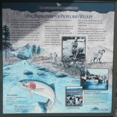
The Blackfoot River swirls, races and meanders 132 miles from the Continental Divide to its confluence with the Clark Fork River. The river has long served as a vital passageway for people and wildlife alike.
As you travel through the corridor, notice the rumpled valleys and pothole lakes - marks of a great ice age that once held this land in its grips. Today, these potholes and adjacent marches attract osprey, great blue heron and Canada geese. Bald eagles nest in treetops above the river as native trout hide under its pools.
Thanks largely to area ranchers that help manage the valley floor, the biological diversity of the corridor has been preserved. The history of its human diversity has been preserved as well. You can still hear tales of the late 1800s when the woods rang with crosscut saws felling trees for railroad ties and mine shafts. In the spring, a wall of logs raced down-river to the sawmill at Bonner until the mid-1920s when the railroad took over the job of transporting logs.
Today, canoes and rafts float past the sites of old Indian camps. Anglers cast their lines into
Photographed By Barry Swackhamer, May 9, 2018
3. Vital Passageway for People and Wildlife panel
Captions: (bottom right) Blackfoot Challenge: Working to Conserve the Valley Conserving the natural beauty and rural lifestyle is more than a vision for the Blackfoot Challenge. This "grass roots" group of private landowners, agencies and local officials formed in 1993. Together, they work on many fronts fro restoring streams, conserving water, improving grazing, and controlling weed to educating others about land stewardship. (above) Restoring fish passage at diversions has improved fish survival in the Blackfoot. (bottom) Tours in the Blackfoot build public-private partnerships and foster resources stewardship.; (bottom left) You Can Help Treat the land and its wildlife with the respect you give to your own home: • You are in a valley with plentiful public lands, but many working ranches as well. Please respect private property. • When camping or picnicking store foods securely and leave sites cleaner than when you arrived. Both black and grizzly bears inhabit the Blackfoot River county and are attracted to our foods.
Topics and series. This historical marker is listed in these topic lists: Environment • Exploration • Settlements & Settlers. In addition, it is included in the Lewis & Clark Expedition series list. A significant historical date for this entry is July 3, 1883.
Location. 46° 52.5′ N, 113° 53.136′ W. Marker is in Missoula, Montana, in Missoula County. Marker is on Montana Highway 200 East (Highway 200) near 1st Street, on the right when traveling west. Touch for map. Marker is at or near this postal address: 7985 Montana Highway 200, Missoula MT 59802, United States of America. Touch for directions.
Other nearby markers. At least 8 other markers are within 5 miles of this marker, measured as the crow flies. Brave New World (a few steps from this marker); Twilight of an Era (a few steps from this marker); Prescott House (approx. 4.6 miles away); a different marker also named Prescott House (approx. 4.6 miles away); Central Heating Plant (approx. 4.7 miles away); Glacial Lake Missoula (approx. 4.7 miles away); All gave some, some gave all (approx. 4.7 miles away); Men's Gymnasium (approx. 4.7 miles away). Touch for a list and map of all markers in Missoula.
More about this marker. This marker is located at a roadside turnout on the north side of Montana Highway 200.
Credits. This page was last revised on September 9, 2018. It was originally submitted on September 9, 2018, by Barry Swackhamer of Brentwood, California. This page has been viewed 290 times since then and 22 times this year. Photos: 1, 2, 3, 4, 5. submitted on September 9, 2018, by Barry Swackhamer of Brentwood, California.
