
Downtown in Springfield in Sangamon County, Illinois — The American Midwest (Great Lakes)
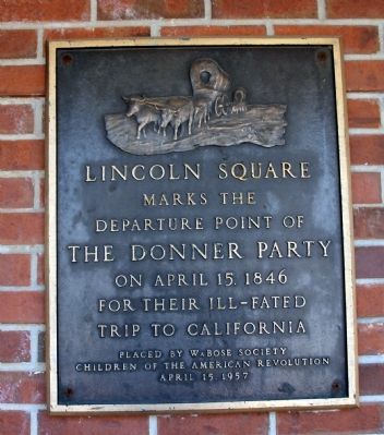
Departure Point of The Donner Party
Photographed by Al Wolf, October 4, 2008
1. Departure Point of The Donner Party Marker
marks the
departure point of
the Donner Party
on April 15, 1846
for their ill-fated
trip to California.
Erected 1957 by WaBose Society, Children of the American Revolution.
Topics. This historical marker is listed in these topic lists: Disasters • Exploration • Settlements & Settlers. A significant historical month for this entry is April 1863.
Location. 39° 48.028′ N, 89° 38.919′ W. Marker is in Springfield, Illinois, in Sangamon County. It is in Downtown. It is on East Adams Street west of 6th Street, on the left when traveling west. Touch for map. Marker is in this post office area: Springfield IL 62701, United States of America. Touch for directions.

Regionally, this marker is in Central Illinois. It is also in the American Midwest and in the Corn Belt. Globally, it is in North America, the Western Hemisphere, the Western World, and the Anglosphere. Historically, it finds itself in what was once the territory of the Mississippian Culture and also the Northwest Territory.
Other nearby markers. At least 8 other markers are within walking distance of this marker: Abraham Lincoln
this page online
Related markers. Click here for a list of markers that are related to this marker. Donner Party Markers at both ends of their trail.
Also see . . .
1. The Donner Party. Legends of America website entry:
Pictures, map, and an interesting history of the Donner Party. Follow the many hot buttons.... (Submitted on October 12, 2008, by Al Wolf of Veedersburg, Indiana.)
2. Donner Party Diary. Website homepage (Submitted on October 13, 2008.)
3. New Light on the Donner Party. Comprehensive web site with biographical, genealogical, and documentary resources. See "Myths and Mysteries" page for a discussion
Photographed by Al Wolf, October 4, 2008
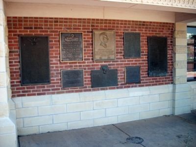
2. Wall of Plaques
The Wall of Plaques is located opposite the Old Illinois State Capitol building.
4. Trail of Tragedy: The Excavation of the Donner Party Site. A video of a United States Forest Service historical "dig" at a suspected "Donner Party" camp site. (Submitted on March 5, 2009, by Al Wolf of Veedersburg, Indiana.)
Credits. This page was last revised on December 14, 2024. It was originally submitted on October 10, 2008, by Al Wolf of Veedersburg, Indiana. This page has been viewed 4,497 times since then and 107 times this year. Photos: 1, 2. submitted on October 10, 2008, by Al Wolf of Veedersburg, Indiana. • Kevin W. was the editor who published this page.
