Near Lolo in Missoula County, Montana — The American West (Mountains)
The Journey Home
Photographed by Barry Swackhamer, May 10, 2018
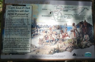
1. The Journey Home Marker
An often overlooked aspect of the Lewis and Clark Expedition is the decision to separate when they left Travelers' Rest on July 3, 1806. This decision was made months earlier during the winter at Fort Clatsop. During that time the captains had determined what they believed to be the shortest route across the continent with Travelers' Rest a crucial point.
By following the network of ancient routes that led to and from Travelers' Rest, the captains and their party were to split again and again - reuniting into new groups as they explored more of present day Montana with an eye toward completing the mission given them by President Jefferson.
This map shows how the Expedition traveled as they made their way back to St. Louis. The first of many splits occurred when they left Travelers' Rest on July 3, 1806. On August 12, 1806, the two groups reunited near the the (sic) confluence of the Missouri and Yellowstone Rivers and then proceeded on to St. Louis,
Erected by Montana
this page online
Topics and series. This historical marker is listed in this topic list: Exploration. In addition, it is included in the Former U.S. Presidents: #03 Thomas Jefferson, and the Lewis & Clark Expedition series lists. A significant historical date for this entry is July 3, 1803.
Location. 46° 45.048′ N, 114° 5.31′ W. Marker is near Lolo, Montana, in Missoula County. It can be reached from Lolo Creek Road (U.S. 12) near U.S. 93, on the left when traveling west. Touch for map. Marker is at or near this postal address: 6717 Lolo Creek Road, Lolo MT 59847, United States of America. Touch for directions.

Regionally, this marker is in Western Montana, in Glacier Country, and in Greater Missoula. It is also in the American Mountain West and in the Lewis & Clark Corridor. Globally, it is in North America, the Rocky Mountains, the Western Hemisphere, the Western World, and the Anglosphere. Historically, it finds itself in what was once Rupert’s Land and also the Louisiana Purchase.
Other nearby markers. At least 8 other markers are within 4 miles of
Photographed by Barry Swackhamer, May 10, 2018
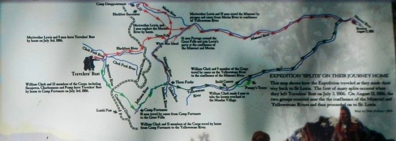
2. Expedition 'Splits" on Their Journey Home
This map shows how the Expedition traveled as they made their way back to St. Louis. The first of many splits occurred when they left Travelers' Rest on July 3, 1806. On August 12, 1806, the two groups reunited near the the (sic) confluence of the Missouri and Yellowstone Rivers and then proceeded on to St. Louis,
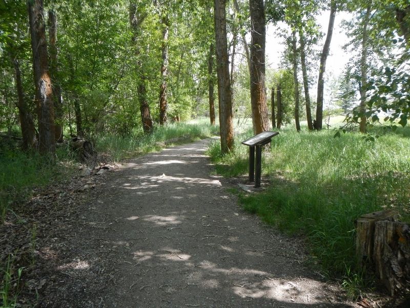
More about this marker. his marker is located on the foot trail in Travelers' Rest State Park.
Photographed by Barry Swackhamer, May 10, 2018
3. The Journey Home Marker
Credits. This page was last revised on September 14, 2018. It was originally submitted on September 14, 2018, by Barry Swackhamer of Brentwood, California. This page has been viewed 465 times since then and 42 times this year. Photos: 1, 2, 3. submitted on September 14, 2018, by Barry Swackhamer of Brentwood, California.
