Near Savage in Howard County, Maryland — The American Northeast (Mid-Atlantic)
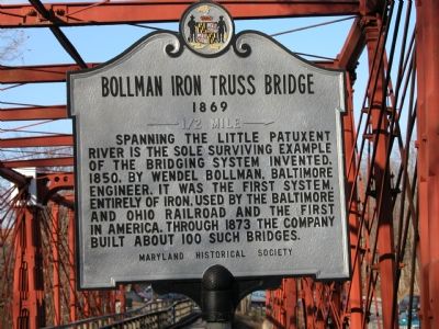
Bollman Iron Truss Bridge
1869
Photographed by Edward A. Gordon, January 31, 2006
1. Bollman Iron Truss Bridge Marker
Spanning the Little Patuxent River is the sole surviving example of the bridging system invented, 1850, by Wendel Bollman, Baltimore engineer. It was the first system, entirely of iron, used by the Baltimore and Ohio railroad and the first in America. Through 1873 the company built about 100 such bridges.
Erected 1966 by Maryland Historical Society.
Topics and series. This historical marker is listed in these topic lists: Bridges & Viaducts • Railroads & Streetcars. In addition, it is included in the ASCE Civil Engineering Landmarks, the Baltimore and Ohio Railroad (B&O), the Maryland Historical Trust, and the National Historic Landmarks series lists. A significant historical year for this entry is 1850.
Location. 39° 8.077′ N, 76° 49.505′ W. Marker is near Savage, Maryland, in Howard County. It is on Foundry Street near Gorman Road, on the left when traveling north. Near Savage Mill. Touch for map. Marker is in this post office area: Savage MD 20763, United States of America. Touch for directions.

Regionally, this marker is in the Baltimore Metro Region and in Central Maryland. It is also in the American Mid-Atlantic
this page online
Other nearby markers. At least 8 other markers are within walking distance of this marker: Baltimore Regional Trail (here, next to this marker); a different marker also named Savage Mill (here, next to this marker); a different marker also named Historic Savage Mill (about 700 feet away); Baldwin Common (approx. 0.2 miles away); Carroll Baldwin Memorial Hall (approx. 0.2 miles away); 9051-9053 Baltimore Street (approx. 0.2 miles away); Millworkers House (approx. ¼ mile away); This Survey Point (approx. 0.4 miles away). Touch for a list and map of all markers in Savage.
Other markers no longer nearby. Savage Mill (was here, next to this marker but has been replaced with another marker now near it); Historic Savage Mill (was about 500 feet away, measured in a direct line but has been replaced with another marker now near it).
More about this marker.
Photographed by Edward A. Gordon, January 31, 2006
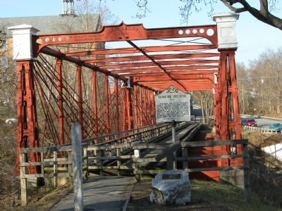
2. Bollman Iron Truss Bridge
Also see . . .
1. Spinning the Iron Web: The Bollman Truss Bridge. ASCE Library website entry (Submitted on March 14, 2022, by Larry Gertner of New York, New York.)
2. B&O Patuxent Branch. Brief historical sketch of the railroad branch line that once crossed this bridge, followed by photographs of various points along the current and original right of way. (Submitted on February 8, 2006.)
3. Historic Bridges of Maryland. Link to book on Amazon.com's web site. (Submitted on February 1, 2006.)
Additional commentary.
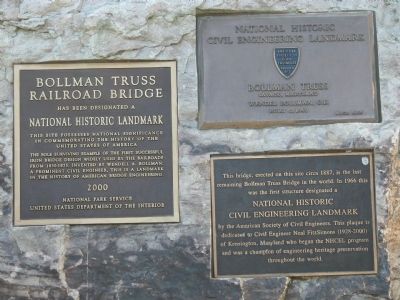
1. Text of the National Historic Landmark Plaque
Bollman Truss Railroad Bridge has been designated a National Historic Landmark. This site possesses national significance in commemorating the history of the United States of America. The sole surviving example of the first successful iron bridge
Photographed by Edward A. Gordon, January 31, 2006
3. Other Bollman Iron Truss Bridge Markers
Erected 2003 by The National Park Service, United Stated Department of the Interior
— Submitted February 1, 2006.
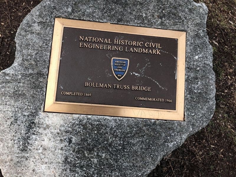
2. Text of First Civil Engineering Landmark Plaque
National Historic Civil Engineering Landmark. Bollman Truss, Savage, Maryland. Weldel Bollman, C.E. Built c.1869.
Erected 1966 by ASCE—the American society of Civil Engineers, founded in 1852.
— Submitted February 1, 2006.
3. Text of Second Civil Engineering Landmark Plaque
This bridge, erected on this site circa 1887, is the last remaining Bollman Truss Bridge in the world. In 1966 this was the first structure designated a National Historic Civil Engineering Landmark by the American Society of Civil Engineers. This plaque is dedicated to Civil Engineer Neal FitzSimons (1828-2000) of Kensington, Maryland who began the NHCEL program and as champion of engineering heritage preservation throughout the world.
— Submitted February 1, 2006.
Additional keywords. B&O
Photographed by Edward A. Gordon, January 31, 2006
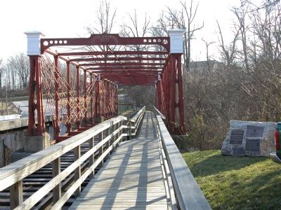
4. Bollman Iron Truss Bridge
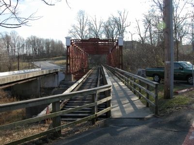
Photographed by Edward A. Gordon, January 31, 2006
5. Bollman Iron Truss Bridge
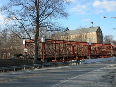
Photographed by Edward A. Gordon, January 31, 2006
6. Bollman Iron Truss Bridge
Bollman Truss Railroad Bridge with Historic Savage Mill in the background.
Credits. This page was last revised on December 28, 2024. It was originally submitted on February 1, 2006, by Edward A. Gordon of Columbia, Maryland. This page has been viewed 4,717 times since then and 91 times this year. Last updated on September 22, 2018, by Ken Derrenbacher of Dayton, Maryland. Photos: 1, 2, 3, 4, 5, 6. submitted on February 1, 2006, by Edward A. Gordon of Columbia, Maryland. 7. submitted on January 1, 2019, by Devry Becker Jones of Washington, District of Columbia. • Bill Pfingsten was the editor who published this page.
