Dorchester in Dorset, England, United Kingdom — Northwestern Europe (the British Isles)
The Roman Walls
Photographed by Michael Herrick, August 3, 2018
1. The Roman Walls Marker
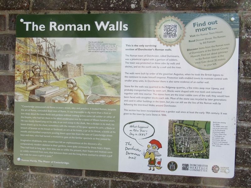
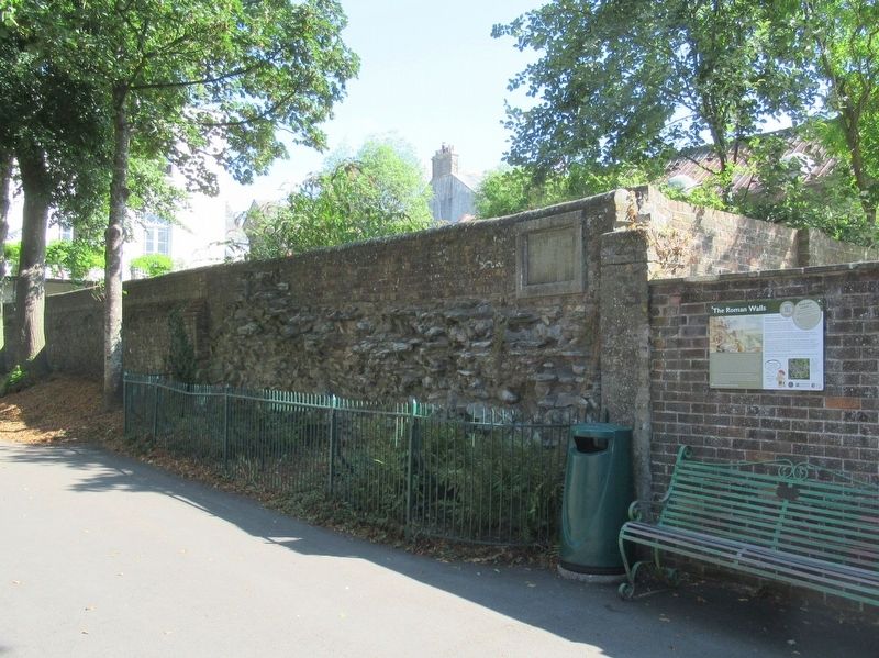
The Roman town of Dorchester, called Durnovaria, was a provincial capital with a garrison of soldiers. The town was protected on three sides by walls and ditches, and on the north side by a wall and the river.
The walls were built by order of the governor Augustus, when he took the British legions to the continent to make himself emperor. Protective walls enabled towns to maintain control with smaller army units. In Dorchester there is also some evidence of an earlier wall.
Stone for the walls was quarried in the Ridgeway quarries, a few miles away near Upwey, and probably transported here by oxen cart. Blocks were shaped with iron tools and cemented together with lime mortar. The stones here are the inner rubble core of the wall; they would have been faced with straighter blocks each side. Most of the stone was recycled by later generations and used in other buildings in the town, but you can still see the line of the Roman walls by following the tree-lined Walks around Dorchester.
This section has been incorporated into a garden
this page online
"Casterbridge announced old Rome in every street, alley and precinct. It looked Roman, bespoke the art of Rome, concealed dead men of Rome. It was impossible to dig more than a foot or two deep about the town fields and gardens without coming across some tall soldier or other of the Empire, who had lain there in his silent unobtrusive rest for a space of fifteen hundred years. He was mostly found lying on his side, in an oval scoop in the chalk, like a chicken in its shell: his knees drawn up to his chest; sometimes with the remains of his spear against his arm; a fibula or brooch of bronze on his breast or forehead; an urn at his knees, a jar at his throat, a bottle at his mouth; and mystified conjecture pouring down upon him from the eyes of Casterbridge street boys and men, who had turned a moment to gaze at the familiar spectacle as they passed by.
Imaginative inhabitants, who would have felt an unpleasantness at the discovery of a comparatively modern skeleton in their gardens, were quite unmoved by these hoary shapes. They had lived
Photographed by Michael Herrick, August 3, 2018
2. The Roman Walls Marker
Thomas Hardy, The Mayor of Casterbridge.
Topics. This historical marker is listed in this topic list: Forts and Castles.
Location. 50° 42.7′ N, 2° 26.417′ W. Marker is in Dorchester, England, in Dorset. It is on West Wall Walks Road close to Bowling Alley Walk, on the left when traveling south. Touch for map. Marker is in this post office area: Dorchester, England DT1 1UD, United Kingdom. Touch for directions.

Regionally, this marker is in South West England. Globally, it is on the Atlantic Ocean, in the North Atlantic Region, in Europe, in Atlantic Europe, on one of the British Isles, in the Western World, and in the Anglosphere. Historically, it finds itself in what was once the Roman Empire.
Other nearby markers. At least 8 other markers are within walking distance of this marker: The Brewery (about 150 meters away, measured in a direct line); Hardy's Dorchester
Photographed by Michael Herrick, August 3, 2018
3. Detail from the Marker
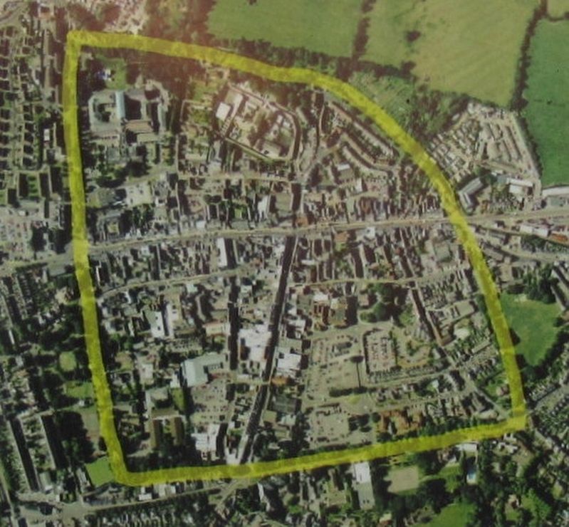
Aerial view showing the Walks. The Walks were laid out at the same time as the Boulevards (tree-lined walks) in Paris. Other than in Fordington, on the eastern side, Dorchester did not expand much beyond its Roman walls until the 19th century.
Credits. This page was last revised on January 27, 2022. It was originally submitted on September 22, 2018, by Michael Herrick of Southbury, Connecticut. This page has been viewed 437 times since then and 21 times this year. Photos: 1, 2, 3. submitted on September 22, 2018, by Michael Herrick of Southbury, Connecticut.
