Near Baker in San Bernardino County, California — The American West (Pacific Coastal)
Francis Marion "Borax" Smith
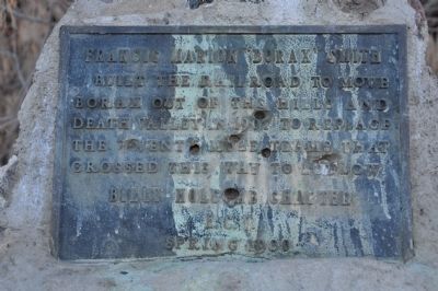
Photographed by Michael Kindig, November 26, 2010
1. Francis Marion "Borax" Smith Marker
Erected 1980 by Billy Holcomb Chapter No. 1069, E Clampus Vitus. (Marker Number 22.)
Topics and series. This historical marker is listed in these topic lists: Industry & Commerce • Railroads & Streetcars. In addition, it is included in the E Clampus Vitus series list. A significant historical year for this entry is 1907.
Location. 35° 5.417′ N, 116° 7.699′ W. Marker is near Baker, California, in San Bernardino County. It is at the intersection of Rasor Road and Crucero Road / Yvonne Boulevard, on the right when traveling east on Rasor Road. Marker is located on the north side of a group of 30' tall trees. The roads here have some heavy sand in a few places, so a 4-wheel drive may be necessary. Touch for map. Marker is in this post office area: Baker CA 92309, United States of America. Touch for directions.

Regionally, this marker is in Greater Los Angeles, in the Mojave Desert, in the Peninsular Ranges, and specifically in the Transverse Ranges.
this page online
Other nearby markers. At least 8 other markers are within 14 miles of this marker, measured as the crow flies: The Desert Studies Center (approx. 3.9 miles away); Soda Springs - Zzyzx Mineral Springs (approx. 3.9 miles away); Zzyzx Mineral Springs Resort (approx. 3.9 miles away); A Traveler's Rest (approx. 3.9 miles away); A Lost Lake (approx. 3.9 miles away); World’s Tallest Thermometer (approx. 12.6 miles away); Bun Boy Restaurant (approx. 12.6 miles away); Marl Springs / Seventeenmile Point (approx. 13.2 miles away). Touch for a list and map of all markers in Baker.
Regarding Francis Marion "Borax" Smith. "Borax" Smith built the Tonopah & Tidewater Railroad (T&T) from Ludlow to Rhyolite. The junction of the railroad at Rasor and the Los Angeles and Salt Lake Railroad (LA&SL), was named after Clarence Rasor. He was one of two brothers who were

Photographed by Michael Kindig, November 26, 2010
2. Trees Near the Marker
SOURCE: Billy Holcomb Chapter 1069 35th Anniversary Plaque Book by Phillip Holdaway
Related markers. Click here for a list of markers that are related to this marker. — 20 Mule Team routes.
Also see . . . Francis Marion "Borax" Smith (1846 - 1931) - Find A Grave Memorial. Western Businessman. Born in Richmond, Wisconsin, at the age of 21 he went west to seek wealth and became known as the "Borax King". (Submitted on December 20, 2011, by Michael Kindig of Elk Grove, California.)
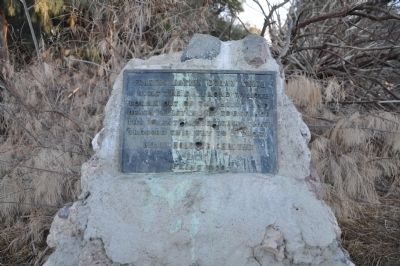
Photographed by Michael Kindig, November 26, 2010
3. Francis Marion "Borax" Smith Marker
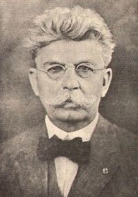
Photographed by Wikipedia
4. Francis Marion "Borax" Smith
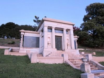
Photographed by Andrew Ruppenstein, December 3, 2011
5. Smith Family Crypt
Mountain View Cemetery, Oakland
Credits. This page was last revised on July 15, 2026. It was originally submitted on December 18, 2011, by Michael Kindig of Elk Grove, California. This page has been viewed 1,185 times since then and 24 times this year. Last updated on September 27, 2018, by Craig Baker of Sylmar, California. Photos: 1. submitted on December 18, 2011, by Michael Kindig of Elk Grove, California. 2. submitted on December 22, 2011, by Michael Kindig of Elk Grove, California. 3. submitted on December 18, 2011, by Michael Kindig of Elk Grove, California. 4. submitted on December 20, 2011, by Michael Kindig of Elk Grove, California. 5. submitted on December 28, 2011, by Andrew Ruppenstein of Lamorinda, California. • Syd Whittle was the editor who published this page.
