Point Pleasant in Mason County, West Virginia — The American South (Appalachia)
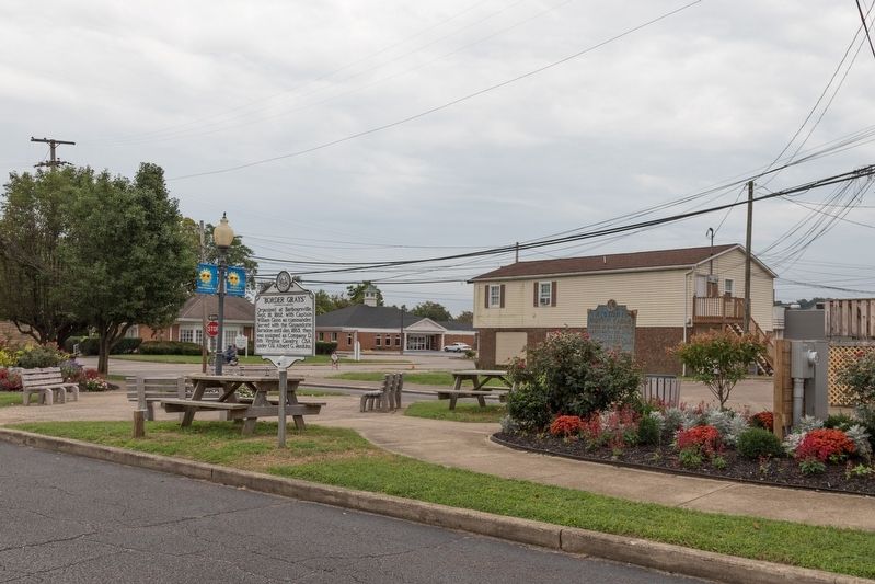
“Border Grays”
Erected 1965 by W. Va. Division, United Daughters of Confederacy and the West Virginia Historic Commission.
Topics and series. This historical marker is listed in this topic list: War, US Civil. In addition, it is included in the West Virginia Archives and History series list. A significant historical month for this entry is January 1863.
Location. 38° 50.552′ N, 82° 8.291′ W. Marker is in Point Pleasant, West Virginia, in Mason County. Marker is on 4th Street east of Main Street, in the median. Touch for map. Marker is in this post office area: Point Pleasant WV 25550, United States of America. Touch for directions.
Other nearby markers. At least 8 other markers are within walking distance of this marker. Historic Point Pleasant (here, next to this marker); “Legend of the Mothman” (within shouting distance of this marker); Mason County Veterans Memorial (within shouting distance of this marker); 330 Main Street (within shouting distance of this marker); Historic Lowe Hotel (within shouting distance of this marker); 313 Main Street (within shouting distance of this marker); Point Pleasant River Museum (within shouting distance of this marker); Lord Dunmore's War (about 400 feet away, measured in a direct line). Touch for a list and map of all markers in Point Pleasant.
Credits. This page was last revised on September 19, 2023. It was originally submitted on October 2, 2018, by J. J. Prats of Powell, Ohio. This page has been viewed 579 times since then and 37 times this year. Photos: 1, 2. submitted on October 2, 2018, by J. J. Prats of Powell, Ohio. 3. submitted on September 10, 2023, by J.T. Lambrou of New Boston, Michigan.


