Nonnebakken / "Nunnery Hill"
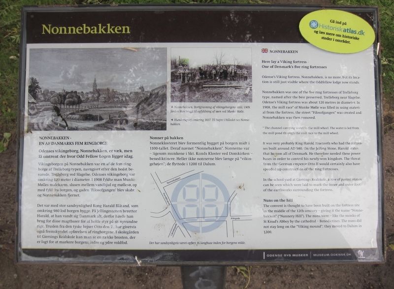
Here lay a Viking fortress -
One of Denmark's five ring fortresses
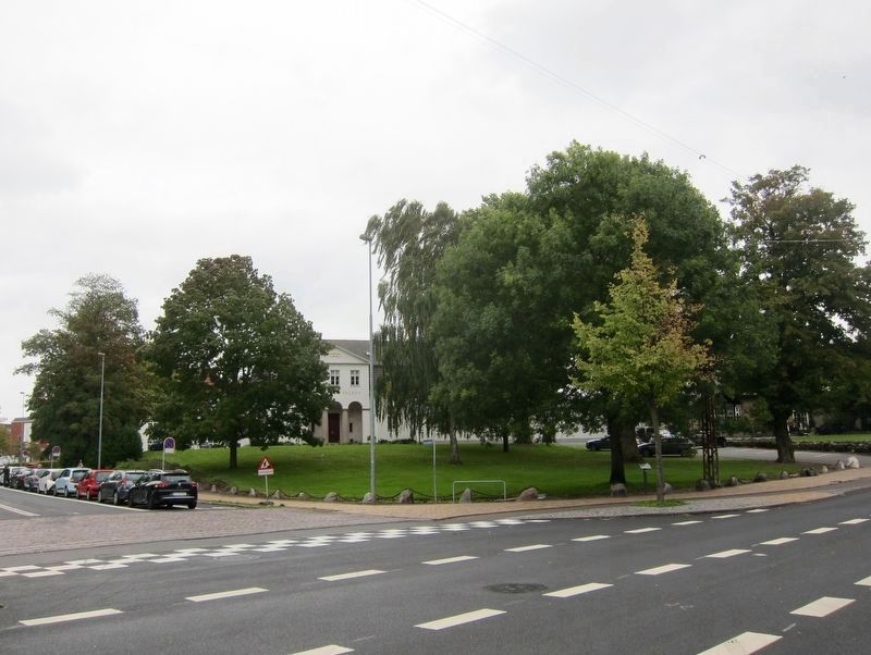
Odense's Viking fortress, Nonnebakken, is no more, but its location is still just visible where the Oddfellow lodge now stands.
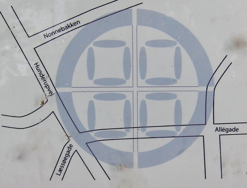
Nonnebakken was one of the five ring fortresses of Trelleborg type, named after the best preserved, Trelleborg near Slagelse. Odense's Viking fortress was about 120 metres in diameter. In 1908, the mill race* of Munke Mølle was filled in using material from the fortress, the street "Filosofgangen" was created and Nonnebakken was then removed.
* The channel carrying water to the mill wheel. The water is led from the mill pond through the mill race to the mill wheel.
It was very probably King Harold Bluetooth who had the fortresses built around AD 980. On the Jelling Stone, Harold states that he won all of Denmark. He therefore needed these power bases in order to control his newly-won kingdom. The threat from the German emperor Otto II would certainly also have speeded up construction of the ring fortresses.
In the school yard at Giersings Realskole, a row of paving stones can be seen which
were laid to mark the inner and outer foot of the earthworks surrounding the fortress.
Nuns on the hill
The convent is thought to have been built on the fortress site in the middle of the 12th century - giving it the name "Nonne-bakken" ("Nunnery Hill"). The nuns were - like the monks of St Knud's Abbey by the cathedral - Benedictines. The nuns did not stay long on the "Viking mound": they moved to Dalum in 1200.
-
Odenses vikingeborg, Nonnebakken, er væk, men lå omtrent der hvor Odd Fellow Logen ligger idag.
Vikingeborgen på Nonnebakken var en af de fem ringborge af Trelleborg-typen, navngivet efter den bedst bevarede, Trelleborg ved Slagelse. Odenses vikingeborg var omkring 120 meter i diameter. I 1908 fyldte man Munke Mølles malekarm, slusen mellem vandhjul og møllesø, op med fyld fra borgen, og gaden 'Filosofgangen' blev skabt og Nonnebakken fjernet.
Det var med stor sandsynlighed Kong Harald Blåtand, som omkring 980 lod borgen bygge. På Jellingestenen beretter Harald, at han vandt sig Danmark alt, derfor havde han brug for disse magtbaser for at holde styr på sit nyvundne rige. Truslen fra den tyske kejser Otto den 2., har givetvis også fremskyndet opførelsen af ringborgene. I skolegården til Giersings Realskole kan man se en række brosten, der er lagt for at
The fortress would have taken up most of what is visible here - Nonnebakken is the street on the left, and Hunderupvej is the street in the foreground. See next photo.
Nonner på bakken
EN AF DANMARKS FEM RINGBORGE
Nonneklosteret blev formentlig bygget på borgen midt i 1100-tallet. Deraf navnet "Nonnebakken". Nonnerne var - ligesom munkene i Skt. Knuds Kloster ved Domkirken -benediktinere. Heller ikke nonnerne blev længe på "vikingehøjen"; de flyttede i 1200 til Dalum.
Erected by Odense By Museer.
Topics. This historical marker is listed in these topic lists: Churches & Religion • Forts and Castles. A significant historical year for this entry is 1908.
Location. 55° 23.503′ N, 10° 23.265′ E. Marker is in Odense, Syddanmark (Southern Denmark), in Odense Kommune. Marker is at the intersection of Hunderupvej and Nonnebakken, on the right when traveling north on Hunderupvej. Touch for map. Marker is at or near this postal address: Nonnebakken 1, Odense, Syddanmark 5000, Denmark. Touch for directions.
Other nearby markers. At least 8 other markers are within walking distance of this marker. Nonner på Vikingborgen / Nuns at the Viking Fortress (about 90 meters away, measured in a direct line); Munke Mølle / Monks' Mill (about 180 meters away); Ambrosius Stub (approx. 0.4 kilometers away); Kongemord og Tordenskræpper / Royal Murder and Red Butterbur (approx. 0.4 kilometers away); Hans Christian Andersen at Vestergade 57-59 (approx. 0.4 kilometers away); Grønbenet Gakket Gangart / Washladies, Water Sprites, and Waddlers (approx. 0.6 kilometers away); Hans Christian Andersen - School (approx. 0.6 kilometers away); The Oldest Kingdom of the World (approx. 0.7 kilometers away). Touch for a list and map of all markers in Odense.
Credits. This page was last revised on October 3, 2018. It was originally submitted on October 3, 2018, by Andrew Ruppenstein of Lamorinda, California. This page has been viewed 148 times since then and 12 times this year. Photos: 1, 2, 3. submitted on October 3, 2018, by Andrew Ruppenstein of Lamorinda, California.

