Hôtel-de-Ville-de-Rivière-du-Loup
⎯⎯⎯
Rivière-du-Loup Town Hall
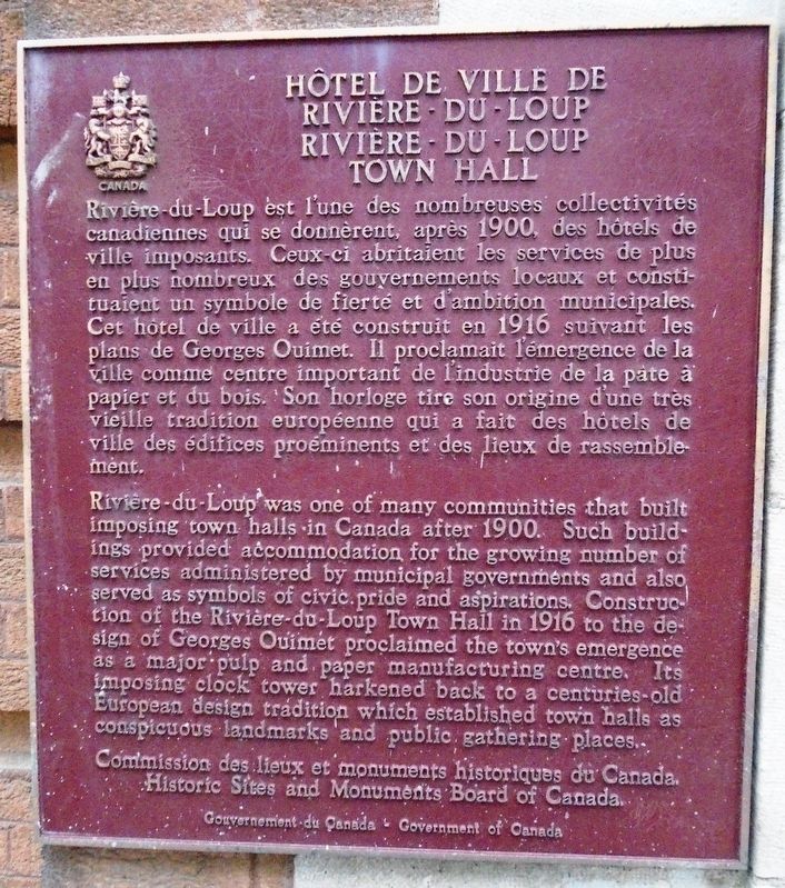

Rivière-du-Loup est l'une des nombreuses collectivités canadiennes qui se donnèrent, après 1900, des hôtels de ville imposants. Ceux-ci abritaient les services de plus en plus nombreux des gouvernements locaux et constituaient un symbole de fierté et d'ambition municipales. Cet hôtel de ville a été construit en 1916 suivant les plans de Georges Ouimet. Il proclamait l'émergence de la ville comme centre important de l'industrie de la pâte à papier et du bois. Son horloge tire son origine d'une très vieille tradition européenne qui a fait des hôtels de ville des édifices proéminents et des lieux de rassemblement.
this page online
Erected by Commission des lieux et monuments historiques du Canada / Historic Sites and Monuments Board of Canada.
Topics and series. This historical marker is listed in this topic list: Notable Buildings. In addition, it is included in the Canada, Historic Sites and Monuments Board series list. A significant historical year for this entry is 1900.
Location. 47° 50.154′ N, 69° 32.197′ W. Marker is in Rivière-du-Loup, Québec. It is at the intersection of rue de l'Hôtel de Ville and rue Lafontaine (Québec Route 185), on the right when traveling north on rue de l'Hôtel de Ville. Marker is on the wall, next to the Town Hall entrance. Touch for map. Marker is at or near this postal address: 65 rue de l'Hôtel de Ville, Rivière-du-Loup QC G5R 3Y7, Canada. Touch for directions.
Regionally, this marker is in Eastern Québec & Gaspésie. It is also in Central Canada. Globally, it is in North America, the Western Hemisphere, and the Western World. Historically, it finds itself in what was once a British colony, the Viceroyalty of New France, 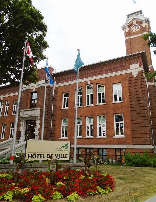
Other nearby markers. At least 8 other markers are within 26 kilometers of this marker, measured as the crow flies: Le projet Fraserville / The Fraserville Project (a few steps from this marker); Hôtel de Ville / City Hall (a few steps from this marker); John McLoughlin (a few steps from this marker); L'Hôtel de ville de Rivière-du-Loup (within shouting distance of this marker); CJFP (within shouting distance of this marker); Première Croix du 1892 (approx. 18.2 kilometers away); L'Église de Saint-André / The Church of Saint-André (approx. 23.1 kilometers away); L'Église / The Church (approx. 24.8 kilometers away). Touch for a list and map of all markers in Rivière-du-Loup.
Also see . . .
1. Rivière-du-Loup Town Hall. Wikipedia entry:
Links to Canadian Register of Historic Places website entry (Submitted on April 25, 2025, by Larry Gertner of New York, New York.)
2. Rivière-du-Loup History. Website entry (Submitted on October 6, 2018, by William Fischer, Jr. of Reynoldsburg, Ohio.)
Credits. This page was last revised on April 25, 2025. It was originally submitted on October 6, 2018, by William Fischer, Jr. of Reynoldsburg, Ohio. This page has been viewed 369 times since then and 28 times this year. Photos: 1, 2. submitted on October 6, 2018, by William Fischer, Jr. of Reynoldsburg, Ohio.
