Flat Rock in Henderson County, North Carolina — The American South (South Atlantic)
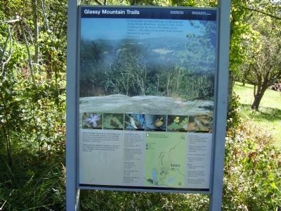
Glassy Mountain Trails
Lilian Sandburg 1945
Glassy Mountain has granite outcroppings that can be seen for miles, glinting in the sunlight. According to local legends, the Cherokee and early pioneers named this mountain for these well-known reflections.
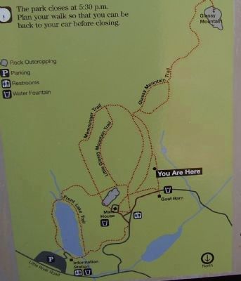
Follow in the the Sandburgs' footsteps to discover the delights that may be found along the five miles of hiking trails within this national historic site.
Erected by National Park Service.
Topics. This historical marker is listed in these topic lists: Landmarks • Notable Places. A significant historical year for this entry is 1945.
Location. 35° 16.204′ N, 82° 26.96′ W. Marker is in Flat Rock, North Carolina, in Henderson County. Marker can be reached from Little River Road (State Highway 1127). This marker is located in Carl Sandburg Home National Park. Touch for map. Marker is in this post office area: Flat Rock NC 28731, United States of America. Touch for directions.
Other nearby markers. At least 8 other markers are within walking distance of this marker. A Home for Champions (about 300 feet away, measured in a direct line); Outdoor Inspiration (approx. 0.2 miles away); Connemara (approx. 0.3 miles away); The Old Flat Rock Post Office (approx. half a mile away); Carl Sandburg (approx. half a mile away); Flat Rock (approx. half a mile away); C.G. Memminger (approx. 0.9 miles away); St. John in the Wilderness (approx. 0.9 miles away). Touch for a list and map of all markers in Flat Rock.
Regarding Glassy Mountain Trails. Marker includes a trail map, hiking tips and photos of local flora and fauna.
Credits. This page was last revised on June 16, 2016. It was originally submitted on October 13, 2008, by Stanley and Terrie Howard of Greer, South Carolina. This page has been viewed 1,142 times since then and 23 times this year. Photos: 1, 2. submitted on October 13, 2008, by Stanley and Terrie Howard of Greer, South Carolina. • Bill Pfingsten was the editor who published this page.

