The White Haven Estate: Other Houses
Ulysses S. Grant National Historic Site
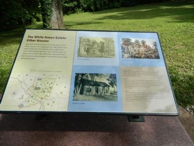
Above Left
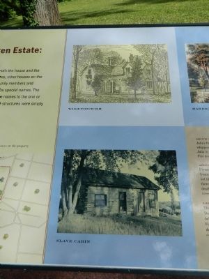
Julia's brother Louis built Wish-ton=Wish (a Native American word for whippoorwill) in 1848. It served as a temporary home for Ulysses and Julia in 1855 and on their visits to St. Louis during Grant's presidency. Fire destroyed the house in 1873.
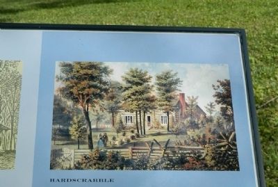
Above
Ulysses built a house in 1856 on 80 acres that Colonel Dent gave the Grants as a wedding gift, although no deed legalized the transfer. Julia did not like the crude log cabin, facetiously named Hardscrabble. They lived there only three months, returning to the main house upon Mrs. Dent;s death. The cabin is now located at Grant's Farm.
Left
This slave cabin from a neighboring farm is typical of cabins in the area. Documents indicate that as many as twelve slave cabins were located behind
this page online
Topics and series. This historical marker is listed in these topic lists: African Americans • Notable Buildings. In addition, it is included in the Former U.S. Presidents: #18 Ulysses S. Grant series list. A significant historical year for this entry is 1848.
Location. 38° 33.125′ N, 90° 21.094′ W. Marker is near Affton, Missouri, in St. Louis County. It can be reached from Grant Road. Touch for map. Marker is at or near this postal address: 7400 Grant Road, Saint Louis MO 63123, United States of America. Touch for directions.

Regionally, this marker is in Greater St. Louis. It is also in the American Midwest, in the Lewis & Clark Corridor, in the Corn Belt, and in the Great River Road Region. Globally, it is in North America, the Western Hemisphere, the Western World, and the Anglosphere. Historically, it finds itself in what was once the Viceroyalty of New France, the territory of the Mississippian Culture, the Louisiana Purchase, and the Antebellum
Other nearby markers. At least 8 other markers are within walking distance of this marker: Slaves Only (here, next to this marker); The Roads to White Haven (here, next to this marker); The Working Farm (here, next to this marker); Green Haven? (here, next to this marker); Early Owners of the Farm (a few steps from this marker); Outbuildings / ~150 Years Ago—Colored Troops (within shouting distance of this marker); A Place Called Home / ~150 Years Ago—Petersburg (within shouting distance of this marker); A Community within a Community / ~150 Years Ago—Contraband (within shouting distance of this marker). Touch for a list and map of all markers in Affton.
Another marker is no longer nearby. White Haven's Outbuildings (was here, next to this marker but has been replaced with another marker now near it).
Credits. This page was last revised on April 24, 2020. It was originally submitted on September 3, 2012, by Bill Pfingsten of Bel Air, Maryland. This page has been viewed 905 times since then and 59 times this year. Last updated on October 15, 2018, by Devry Becker Jones of Washington, District of Columbia. Photos: 1, 2, 3. submitted on September 3, 2012, by Bill Pfingsten of Bel Air, Maryland. • Andrew Ruppenstein was the editor who published this page.
