Kaysville in Davis County, Utah — The American Mountains (Southwest)
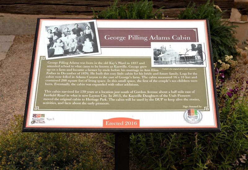
George Pilling Adams Cabin
Photographed by Andrew Johnson, September 30, 2018
1. George Pilling Adams Cabin Marker
This cabin survived for 139 years at a location just south of Gordon Avenue about a half mile east of Fairfield Road in what is now Layton City. In 2015, the Kaysville Daughters of the Utah Pioneers moved the original cabin to Heritage Park. The cabin will be used by the DUP to keep alive the stories, activities, and facts about the early pioneers.
Erected 2016 by Kaysville City. (Marker Number 8.)
Topics. This historical marker is listed in this topic list: Architecture. A significant historical month for this entry is December 1876.
Location. 41° 2.415′ N, 111° 56.172′ W.
this page online

Regionally, this marker is in the Wasatch Front and in Greater Salt Lake. It is also in the American Mountain West and on the Colorado Plateau. Globally, it is in North America, the Rocky Mountains, the Western Hemisphere, the Western World, and the Anglosphere. Historically, it finds itself in what was once New Spain and also Mexico’s Alta California.
Other nearby markers. At least 8 other markers are within 2 miles of this marker, measured as the crow flies: The Weinel Mill (approx. 0.3 miles away); Kaysville Presbyterian Church and School (approx. 0.4 miles away); John George Moroni Barnes House (approx. 0.4 miles away); Barnes-Gibson Home (approx. 0.4 miles away); Kaysville Tabernacle (approx. half a mile away); Kay's Ward Meetinghouse (approx. half a mile away);
Photographed by Andrew Johnson, September 30, 2018
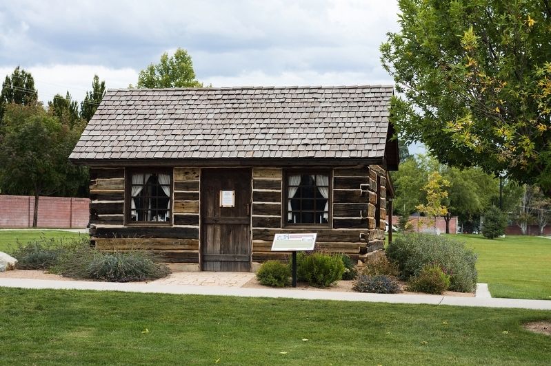
2. George Pilling Adams Cabin and Marker
Photographed by Andrew Johnson, September 30, 2018
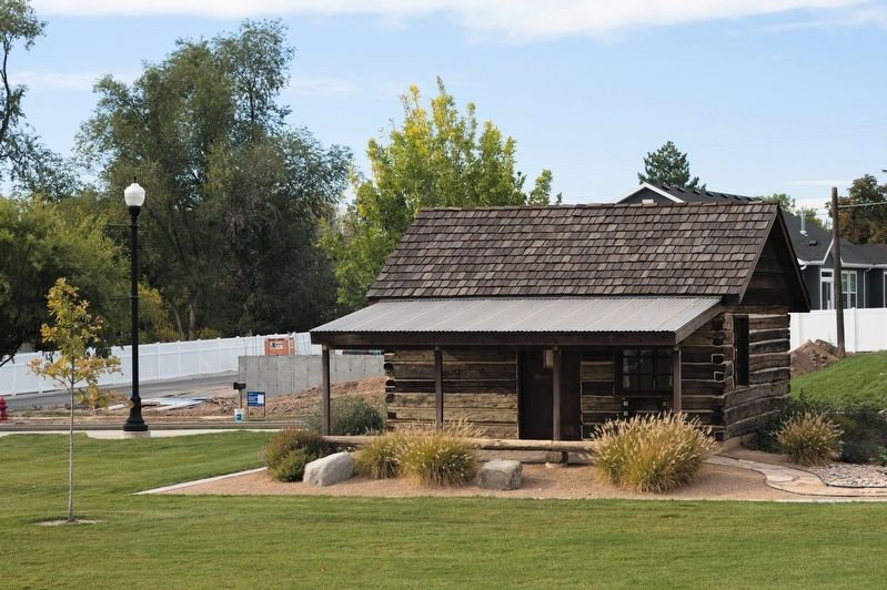
3. Back of George Pilling Adams Cabin
Credits. This page was last revised on October 21, 2018. It was originally submitted on October 20, 2018, by Andrew Johnson of Salt Lake City, Utah. This page has been viewed 1,269 times since then and 87 times this year. Photos: 1, 2, 3. submitted on October 20, 2018, by Andrew Johnson of Salt Lake City, Utah. • Andrew Ruppenstein was the editor who published this page.
