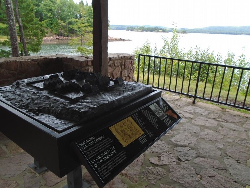
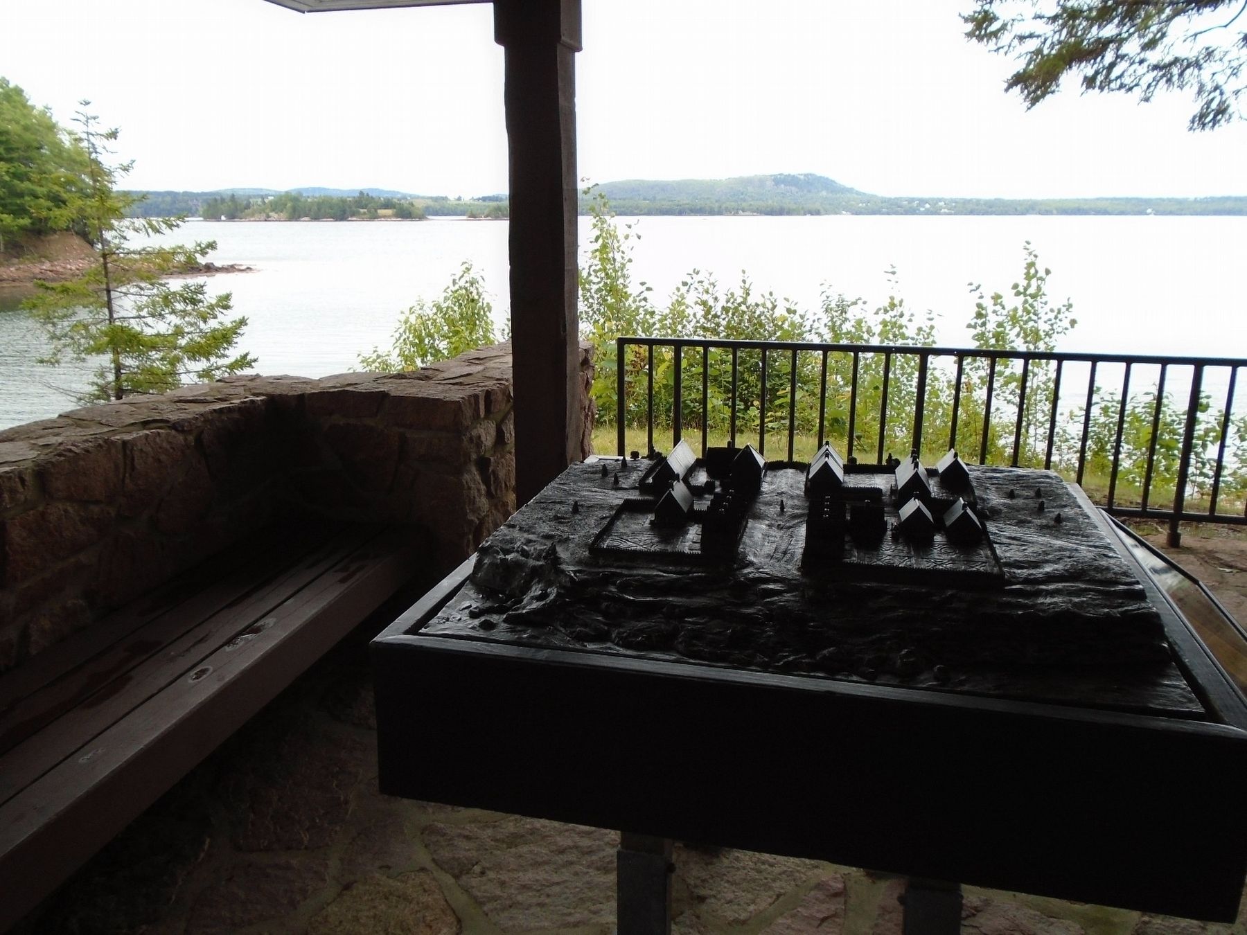
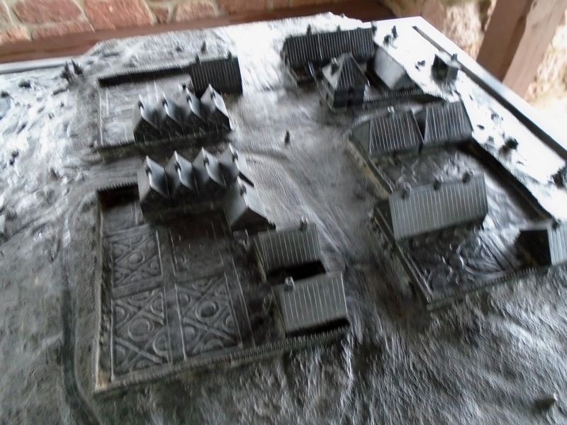
Imagining the Settlement / La colonie telle qu'on l'imagine
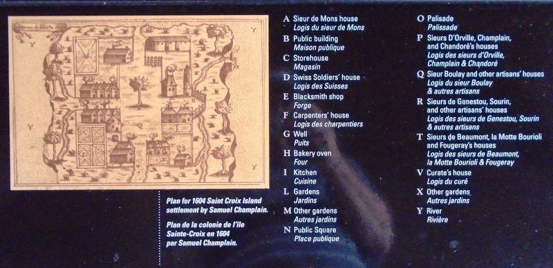
This model shows the Saint Croix Island colony as depicted by Samuel Champlain. His depiction was idealized. Archeological research has revealed discrepancies in building size and location.
[Sketch caption reads]
Plan for 1604 Saint Croix Island settlement by Samuel Champlain.
[Model Key, not transcribed]
Extensive archeological research was carried out on Saint Croix Island in 1789, 1949, and 1969.
Fragments from about thirty ceramic containers from Normandy were found on the island.
[La légende de l'esquisse est lue]
Plan de la colonie de l'île Sainte-Croix en 1604 par Samuel Champlain.
[Modèle de clé, non transcrit]
D'importante travaux de recherche archéologique ont été menés à l'île Sainte-Croix en 1789, en 1949 et en 1969.
Des fragments d'une trentaine de pots en céramique provenant de la Normandie ont été découverts dans l'île.
Erected by National Park Service.
Topics. This historical marker is listed in these topic lists: Colonial Era • Settlements & Settlers. A significant historical year for this entry is 1604.
Location. 45° 7.433′ N, 67° 8.743′ W. Marker is near Calais, Maine, in Washington County. Marker is on the grounds of Saint Croix Island International Historic Site, under the pavilion at the end of the interpretive trail. Touch for map. Marker is at or near this postal address: 84 Saint Croix Drive, Calais ME 04619, United States of America. Touch for directions.
Other nearby markers. At least 8 other markers are within walking distance of this marker. Lessons Learned / Leçons durement apprises (a few steps from this marker); Trapped For The Winter / Prisonniers de l'hiver (within shouting distance of this marker); Exploring the Coast / Exploration de la côte (within shouting distance of this marker); Building A Community / Tout à bâtir (within shouting distance of this marker); Settling on Saint Croix Island / Colonisation de l'île Sainte-Croix (within shouting distance of this marker); Strangers Offshore / Étrangers du grand large (within shouting
Also see . . .
1. Saint Croix Island International Historic Site. (Submitted on October 21, 2018, by William Fischer, Jr. of Scranton, Pennsylvania.)
2. Saint Croix Island International Historic Site Audio Files for Interpretive Trail. (Submitted on October 21, 2018, by William Fischer, Jr. of Scranton, Pennsylvania.)
Credits. This page was last revised on September 24, 2020. It was originally submitted on October 21, 2018, by William Fischer, Jr. of Scranton, Pennsylvania. This page has been viewed 143 times since then and 7 times this year. Photos: 1, 2, 3, 4, 5. submitted on October 21, 2018, by William Fischer, Jr. of Scranton, Pennsylvania.
