Near Santa Paula in Ventura County, California — The American West (Pacific Coastal)
Santa Clara Schoolhouse
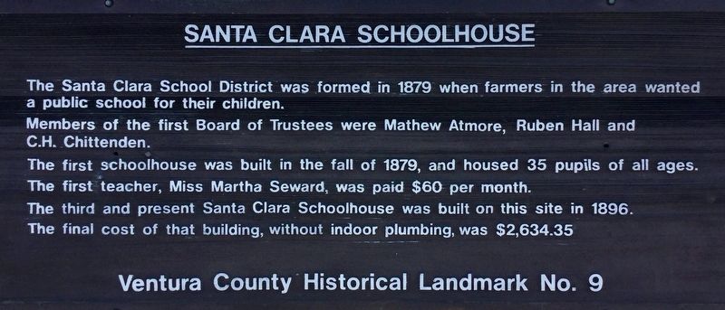
Photographed by Craig Baker, September 23, 2018
1. Santa Clara Schoolhouse Marker
Erected by Ventura County. (Marker Number 9.)
Topics and series. This historical marker is listed in this topic list: Education. In addition, it is included in the Ventura County Historical Landmarks series list.
Location. 34° 22.586′ N, 118° 59.998′ W. Marker is near Santa Paula, California, in Ventura County. It is on East Telegraph Road (California Route 126), on the right when traveling east. 3 miles east of Santa Paula. Touch for map. Marker is at or near this postal address: 20030 East Telegraph Road, Santa Paula CA 93060, United States of America. Touch for directions.

Regionally,
this page online
Other nearby markers. At least 8 other markers are within 4 miles of this marker, measured as the crow flies: Sycamore Tree (approx. 0.6 miles away); Tanner Homestead (approx. 2.3 miles away); Portolá Expedition (approx. 3.2 miles away); St. Francis Dam Disaster (approx. 3½ miles away); Canyon School (approx. 3.6 miles away); Saint Francis Dam Disaster Memorial (approx. 3.7 miles away); The Hardison Estate (approx. 3.7 miles away); Birthplace of Union Oil Company of California (approx. 3.8 miles away). Touch for a list and map of all markers in Santa Paula.
Regarding Santa Clara Schoolhouse. The school has been in continuous operation since 1879 and today serves K-6 students in the three school rooms.
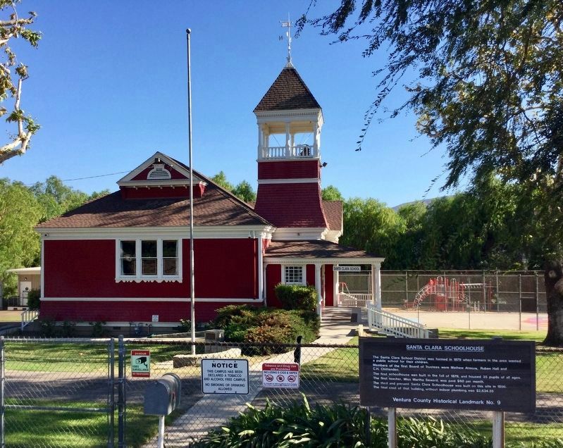
Photographed by Craig Baker, September 23, 2018
2. Schoolhouse and Marker
Credits. This page was last revised on November 1, 2018. It was originally submitted on September 24, 2018, by Craig Baker of Sylmar, California. This page has been viewed 510 times since then and 26 times this year. Last updated on October 28, 2018, by Craig Baker of Sylmar, California. Photos: 1, 2. submitted on September 24, 2018, by Craig Baker of Sylmar, California. • Andrew Ruppenstein was the editor who published this page.
