Shoreacres near La Porte in Harris County, Texas — The American South (West South Central)
Battle of San Jacinto
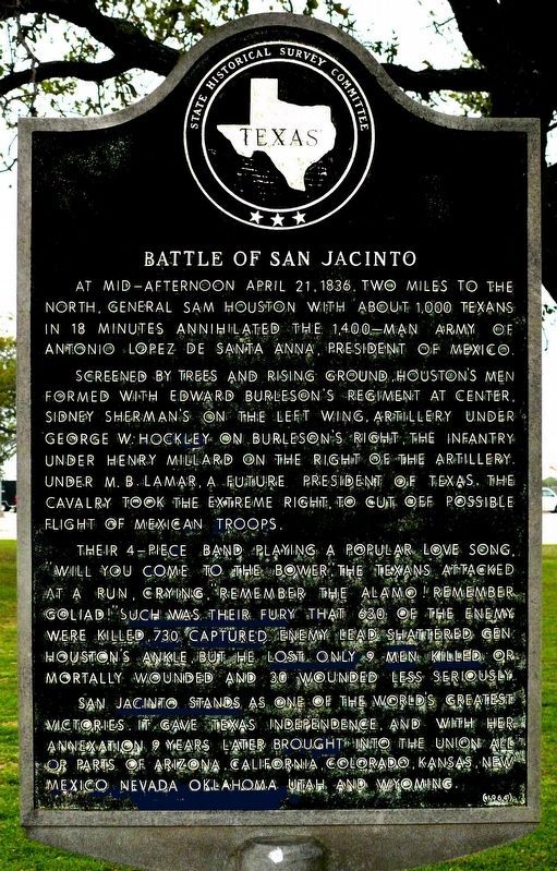
At mid-afternoon April 21, 1836, two miles to the north, General Sam Houston with about 1,000 Texans in 18 minutes annihilated the 1,400-man army of Antonio Lopez de Santa Anna, President of Mexico.
Screened by trees and rising ground, Houston's men formed with Edward Burleson's regiment at center, Sidney Sherman's on the left wing, artillery under George W. Hockley on Burleson's right, the infantry under Henry Millard on the right of the artillery. Under M. B. Lamar, a future president of Texas, the cavalry took the extreme right, to cut off possible flight of Mexican troops. Their 4-piece band playing a popular love song, “Will You Come to the Bower,” the Texans attacked at a run, crying, “Remember the Alamo! Remember Goliad!” Such was their fury that 630 of the enemy were killed, 730 captured. Enemy lead shattered Gen. Houston's ankle, but he lost only 9 men killed or mortally wounded and 30 wounded less seriously.
San Jacinto stands as one of the world's greatest victories. It gave Texas independence, and with her annexation 9 years later brought into the Union all or parts of Arizona, California, Colorado, Kansas, New Mexico, Nevada, Oklahoma, Utah and Wyoming.
Erected 1964 by State Historical Survey Committee. (Marker Number 10606.)
Topics. This historical marker is listed in this topic list: War, Texas Independence. A significant historical date for this entry is April 21, 1836.
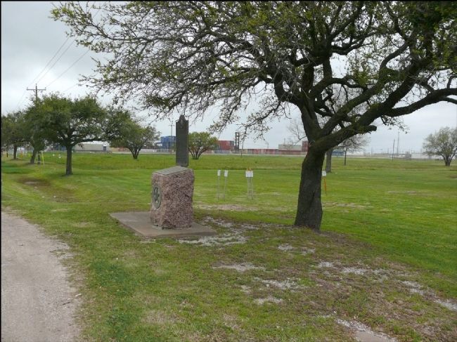
Location. 29° 42.903′ N, 95° 5.387′ W. Marker is near La Porte, Texas, in Harris County. It is in Shoreacres. Marker is on Independence Parkway, 0.8 miles north of Pasadena Freeway (State Highway 225), on the left when traveling north. Touch for map. Marker is at or near this postal address: 739 Independence Parkway, La Porte TX 77571, United States of America. Touch for directions.
Other nearby markers. At least 8 other markers are within 3 miles of this marker, measured as the crow flies. The Texas Army Attacked in Four Divisions (here, next to this marker); Mexican Cavalry, Battle of San Jacinto (approx. 0.6 miles away); Site of Battle of San Jacinto, 1836 (approx. 1.2 miles away); Will You Come to the Bower, Battle of San Jacinto (approx. 1.2 miles away); Within A Few Minutes, Battle of San Jacinto Site (approx. 1.7 miles away); Mexican Surrender (approx. 2.2 miles away); Almonte Captured (approx. 2.2 miles away); Mexican Position (approx. 2.2 miles away). Touch for a list and map of all markers in La Porte.
Regarding Battle of San Jacinto. After the Revolutionary War and the War Between the States, this (Texas Revolution) is probably the most important war toward the formation of the United States. Though Texas became an independent nation following their victory in this battle for independence, ten years later they joined the United States.
Also see . . .
1. Battle of San Jacinto. The Handbook of Texas Online, Texas State Historical Association (Submitted on March 13, 2012, by Jim Evans of Houston, Texas.)
2. The Battle of San Jacinto. Texas A&M, Sons of Dewitt Colony Texas (Submitted on March 13, 2012, by Jim Evans of Houston, Texas.)
3. Battle of San Jacinto. Wikipedia (Submitted on March 13, 2012, by Jim Evans of Houston, Texas.)
4. The Battle of San Jacinto. Son of the South (Submitted on March 13, 2012, by Jim Evans of Houston, Texas.)
Credits. This page was last revised on February 1, 2023. It was originally submitted on March 13, 2012, by Jim Evans of Houston, Texas. This page has been viewed 2,273 times since then and 342 times this year. Last updated on November 4, 2018, by Brian Anderson of Humble, Texas. Photos: 1. submitted on April 5, 2020, by Jim Evans of Houston, Texas. 2. submitted on March 13, 2012, by Jim Evans of Houston, Texas. • Andrew Ruppenstein was the editor who published this page.

