Near Pasadena in Harris County, Texas — The American South (West South Central)
Vince's Bridge
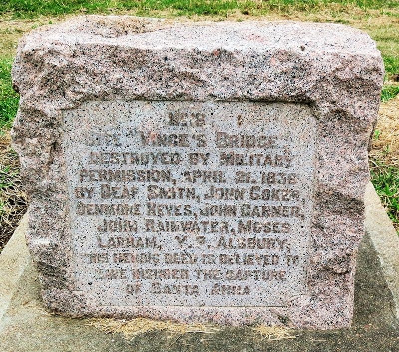
Site Vince's Bridge
destroyed by military
permission April 21, 1836
by Deaf Smith, John Coker,
Denmore Reves, John Garner,
John Rainwater, Moses
Lapham, V.P. Alsbury.
This historic deed is believed to
have insured the capture
of Santa Anna.
Erected 1912 by San Jacinto Chapter, Daughters of the Republic of Texas. (Marker Number 18.)
Topics. This historical marker is listed in these topic lists: Bridges & Viaducts • War, Texas Independence. A significant historical date for this entry is April 21, 1836.
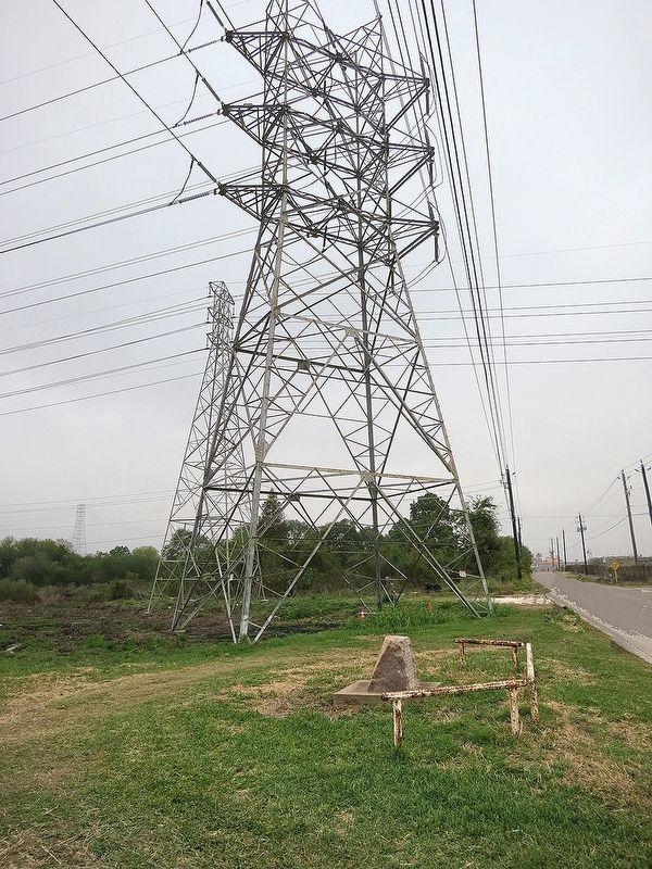
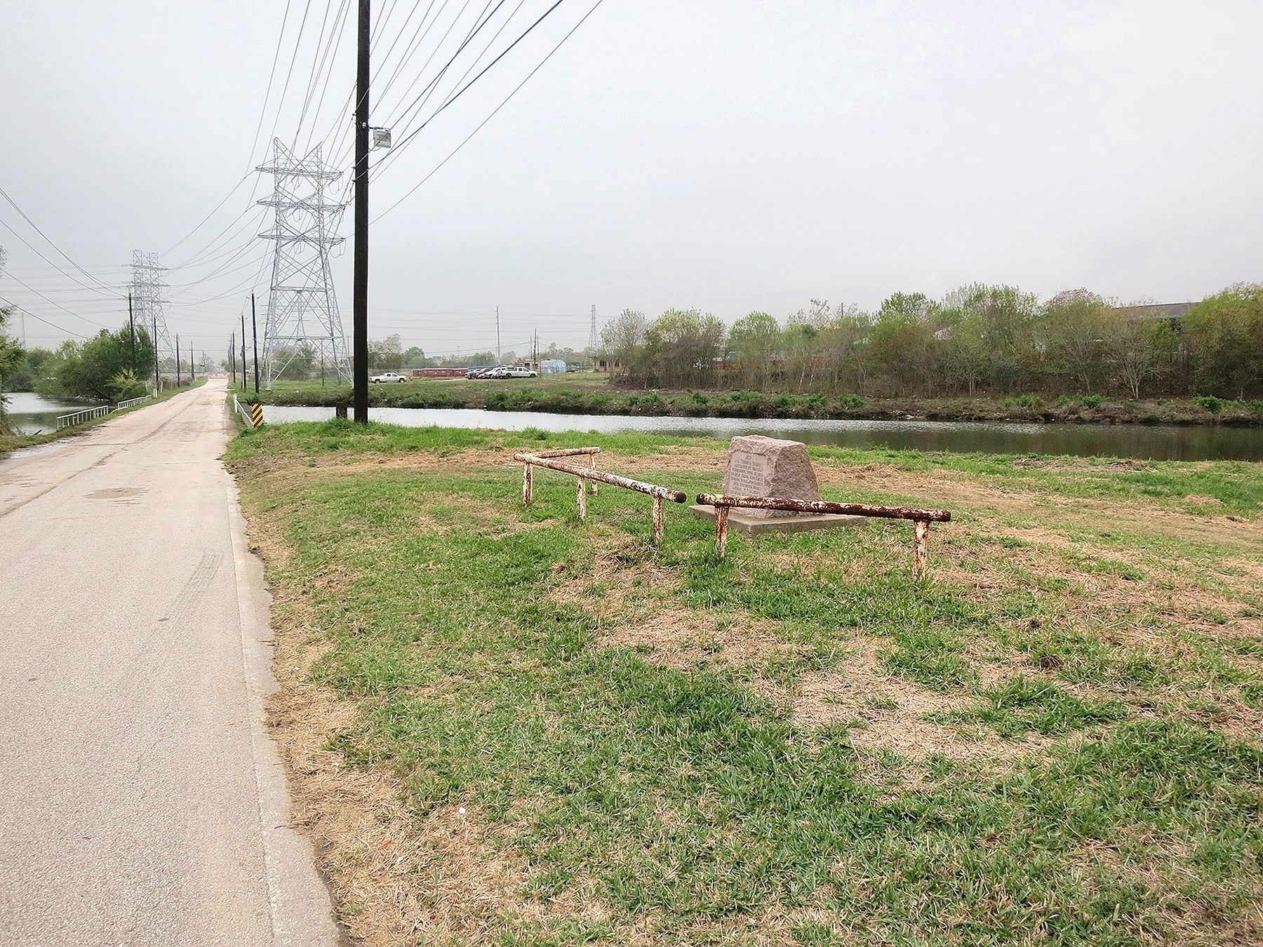
Location. 29° 43.16′ N, 95° 13.209′ W. Marker is near Pasadena, Texas, in Harris County. Marker is on North Richey Street, half a mile north of West Shaw Avenue, on the left when traveling north. Touch for map. Marker is in this post office area: Pasadena TX 77506, United States of America. Touch for directions.
Other nearby markers. At least 8 other markers are within 4 miles of this marker, measured as the crow flies. Crown Hill Cemetery (about 600 feet away, measured in a direct line); Allen Ranch (approx. half a mile away); The Capture of Santa Anna (approx. 0.6 miles away); Bob Harris Station (approx. ¾ mile away); City of Pasadena (approx. 0.9 miles away); Pasadena Independent School District (approx. 0.9 miles away); Texan Army Crossing of Buffalo Bayou (approx. 1.3 miles away); Glendale Cemetery (approx. 3.3 miles away). Touch for a list and map of all markers in Pasadena.
More about this marker. In 1912, the San Jacinto Chapter of the Daughters of the Republic of Texas placed a series of 20 stone markers to commemorate key points on the battlefield. This marker is number 18 in that series and the only one that is not located within the boundaries of the San Jacinto Battleground State Historic Site.
Regarding Vince's Bridge. There has been dispute over the location of the bridge Sam Houston's men burned. It was originally reported by the participants the bridge was over Vince's Bayou and this marker is beside Vince's Bayou. Later historians began suggesting the bridge was not over Vince's Bayou, rather it was a bridge over Sims Bayou. Starting in the mid 1900s, two authorities threw support behind the belief the bridge that foiled the retreat of the Mexican forces and escape of Santa Anna was in fact over Sims Bayou instead of Vince's Bayou. And, this became the prevailing belief. In the 1830s the area was sparsely populated, roads were not well marked and, to further confuse this, there were two Vince brothers who owned extensive land adjacent to each other. So, the ball has bounced back and forth.
See "The Latest & Recently Published Article on the Location of the Bridge" in the links. It argues the Sims Bayou advocates are mistaken and the bridge was indeed over Vince's Bayou.
Interestingly, the marker doesn't mention the primary reason they destroyed the bridge -- to prevent supplies and reinforcements reaching the Mexican forces and to impede their retreat.
Also see . . .
1. Vince's Bridge. The Handbook of Texas, Texas State Historical Association (Submitted on December 8, 2016.)
2. Vince's Bridge. Wikipedia (Submitted on December 12, 2016, by Jim Evans of Houston, Texas.)
3. The Latest & Recently Published Article on the Location of the Bridge. (Submitted on January 2, 2017, by Jim Evans of Houston, Texas.)
Credits. This page was last revised on February 1, 2023. It was originally submitted on December 7, 2016, by Jim Evans of Houston, Texas. This page has been viewed 1,710 times since then and 241 times this year. Last updated on November 6, 2018, by Brian Anderson of Humble, Texas. Photos: 1, 2, 3. submitted on December 7, 2016, by Jim Evans of Houston, Texas. • Andrew Ruppenstein was the editor who published this page.


