Shoreacres near La Porte in Harris County, Texas — The American South (West South Central)
Lamar's Camp
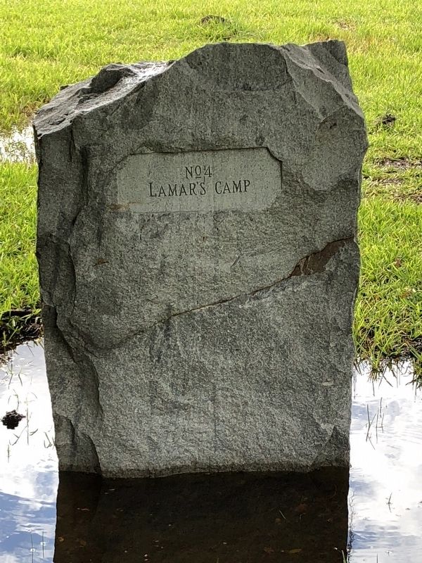
Photographed by Brian Anderson, November 4, 2018
1. Lamar's Camp Marker
Lamar's Camp
Erected 1912 by San Jacinto Chapter, Daughters of the Republic of Texas. (Marker Number 4.)
Topics. This historical marker is listed in this topic list: War, Texas Independence. A significant historical date for this entry is April 21, 1836.
Location. 29° 45.158′ N, 95° 5.41′ W. Marker is near La Porte, Texas, in Harris County. It is in Shoreacres. It can be reached from Independence Parkway. Marker is located within the San Jacinto Battleground State Historic Site. Touch for map. Marker is at or near this postal address: 3523 Independence Parkway, La Porte TX 77571, United States of America. Touch for directions.

Regionally, this marker is in the Houston Metropolitan Area. It is also in the American South and on the Gulf Coast. Globally, it is in North America, a Gulf of Mexico state, the Western Hemisphere, the Western World, and the Anglosphere. Historically, it finds itself in what was once New Spain, the Republic of Texas, one of the Confederate States of America, and the Antebellum South.
Other nearby markers. At least 8 other markers are within walking distance of this marker: Roster Company No. 6
this page online
More about this marker. In 1912, the San Jacinto Chapter of the Daughters of the Republic of Texas placed a series of 20 stone markers to commemorate key points on the battlefield. This marker is number 4 in that series.
Also see . . .
1. Lamar, Mirabeau Buonaparte - The Handbook of Texas Online. Texas State Historical Association (TSHA) (Submitted on November 6, 2018, by Brian Anderson of New Albany, Ohio.)
2. San Jacinto, Battle of - The Handbook of Texas Online. Texas State Historical Association (TSHA) (Submitted on November 6, 2018, by Brian Anderson of New Albany, Ohio.)
Credits. This page was last revised on February 1, 2023. It was originally submitted on November 6, 2018, by Brian Anderson of New Albany, Ohio. This page has been viewed 372 times since then and 81 times this year. Photo 1. submitted on November 6, 2018, by Brian Anderson of New Albany, Ohio. • Andrew Ruppenstein was the editor who published this page.
